Hahahahahaha let's reel it in baby! Let's rage!I hate this hobby, and winter with a passion View attachment 142317
-
Hello, please take a minute to check out our awesome content, contributed by the wonderful members of our community. We hope you'll add your own thoughts and opinions by making a free account!
You are using an out of date browser. It may not display this or other websites correctly.
You should upgrade or use an alternative browser.
You should upgrade or use an alternative browser.
Pattern Jammin January 2024
- Thread starter SD
- Start date
iGRXY
Member
This is a trolling of all trollingI hate this hobby, and winter with a passion View attachment 142317
What exactly is causing this.I hate this hobby, and winter with a passion View attachment 142317
Storm5
Member
Drizzle Snizzle
Member
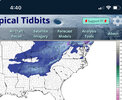
Snow on top of snow ?View attachment 142320
Friday for north Alabama
Yes true. That total will be just for the Friday system.Snow on top of snow ?
JHS
Member
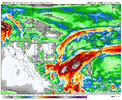
The GFS has a big 591MB ridge just off the coast of the southeast that is no hurry to move late in the run. 60-degree dewpoints up to I-85 for several days. That high shows up late next weekend and is still around at hour 318.
Brick Tamland
Member
Been raining like crazy for the last two weeks. But when we get precip now it's too warm for snow, and when we go into the deep feeeze there won't be any precip. Ridiculous how hard it is to get snow in NC.I hate this hobby, and winter with a passion View attachment 142317
Sounds about rightThe GFS has a big 591MB ridge just off the coast of the southeast that is no hurry to move late in the run. 60-degree dewpoints up to I-85 for several days. That high shows up late next weekend and is still around at hour 318.
NCSNOW
Member
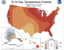
Lets supose 18z GFS is right. Well its no secret we warm up jan 21-28. Hate to be the bad news guy and Brick is gonna hate this. But 21st,22cnd are seasonable almost with highs in low to mid 50's.
23rd-27th it rains on an off non stop per gfs. Then it exits and leaves everyone with a perfectly parked Cad HP. "Enjoy the wx, its the only wx you got"
23rd-27th it rains on an off non stop per gfs. Then it exits and leaves everyone with a perfectly parked Cad HP. "Enjoy the wx, its the only wx you got"
NCSNOW
Member
Also rains for 4 straight days while its parked there. Good Times! Wx heard you needing more rain an its gonna deliver.The GFS has a big 591MB ridge just off the coast of the southeast that is no hurry to move late in the run. 60-degree dewpoints up to I-85 for several days. That high shows up late next weekend and is still around at hour 318.
Itryatgolf
Member
Also, the SSW has begun and I think it takes a few weeks to feel any sensible impacts from it. It's a bottom up type event from what I understand
Getting rid of the drought good to see the maxima right over the Jonesville desert
I’m not sure what you’re looking at on the GFS but that ridge is moving east after 2 days or so and the warmest CLT got on that entire run was 64 a couple times around the 27th… most of the mild spell for the Piedmont and upstate sees highs in the mid to upper 50s. Right after that you can see the ridge start to spike up out west as a +PNA takes hold.The GFS has a big 591MB ridge just off the coast of the southeast that is no hurry to move late in the run. 60-degree dewpoints up to I-85 for several days. That high shows up late next weekend and is still around at hour 318.
Cad Wedge NC
Member
It's just @JHS being himself.I’m not sure what you’re looking at on the GFS but that ridge is moving east after 2 days or so and the warmest CLT got on that entire run was 64 a couple times around the 27th… most of the mild spell for the Piedmont and upstate sees highs in the mid to upper 50s. Right after that you can see the ridge start to spike up out west as a +PNA takes hold.
Webb said on twitter back at the beginning of Jan that he expected big dog potential beginning of February or a little after. Is that what your thinking as well?I’m not sure what you’re looking at on the GFS but that ridge is moving east after 2 days or so and the warmest CLT got on that entire run was 64 a couple times around the 27th… most of the mild spell for the Piedmont and upstate sees highs in the mid to upper 50s. Right after that you can see the ridge start to spike up out west as a +PNA takes hold.


