ForsythSnow
Moderator
It's a wood pole mounted one in our subdivision. Pretty hefty sign to get blown down.That will end up on someone’s wall as a storm souvenir
It's a wood pole mounted one in our subdivision. Pretty hefty sign to get blown down.That will end up on someone’s wall as a storm souvenir
WowwPer TWC, KATL just had their highest gust yet at 51!.
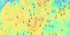
Mark hope u guys are doing well. How's the wind down your way just over the line?Current winds around.
Maybe pushing 10 now. Nothing too bad. But the rain has been been steady all morning.Mark hope u guys are doing well. How's the wind down your way just over the line?
Your in the teeth of it right nowjust woke up, highest gust so far is 30mph 0.94" of rain. Based off y'all's reports, my worst yet to come?
What's the timestamp?Gust to 81 mph in Travelers Rest S.C., per TWC
Cartersville airport had a 49. I think I had higher since I'm on the edge of a south facing hill but both weather stations went out with the power.Per TWC, KATL just had their highest gust yet at 51!.
As in ?? Winds come back up or what?Things are coming down in Atlanta
Yeah that's what I was going to say about 10 mph but steady as she goes on the rain.Maybe pushing 10 now. Nothing too bad. But the rain has been been steady all morning.
Sustained winds and winds gust has decreased!As in ?? Winds come back up or what?
Mine's upRadarScope says GSP radar is unavailable anyone else? Did their radar get knocked out?
Pretty stout sustained winds earlier this morning. Blowing my door decorations around banging the door. Couldn’t figure out what it was for about 30 minutes. Other than that no real concerns here. I can’t believe we cancel schools for these kinds of things.

I would assume its largely for liability reasonsPretty stout sustained winds earlier this morning. Blowing my door decorations around banging the door. Couldn’t figure out what it was for about 30 minutes. Other than that no real concerns here. I can’t believe we cancel schools for these kinds of things.