Well that moved WAY WEST from the previous issue
from BMX
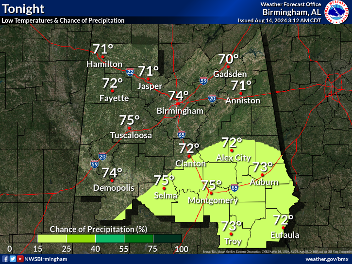
from BMX
Last edited:

I bet the NHC goes cat 2 at landfall
Sent from my SM-J320VPP using Tapatalk


some areas they cover are under a TS Watch still, though Birmingham is under a Warningtropical storm warning moved further north and includes all areas covered by the BMX NWS market

Ya models nailed that part very lopsidedRecon is crazy. FL winds near 90knts in the eastern side with 20knts on the western side.


.GIF")