Storm5
Member
Spann going with Euro and days says he doubts he it reaches hurricane strength fwiw
Sent from my SM-J320VPP using Tapatalk
Sent from my SM-J320VPP using Tapatalk
I would say based on the pattern. Looks like a strong SW to NE flow is gonna be there in front of the cold front. Winds and precip might be a east weightedWhatcha basing this on Chris ?
Sent from my iPhone using Tapatalk
Well there goes my theory. LolSpann going with Euro and days says he doubts he it reaches hurricane strength fwiw
Sent from my SM-J320VPP using Tapatalk

Puts Moble/Pensacola in the middleTropical models shift west a little at 12z
Sent from my SM-J320VPP using Tapatalk

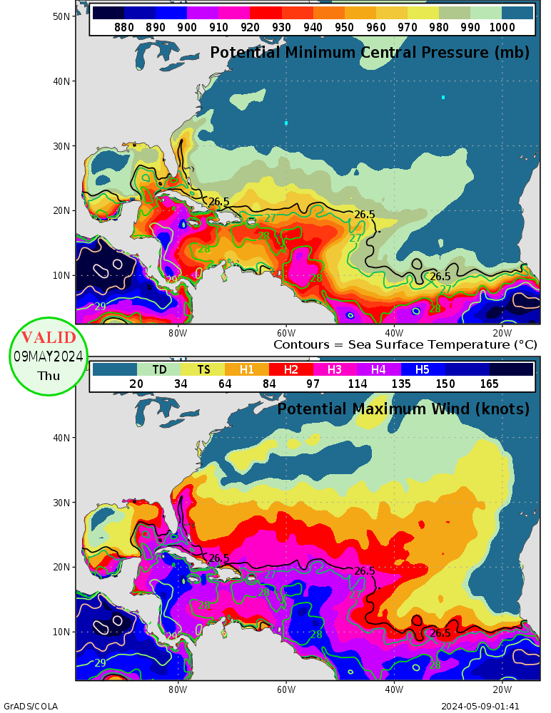
Seems to be a theme this season of models missing the intensity and quickness of intensification, hopefully this will not continue the theme!? But as you stated, stay over open ocean, with all that bath water , could be troubleCyclone potential has dropped off quite a bit in the Gulf and upper Caribbean, but look at where the system is, and look at the potentials. Have to watch the intensity of the system when it forms just to see if it stays weak or begins strengthening. Now I am not saying we will see an intense hurricane quickly, but rather there is a lot of energy down there and anything can happen, and by how this season has gone I wouldn't doubt a major hurricane unless this storm rides land a lot.


Could be due to the fact that it just started running at 18Z last night and at least a tropical storm has yet to form. It seems to do that when storms initialize as does the HWRF sometimes, so I usually just wait for a storm to form, then I use them. Yes, it is funny to look and laugh at the HMON sometimes, especially here where it goes from a strong cat 4 to a weak TD at best.The HMON is laughable .
00z vs 06z


Sent from my SM-J320VPP using Tapatalk
NHC will initiate advisories at 11 AM EDT on Tropical Depression Sixteen, currently located over the Southwestern Caribbean Sea.Nice well defined surface circulation. Not looking too bad this morning . Bet we have a TD
Sent from my SM-J320VPP using Tapatalk
I don't know, looks fairly large at the momentThe overall system doesn't seem too large at the moment, which could mean a chance at fast development if in the right environment.

If that isn't a Euro like track I dont know what is

It's a Euro focused, but leaned west track.If that isn't a Euro like track I dont know what is
Sent from my SM-J320VPP using Tapatalk
Not again. I seriously don't want to do tree cleanup again. Already have a large compromised half split limb from Irma that will come down with a big gust. May have to get that trimmed if this comes here.TS force could extend pretty far inland with the systems forward speed
Sent from my SM-J320VPP using Tapatalk


LOL I went over there and it is nothing but self absorbed hype. I stopped listening to him several months ago because of all of it. Meanwhile, the NHC said this:Meanwhile let's check in on JB's planet for an update ......
Sent from my SM-J320VPP using Tapatalk

Which is a hard combo to beat inside day 5NHC on the the eastern envelope of most models from this mornings run and last night exception of the EURO and Ukie
Sent from my iPhone using Tapatalk
Slower trough is not a crazy idea in fact very plausible and consistent with what we've seen12z gfs even further west . Very weak. Seems a little slower with the trough
Sent from my SM-J320VPP using Tapatalk

We have to wait until the 12Z runs for both. The euro isn't consistent yet on a lamdfalling location.Lol GFS/CMC vs Euro/Ukmet
Per a Twitter post the 12z ukmet is west and on top on MobileWe have to wait until the 12Z runs for both. The euro isn't consistent yet on a lamdfalling location.
