-
Hello, please take a minute to check out our awesome content, contributed by the wonderful members of our community. We hope you'll add your own thoughts and opinions by making a free account!
You are using an out of date browser. It may not display this or other websites correctly.
You should upgrade or use an alternative browser.
You should upgrade or use an alternative browser.
Tropical Hurricane Milton
- Thread starter SD
- Start date
Webberweather53
Meteorologist
The thing that makes me apprehensive to bite on the southerly global NWP solutions is the fact that the vortex depth & intensity is probably too shallow compared to reality (in part because this is a small TC & they can't resolve Milton's core like the hurricane models can). This makes the storm steer further to the east, whereas a stronger/deeper storm as shown by the higher-res models lifts to the north.
I'm leaning a little more towards the more northerly solutions near or even a tad north of Tampa here.
I'm leaning a little more towards the more northerly solutions near or even a tad north of Tampa here.
Henry2326
Member
Henry2326
Member
Belle Lechat
Member
- Joined
- Aug 29, 2021
- Messages
- 936
- Reaction score
- 712
Henry2326
Member
Belle Lechat
Member
- Joined
- Aug 29, 2021
- Messages
- 936
- Reaction score
- 712
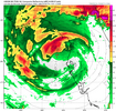
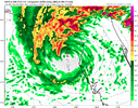
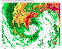
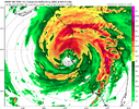
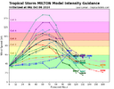
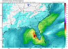
Interesting how all of these except HWRF show a hollowed out core upon landfall00z HMON, has now been joined by HAFS A and B for more northerly track, practically identical.
Hwrf direct hit to Tampa. This is the third run (out of 4) with this solution.
All are slower, with landfall on Thursday.
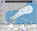
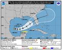
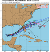
View attachment 152667View attachment 152668View attachment 152669View attachment 152670
Henry2326
Member
Henry2326
Member
I tend to go with Hwrf.Interesting how all of these except HWRF show a hollowed out core upon landfall
Henry2326
Member
It's got some twirl.....
Belle Lechat
Member
- Joined
- Aug 29, 2021
- Messages
- 936
- Reaction score
- 712
Henry2326
Member
Hwrf has it coming in that path at 947 pressure. His winds in that slide are way under done that close to the coast.
Belle Lechat
Member
- Joined
- Aug 29, 2021
- Messages
- 936
- Reaction score
- 712
Hwrf has it coming in that path at 947 pressure. His winds in that slide are way under done that close to the coast.
At 15mph the center would have been over land 2 hours
Belle Lechat
Member
- Joined
- Aug 29, 2021
- Messages
- 936
- Reaction score
- 712
Presoak


Belle Lechat
Member
- Joined
- Aug 29, 2021
- Messages
- 936
- Reaction score
- 712
Belle Lechat
Member
- Joined
- Aug 29, 2021
- Messages
- 936
- Reaction score
- 712
Henry2326
Member
It's about 40 miles inland and alot of water in between.At 15mph the center would have been over land 2 hours
Helene came in at 938 pressure and 60 miles inland at Valdosta, GA sustained winds were 102 mph and 133 Gusts. It took 3 hours to get there.
Henry2326
Member

