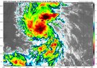
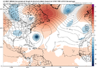
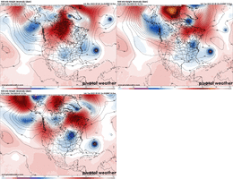
What you see currently would be a better response in my humble opinion! I’ve said it before, it’s a weather board and it’s probably the only thing worth discussing at the moment but it’s still 12-13 days out. Live by the individual op runs and you might be correct but a lot can change! I also don’t get why you would want to see destruction as modeled currently?I get it but all i can do is go with what I see. IF I was in NC i would want it to come close too .
-
Hello, please take a minute to check out our awesome content, contributed by the wonderful members of our community. We hope you'll add your own thoughts and opinions by making a free account!
You are using an out of date browser. It may not display this or other websites correctly.
You should upgrade or use an alternative browser.
You should upgrade or use an alternative browser.
Tropical Hurricane Lee
- Thread starter RBR71
- Start date
This GFS run should be well OTS. 939 at 126!
Brent
Member
Out to 210 the pressure has risen to 958 and it looks like it’s starting to bend back west some. Should still end up turning N and NE though in the next couple framesThis GFS run should be well OTS. 939 at 126!
Yeah I was premature on that going off of past runs and the current frame! Learning everyday!Out to 210 the pressure has risen to 958 and it looks like it’s starting to bend back west some. Should still end up turning N and NE though in the next couple frames
Shaggy
Member
I mean it's only a jump from maritime Canada to just off the mid Atlantic in one runYeah I was premature on that going off of past runs and the current frame! Learning everyday!
I might have spoke too soon as well. At 240 it looks like it might be headed for New England landfallYeah I was premature on that going off of past runs and the current frame! Learning everyday!
Ends up scraping the New England coast before a landfall in New Brunswick. Still that was a fairly big shift to the west.
Shaggy
Member
Is it a full recurve or a sce ario where it gets dropped off long enough to turn back west and threaten New England as depicted in the gfs is still a big question.Ends up scraping the New England coast before a landfall in New Brunswick. Still that was a fairly big shift to the west.
The barrage of troughs on the EC will make any forecast at this lead problematic but they are likely to at least bias the track N-NE. That said the fact that we don't get a big full latitude trough at least leaves the stair step getting left behind then hitting the US scenario as a possibility that's lower on the probability scale. I think the better chance of a US landfall might actually be the NE
Ukmet at 12z.


12 z UKmet is lot futher sw and slower than gfs and can, about to miss trough looks like. I cant go out any futher on pivotal
The 12z icon is the first model run so far that gets my attention with this. It really slows down between 144 and 180. If it stalls near the Bahamas it changes the game pretty drastically since we open the window for some Atlantic ridge flex between troughs and you get into a Dorian like situation where it can renew its NW movement toward the SE coast but even then this may be too far E that even a renewed WNW to NW track wouldn't be enough to beat the trough to the SE US coastIs it a full recurve or a sce ario where it gets dropped off long enough to turn back west and threaten New England as depicted in the gfs is still a big question.
Shaggy
Member
I believe Irene also had a slow down near the Bahamas then a steady NNW movement but that's been a while and my memory may be offThe 12z icon is the first model run so far that gets my attention with this. It really slows down between 144 and 180. If it stalls near the Bahamas it changes the game pretty drastically since we open the window for some Atlantic ridge flex between troughs and you get into a Dorian like situation where it can renew its NW movement toward the SE coast but even then this may be too far E that even a renewed WNW to NW track wouldn't be enough to beat the trough to the SE US coast
As much as the gfs and others have improved over the last few years when the escape hatch on a hurricane comes down to the 500mb pattern across the US and north Atlantic I'm going to lean towards the euro/eps until they are proven wrong. You can see the 12z gefs already recurving well east and the only run to run trend is really south not westI believe Irene also had a slow down near the Bahamas then a steady NNW movement but that's been a while and my memory may be off
Shaggy
Member
I Always keep a watchful eye on the ukmet and have learned to never discount that one either. It's performance with both Irma and Florence was pretty good even though it was seen as an outlier to both originally.As much as the gfs and others have improved over the last few years when the escape hatch on a hurricane comes down to the 500mb pattern across the US and north Atlantic I'm going to lean towards the euro/eps until they are proven wrong. You can see the 12z gefs already recurving well east and the only run to run trend is really south not west
Also the predicted strength of Lee screams recurve as it will want to go poleward versus a weaker system
Shaggy
Member
Banter but today is Frans anniversary date. Sept 5th 1996
lexxnchloe
Member
GFS is quite a bit better. Will the euro improve?
12z today

last night

12z today

last night

Downeastnc
Member
Banter but today is Frans anniversary date. Sept 5th 1996
Still windiest cane here ever PGV gusted 105-110.....
lexxnchloe
Member
Trof and ridge better on euro. May be a good shift west tonight.
Cary_Snow95
Member
Definitely a westward shift on the Euro, still misses the EC for the most part although the NE might still be in play. Slows it down before the turn n/nw also. Still long ways to go with this one


Downeastnc
Member
the Bahama stall is nothing new, seems the big nasty storms dont like to turn fast down that far south.....any kind of stall could be trouble.....but only if the ridging is stout enough to push the storm back NW, alot of times they will linger or move real slow and wait for the next trough.
lexxnchloe
Member
decent west shift
Not sure the trough will do exactly what the models are projecting it to do as far as timing is concerned. This could pull it a bit more west than current models project.Trof and ridge better on euro. May be a good shift west tonight.
lexxnchloe
Member
I thought the west shift would start last night. delayed 12 hours
Storm still seems too far north at that point. It is highly unlikely to proceed west or wnw from that position. It really needs to be farther to the south at that time.
Steven_1974
Member
Surely you're not rooting for it to hit the east coast.GFS is quite a bit better. Will the euro improve?
12z today

last night

lexxnchloe
Member
Dont even start that. No one is here because they like boring weather. When you can prove i have the power to control the weather then you can begin the guilt tripsSurely you're not rooting for it to hit the east coast.
Brent
Member
Storm still seems too far north at that point. It is highly unlikely to proceed west or wnw from that position. It really needs to be farther to the south at that time.
Yeah for me to really believe a legit US threat I'm gonna say it needs to run closer to PR this weekend... If it's way north like forecast now forget it. Also the overwhelming majority of the ensembles are still clearly OTS
You have to remember that most storms in this area recurve. It takes a perfect setup to get a hit. Something is gonna have to change from the current track
Actually I just looked, Fran was a little further further north of the Caribbean and Florence was a lot further north when compared to what the 12z GFS and the 12z UKMET showed. Florence never even threatened the Virgin Islands it was moving so far north… it looked at that point like it would go east of Bermuda.Good point... Fran/Flo were north of the Caribbean but not that far north.
View attachment 136838View attachment 136839
lexxnchloe
Member
GFS has another repeat but its alot weaker over the same water and this trof means business.


lexxnchloe
Member
Dont forget isabelActually I just looked, Fran was a little further further north of the Caribbean and Florence was a lot further north when compared to what the 12z GFS and the 12z UKMET showed. Florence never even threatened the Virgin Islands it was moving so far north… it looked at that point like it would go east of Bermuda.
The one thing that gives me a little pause is seeing where the 12Z UKMET positions the storm at the end of its run. That’s been the model that has often caught onto the storms out there taking a more westerly track the last few years… Irma and Florence are a couple of examples.Yeah for me to really believe a legit US threat I'm gonna say it needs to run closer to PR this weekend... If it's way north like forecast now forget it. Also the overwhelming majority of the ensembles are still clearly OTS
You have to remember that most storms in this area recurve. It takes a perfect setup to get a hit. Something is gonna have to change from the current track
lexxnchloe
Member
The big difference on the euro is the low east of LEE. At 12z they may be interacting. last night the low was far NE
Last night

today

Last night

today

lexxnchloe
Member
That would imply 264 and 288 will be interesting

