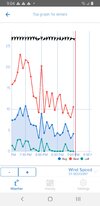
Constant gust 50mph+, just put under FF warning. Been a windy,raw day.
-
Hello, please take a minute to check out our awesome content, contributed by the wonderful members of our community. We hope you'll add your own thoughts and opinions by making a free account!
You are using an out of date browser. It may not display this or other websites correctly.
You should upgrade or use an alternative browser.
You should upgrade or use an alternative browser.
Tropical Hurricane Ian
- Thread starter severestorm
- Start date
-
- Tags
- tropical
The wind and rain here right now is the heaviest it's been all day.
blueheronNC
Member
I can confirm the 70+ DPs in the east, sitting at 73/73 and PGV hit 75/75 about a half hour ago, far cry from what it felt like for most of the day. Crazy system indeed, it honestly looked post tropical coming off the east coast of FL. It’s going to take awhile for the wind field to die down.
- Joined
- Jan 23, 2021
- Messages
- 4,603
- Reaction score
- 15,199
- Location
- Lebanon Township, Durham County NC
University Hospital Helipad had a gust to 54MPH not too long ago.
65/65 999 wind has turned out of the SE
I think that’s a mid-level circulation. The surface COC is over by Fayetteville…. I’ve got winds out of the north now which means center is to my east and I’m in eastern Union Co., NCThe COC looks to be headed for a direct crossing of CLT metro! We’re models showing it that far west? Thought center was going up through Greensboro from what I saw this AM?View attachment 122710
Things have started to calm down in the last fifteen minutes or so. That last band that rolled through really put down the rain. I have over five inches in the gauge now with a reading of 5.33 inches! There are puddles on the lawn now which rarely happens here. And most miraculously of all we didn't lose power with this storm as intense as it was for a tropical storm in my general vicinity.
GarnerNC
Member
Rain and wind have come to an end, now the wait to have power restored begins.
- Joined
- Jan 23, 2021
- Messages
- 4,603
- Reaction score
- 15,199
- Location
- Lebanon Township, Durham County NC
Gentleman from Duke energy just mentioned on the WRAL coverage that some folks will likely be without power for several days.
Gentleman from Duke energy just mentioned on the WRAL coverage that some folks will likely be without power for several days.
Yep, I was just looking over their outage map and I doubt many expected Wake and several other counties along the 40 corridor to be approaching a 20% outage rate. A few of the outages had restore times earlier but they now just show assessment underway.
iGRXY
Member
Rainfall really racking up quick here. Those bands have not let up at all. Looks like the northern upstate will get hit with the pivot on top of what was rotating in from east to west for most of the last 6 hours. 2-4” along and east of highway 25 looks to be the dividing line between big rain and less than 1”
GarnerNC
Member
We had power come back on about 2 hrs ago for a few moments. Gives me hope that is an indication they are working in the area.Yep, I was just looking over their outage map and I doubt many expected Wake and several other counties along the 40 corridor to be approaching a 20% outage rate. A few of the outages had restore times earlier but they now just show assessment underway.
Snow mixing in with sleet and rain in the mountains.
Cary_Snow95
Member
Ended with 3.77” in Cary. Success in my books
Nothing like the front side but it's gotten a little gusty in the past 15 minutes as pressures start rising.
Looks like 997mb will be the lowest pressure here, no idea on rain since I lost time with the power out.
Looks like 997mb will be the lowest pressure here, no idea on rain since I lost time with the power out.
Stormsfury
Member
Ian took a scenic route and had way too many Cuban Cigars on the way
Snow mixing in with sleet and rain in the mountains.
September frozen precip … kind of a big deal!!
4500’ Yancey NC
That in Jonesville??
Nomanslandva
Member
Have been between 49 and 51 for 24 hours. Had a fire in the woodstove all day yesterday. Steady rain didn't start until 5 last night, not sure how much yet...can't see, no power. I didn't hear any high wind last night but could have slept through it.
GarnerNC
Member
Still waiting on power like many others this morning. Definitely no shortage of cleanup to do this weekend.
Now off to find coffee and breakfast.
Now off to find coffee and breakfast.
Downeastnc
Member
Avalanche
Member
Anyone have a storm total map for central NC?
iGRXY
Member
ended up with 2.41” here so less than what the thinking was on Sunday and Monday but more than what was being projected towards the end of the end. Peak gust here was 42 mph but sustained was between 15-25 mph since Thursday.
Lost power last night around 7:30. Came back on around 10. Lots of tree branches/leaves covering the yard. I ended up with only around 2.5". Much less than others around me. But that was still good enough to put a dent in this dry spell.
PDubRDU
Member
Bannerdude
Member
Lost power at 8:30 PM last night and just got an update that they expect to have it back on by 8 PM tonight.
Emptying out my fridge and freezer wasn't on the to-do list today, but c'est la vie.
At least I had over 3" in the rain gauge. Very much needed!
Emptying out my fridge and freezer wasn't on the to-do list today, but c'est la vie.
At least I had over 3" in the rain gauge. Very much needed!
Henry2326
Member
Radar loop of Ian
Iceagewhereartthou
Member
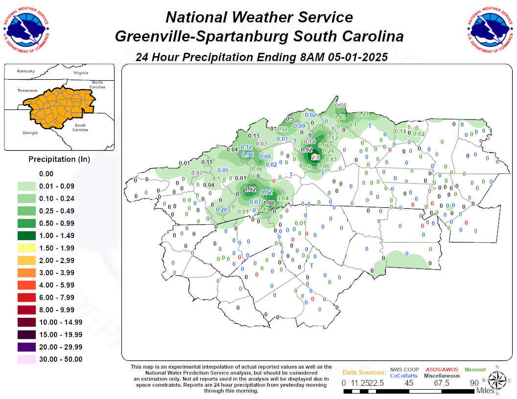
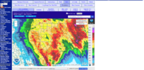
Some of these totals East of I26 look low to me (I think the Spartanbug airport got more than 3 inches) but you can certainly see the big cutoff West. Only .46 for me but I'm good with that. Now if this had been a snowstorm I would be in mourning!
Avalanche
Member
How can I get a rain total map for central NC?
Some of these totals East of I26 look low to me (I think the Spartanbug airport got more than 3 inches) but you can certainly see the big cutoff West. Only .46 for me but I'm good with that. Now if this had been a snowstorm I would be in mourning!
Rah will probably put one out. In the mean time here is a link to a text versionHow can I get a rain total map for central NC?
NWSChat - NOAA's National Weather Service
Avalanche
Member
Thank you!!Rah will probably put one out. In the mean time here is a link to a text version
NWSChat - NOAA's National Weather Service
nwschat.weather.gov
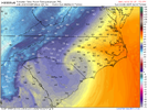
Going to be interesting to see how drizzly/showery we can get tomorrow evening into Monday as the remnant of Ian come back south and shift offshore and the next upper end digs in. A deep N to NE flow with showers Monday could lock some areas along and west of US1 into the low 50s
No problem. I was going to post the radar estimates but it's way off.Thank you!!
Couple examples
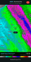
Radar estimate here 2.5 I recorded 2.6 but lost 3 hours of data due to the power being out so its more likely 3.5.
Parents got 4.5 but the radar estimates 1.98
Avalanche
Member
You guys did great then!!No problem. I was going to post the radar estimates but it's way off.
Radar estimate here 2.5 I recorded 2.6 but lost 3 hours of data due to the power being out so its more likely 3.5
Iceagewhereartthou
Member
Here's the best I can do until RAH does their thing.How can I get a rain total map for central NC?
