NWS might start posting wind advisories for eastern counties.Agree seems the ULL might not be as strong as modeled also noticed it kind of drifting more SW than S...on the heading it is on now Helene would end up over or even just east of Charlotte which would really change things up for SC/NC....she is also still busting out some big time gust especially on the dry side of the circulation where the dry air helps mixes the big gust down, you will notice the big difference between sustained winds in the 30-40 range but gust to damn near if not 100....
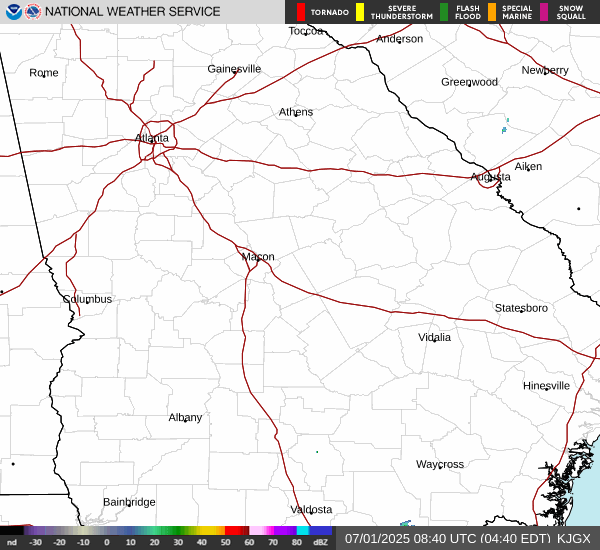
Seeing gust into the 80's around Vidalia now....most of these places are in TS warnings but getting cane force gust
-
Hello, please take a minute to check out our awesome content, contributed by the wonderful members of our community. We hope you'll add your own thoughts and opinions by making a free account!
You are using an out of date browser. It may not display this or other websites correctly.
You should upgrade or use an alternative browser.
You should upgrade or use an alternative browser.
Tropical Major Hurricane Helene
- Thread starter SD
- Start date
- Status
- Not open for further replies.
Belle Lechat
Member
- Joined
- Aug 29, 2021
- Messages
- 1,530
- Reaction score
- 1,215


Cochran, GA's Airport has 969 mb.
Last edited:
lj0109
Member
30 miles SE of Columbia and the wind is really starting to ramp up over the last 20min, especially with any cells that help mix down to the surface as they race overAlso with her getting close to 30 mph even several hrs more NNE will get a lot of places not expecting bigger winds in that part of the circulation....cough Columbia cough....
It would appear the turn to the north has finally commenced.
SnowwxAtl
Member
I see it... the gusty winds about to come for Atlanta but not that bad as the Eastside of ATL...Augusta be preparedIt would appear the turn to the north has finally commenced.
lj0109
Member
Yep, not yet true north but a 10 degree shift over last 2 hrs:It would appear the turn to the north has finally commenced.

Loganville Winter
Member
Still going well east of us. I seriously doubt it makes it west of Athens.It would appear the turn to the north has finally commenced.
SnowwxAtl
Member
More like a turnYep, not yet true north but a 10 degree shift over last 2 hrs:
View attachment 152135
A true "North" NE motion...lolMore like a turn
From NHC at 4AM:
A University of Georgia weather station in Vidalia, Georgia
recently reported a wind gust of 77 mph (124 km/h). An ASOS station
at The Savannah International Airport in Georgia recently reported
a sustained wind of 49 mph (79 km/h) with a gust to 76 mph
(122 km/h).
A University of Georgia weather station in Vidalia, Georgia
recently reported a wind gust of 77 mph (124 km/h). An ASOS station
at The Savannah International Airport in Georgia recently reported
a sustained wind of 49 mph (79 km/h) with a gust to 76 mph
(122 km/h).
I might have been too far west with Athens call. But who knows. Finally started to see some more north progression, so still seems an okay area for the center to try and go over
Belle Lechat
Member
- Joined
- Aug 29, 2021
- Messages
- 1,530
- Reaction score
- 1,215
FLASH FLOOD WARNING...CORRECTED
NATIONAL WEATHER SERVICE GREENVILLE-SPARTANBURG SC
415 AM EDT FRI SEP 27 2024
..FLASH FLOOD EMERGENCY FOR ACROSS HAYWOOD COUNTY
THE NATIONAL WEATHER SERVICE IN GREENVILLE-SPARTANBURG HAS ISSUED A
* FLASH FLOOD WARNING FOR...
HAYWOOD COUNTY IN WESTERN NORTH CAROLINA...
* UNTIL 1015 AM EDT.
* AT 409 AM EDT, EMERGENCY MANAGEMENT REPORTED NUMEROUS ROAD
CLOSURES, ONGOING WATER RESCUES, AND FLOODED HOMES ACROSS HAYWOOD
COUNTY. ONGOING RAINFALL IS CONTRIBUTING TO SWIFTLY RISING STREAM
LEVELS, INCREASING SIGNIFICANT FLOOD RISK, AND INCREASING RISK OF
LIFE-THREATENING LANDSLIDES. BETWEEN 6 AND 10 INCHES OF RAIN HAVE
ALREADY FALLEN, AND ADDITIONAL HEAVY RAINFALL IS IMMINENT.
THIS IS A FLASH FLOOD EMERGENCY FOR ACROSS HAYWOOD COUNTY. THIS IS
A PARTICULARLY DANGEROUS SITUATION. SEEK HIGHER GROUND NOW!
HAZARD...LIFE THREATENING FLASH FLOODING. THUNDERSTORMS
PRODUCING FLASH FLOODING.
SOURCE...EMERGENCY MANAGEMENT REPORTED.
IMPACT...THIS IS A PARTICULARLY DANGEROUS SITUATION. SEEK
HIGHER GROUND NOW! LIFE THREATENING FLASH FLOODING OF
LOW WATER CROSSINGS, SMALL CREEKS AND STREAMS, URBAN
AREAS, HIGHWAYS, STREETS AND UNDERPASSES. LIFE-
THREATENING INUNDATION OF HOMES AND BUSINESSES.
DAMAGE TO ROADWAYS AND INFRASTRUCTURE. SUDDEN STREAM
RISES. LIFE-THREATENING LANDSLIDE ACTIVITY.
* SOME LOCATIONS THAT WILL EXPERIENCE FLASH FLOODING INCLUDE...
WAYNESVILLE, CHEROKEE, CANTON, LAKE JUNALUSKA, CLYDE, MAGGIE
VALLEY, SMOKY MOUNTAINS-CATALOOCHEE, B.R. PARKWAY-BALSAM GAP TO
BLACK BALSAM AREA, B.R. PARKWAY-SMOKY MOUNTAINS TO BALSAM GAP,
BLACK BALSAM AREA, SMOKY MOUNTAINS-BIG CREEK, SMOKY
MOUNTAINS-BALSAM MOUNTAIN, B.R. PARKWAY-BLACK BALSAM TO MOUNT
PISGAH, GRAVEYARD FIELDS, MOUNT PISGAH, COVE CREEK, FINES CREEK,
SUNBURST, CRUSO AND WATERVILLE.
PRECAUTIONARY/PREPAREDNESS ACTIONS...
MOVE TO HIGHER GROUND NOW! THIS IS AN EXTREMELY DANGEROUS AND
LIFE-THREATENING SITUATION. DO NOT ATTEMPT TO TRAVEL UNLESS YOU ARE
FLEEING AN AREA SUBJECT TO FLOODING OR UNDER AN EVACUATION ORDER.
HEAVY RAIN IS SIGNIFICANTLY INCREASING THE RISK OF LANDSLIDES,
ESPECIALLY IN AREAS WHERE SLIDES HAVE OCCURRED IN THE PAST. SLIDES
CAN DESTROY SINGLE HOMES AND OTHER STRUCTURES AND LARGE SECTIONS OF
ROADS. IF YOU ARE IN THE WARNED AREA, YOU SHOULD NOT TRAVEL, EXCEPT
TO MOVE AWAY FROM FLASH FLOOD OR LANDSLIDE DANGERS. IF YOU ARE IN
THE VICINITY OF A STREAM NEAR THE HEAVY RAINFALL, ESPECIALLY ON A
MOUNTAINSIDE, OR AT THE BASE OF A MOUNTAIN OR IN A COVE, MOVE
IMMEDIATELY TO A SAFER LOCATION.
TURN AROUND, DON'T DROWN WHEN ENCOUNTERING FLOODED ROADS. MOST FLOOD
DEATHS OCCUR IN VEHICLES.
BE ESPECIALLY CAUTIOUS AT NIGHT WHEN IT IS HARDER TO RECOGNIZE THE
DANGERS OF FLOODING.
BE AWARE OF YOUR SURROUNDINGS AND DO NOT DRIVE ON FLOODED ROADS.
LAT...LON 3574 8292 3562 8285 3563 8281 3558 8277
3547 8280 3541 8275 3532 8283 3531 8295
3545 8308 3546 8314 3549 8314 3551 8319
3555 8316 3564 8320 3567 8318 3572 8326
3579 8308 3577 8300 3579 8296 3575 8296
FLASH FLOOD...OBSERVED
FLASH FLOOD DAMAGE THREAT...CATASTROPHIC
TORNADO WARNING COLUMBIA SC - KCAE 417 AM EDT FRI SEP 27 2024
FLASH FLOOD WARNING GREENVILLE-SPARTANBURG SC - KGSP 415 AM EDT FRI SEP 27 2024
FLASH FLOOD WARNING JACKSONVILLE FL - KJAX 415 AM EDT FRI SEP 27 2024
FLASH FLOOD WARNING GREENVILLE-SPARTANBURG SC - KGSP 414 AM EDT FRI SEP 27 2024
FLASH FLOOD WARNING GREENVILLE-SPARTANBURG SC - KGSP 409 AM EDT FRI SEP 27 2024
FLASH FLOOD WARNING GREENVILLE-SPARTANBURG SC - KGSP 408 AM EDT FRI SEP 27 2024
FLASH FLOOD WARNING GREENVILLE-SPARTANBURG SC - KGSP 401 AM EDT FRI SEP 27 2024
TORNADO WARNING CHARLESTON SC - KCHS 400 AM EDT FRI SEP 27 2024
FLASH FLOOD WARNING GREENVILLE-SPARTANBURG SC - KGSP 353 AM EDT FRI SEP 27 2024
Severe Weather Warnings Page
kamala.cod.edu
No doubt. In our area, I expect our strongest winds will come after the center moves north of us and the wind backs in from the W and SW. I'm thinking of a few gusts to maybe 40 mph.Still going well east of us. I seriously doubt it makes it west of Athens.
I wanted to wait and see what ended up being the track before making any comments. The track they had was so off it is shocking. I am glad it hasn’t been the worse case scenario for a lot of us but this was a huge miss for the cone and track. There are a few power outages in my area but just a couple of neighborhoods here and there per the outage map. I am up because my power went out - I got up to check and it is back on.
It's getting comical at this point that the NHC has continued their error to the west in the forecast track. Releasing an 11pm track and cone that continued NNW track while the global models, sat and radar tracking continued to confirm a NNE track is ridiculous. They really blew this forecast. They need to really re-evaluate their approach to these gulf systems. Whatever they're relying on isn't working. period.Still thinking the symptom of their track being to far West was relying on the Super Ensemble and Ships guidance.. they both started shifting East (especially today, faster than their cone).. I didn't look horribly close at things, but I think the Canadian model's ensemble system was skewing the mean to the West Wednesday afternoon.
Combine that with the hurricane models being too far West, and you had a recipe for the error.
There's a good chance a portion of the CoC tracks on the line on the Eastern most of the cone, which technically is still "accurate." Too bad it wouldn't have been without any Eastern shifts of the forecast.
The biggest problem I have with this whole thing is areas that were expecting TS gusts at most are now looking at hurricane force gusts that weren't expecting it. 50,75,150 miles to the East really mucks things up with such an expansive storm with such an expansive wind field.
Meanwhile we have a system tracking northward through eastern GA that they forecast to be in western GA.
There needs to be some accountability.
Snowflowxxl
Member
Light rain and still out here. Not even a light breeze atm
I wouldn't let my guard down up your way. If the storm tracks even a little NNW soon, the NE Ga. mountain counties are in for quite a blow.I wanted to wait and see what ended up being the track before making any comments. The track they had was so off it is shocking. I am glad it hasn’t been the worse case scenario for a lot of us but this was a huge miss for the cone and track. There are a few power outages in my area but just a couple of neighborhoods here and there per the outage map. I am up because my power went out - I got up to check and it is back on.
- Joined
- Jan 2, 2017
- Messages
- 1,566
- Reaction score
- 4,279
Steady 20+mph east winds..watching the trees closely!
I don’t usually post. Just a long time reader. I am in Gibson, GA and it seems like this track shift to the east is putting me in the crosshairs for the worst winds. It’s consistently getting worse now. I’m a new dad so I got the family in the living room away from the east side of the house. A lot worse than I was expecting from the nws forecast.
lj0109
Member
Under the gun with this cell:

Belle Lechat
Member
- Joined
- Aug 29, 2021
- Messages
- 1,530
- Reaction score
- 1,215
430 AM EDT FRI SEP 27 2024
THE NATIONAL WEATHER SERVICE IN CHARLESTON HAS ISSUED A
* TORNADO WARNING FOR PORTIONS OF...
BERKELEY COUNTY IN SOUTHEASTERN SOUTH CAROLINA...
CHARLESTON COUNTY IN SOUTHEASTERN SOUTH CAROLINA...
DORCHESTER COUNTY IN SOUTHEASTERN SOUTH CAROLINA...
* UNTIL 515 AM EDT.
* AT 430 AM EDT, A SEVERE THUNDERSTORM CAPABLE OF PRODUCING A
TORNADO WAS LOCATED NEAR SUMMERVILLE, MOVING NORTH AT 60 MPH.
* LOCATIONS IMPACTED INCLUDE...
NORTH CHARLESTON, SUMMERVILLE, LADSON, RIDGEVILLE, JEDBURG,
KNIGHTSVILLE, SANGAREE, LINCOLNVILLE, NEW HOPE AND LOTTS
CROSSROADS.
THIS INCLUDES I-26 BETWEEN MILE MARKERS 187 AND 203.
Hang in there; it will pass quickly. Congrats on the new kid and keep it safe. You can tell it the story of the storm Helene some day.I don’t usually post. Just a long time reader. I am in Gibson, GA and it seems like this track shift to the east is putting me in the crosshairs for the worst winds. It’s consistently getting worse now. I’m a new dad so I got the family in the living room away from the east side of the house. A lot worse than I was expecting from the nws forecast.
Makeitsnow
Member
Currently I've had a top gust so far of 38mph. Will be entering the northern eyewall within the hour...but as of now I'm still hopeful the worst of the winds will be east of here in the Carolinas/savannah river.
I’m not quite yet but it’s obviously way east - it’s breezy but that’s about it. There was a flood emergency alert a few minutes ago and we have had a ton of rain. But all the dire wording with a completely wrong path is utterly insane with reality.I wouldn't let my guard down up your way. If the storm tracks even a little NNW soon, the NE Ga. mountain counties are in for quite a blow.
Henry2326
Member
Well that clearly is not westbound.....
This doesn't do it justice. Go watch the loop. Let's just say it isn't headed for Alabama.

GOES-19 CONUS - Band 7 - NOAA / NESDIS / STAR
Near real-time publication of GOES-East and GOES-West images from NOAA/NESDIS/STARwww.star.nesdis.noaa.gov
Belle Lechat
Member
- Joined
- Aug 29, 2021
- Messages
- 1,530
- Reaction score
- 1,215
FLASH FLOOD WARNING COLUMBIA SC - KCAE 438 AM EDT FRI SEP 27 2024
TORNADO WARNING CHARLESTON SC - KCHS 436 AM EDT FRI SEP 27 2024
FLASH FLOOD WARNING GREENVILLE-SPARTANBURG SC - KGSP 435 AM EDT FRI SEP 27 2024
TORNADO WARNING COLUMBIA SC - KCAE 435 AM EDT FRI SEP 27 2024
TORNADO WARNING CHARLESTON SC - KCHS 436 AM EDT FRI SEP 27 2024
FLASH FLOOD WARNING GREENVILLE-SPARTANBURG SC - KGSP 435 AM EDT FRI SEP 27 2024
TORNADO WARNING COLUMBIA SC - KCAE 435 AM EDT FRI SEP 27 2024
Severe Weather Warnings Page
kamala.cod.edu
- Joined
- Jan 2, 2017
- Messages
- 1,566
- Reaction score
- 4,279
Getting 35mph gusts now...surprised the power is still on. Just a matter of time
- Joined
- Jan 2, 2017
- Messages
- 1,566
- Reaction score
- 4,279

Makeitsnow
Member
I've been expecting any minute.Getting 35mph gusts now...surprised the power is still on. Just a matter of time
It's trying to climb North. The storm is starting to really get invovled with the ULL but man.. this is a big f up track wise. 4:30 AM and people with almost hurricane force winds happening right now when not called for
- Joined
- Jan 2, 2017
- Messages
- 1,566
- Reaction score
- 4,279
I do believe the forecast track never could figure out the influence of the front or ULL had on this sucker...hopefully a chance to learn and do betterIt's trying to climb North. The storm is starting to really get invovled with the ULL but man.. this is a big f up track wise. 4:30 AM and people with almost hurricane force winds happening right now when not called for
Oh. It did. We had days of notice.I do believe the forecast track never could figure out the influence of the front or ULL had on this sucker...hopefully a chance to learn and do better
The NHC ignored it.
Blue_Ridge_Escarpment
Member
The guidance was in front of the NHC with the globals for a couple days now. Why they chose to ignore it as part of the forecast is something that will have to be answered in the coming days.It's trying to climb North. The storm is starting to really get invovled with the ULL but man.. this is a big f up track wise. 4:30 AM and people with almost hurricane force winds happening right now when not called for
Makeitsnow
Member
Local met in Atlanta just showed an absurd graphic showing it moving nnw from right now in order to make it work with nhcs wrong track.It's trying to climb North. The storm is starting to really get invovled with the ULL but man.. this is a big f up track wise. 4:30 AM and people with almost hurricane force winds happening right now when not called for
chuckhendo
Member
I know weather forecasting isn’t an exact science, and of course it’s possible this thing could have gone west, but it’s almost reckless how the NHC refused to budge on trackOh. It did. We had days of notice.
The NHC ignored it.
On topic, power flickering here in Irmo SC. Wish I had set up my weather station before this; getting some pretty good gusts
At least the NHC made me test-run my little generator for the first time in twenty years. Now, I'm ready for my NWS winter storm warnings that turn out to be a few pingers on the deck.It's trying to climb North. The storm is starting to really get invovled with the ULL but man.. this is a big f up track wise. 4:30 AM and people with almost hurricane force winds happening right now when not called for
Belle Lechat
Member
- Joined
- Aug 29, 2021
- Messages
- 1,530
- Reaction score
- 1,215
Isaac apparently now has stronger winds than Helene.

Helene: N at 30 mph.
Helene: N at 30 mph.
Their forecasting ignorance was more than reckless. They need a real wake-up call as to how they affect real people's lives.I know weather forecasting isn’t an exact science, and of course it’s possible this thing could have gone west, but it’s almost reckless how the NHC refused to budge on track
On topic, power flickering here in Irmo SC. Wish I had set up my weather station before this; getting some pretty good gusts
Loganville Winter
Member
I saw the same thing. Looked like a Charlie Morton curveball.Local met in Atlanta just showed an absurd graphic showing it moving nnw from right now in order to make it work with nhcs wrong track.
Belle Lechat
Member
- Joined
- Aug 29, 2021
- Messages
- 1,530
- Reaction score
- 1,215
TORNADO WARNING CHARLESTON SC - KCHS 454 AM EDT FRI SEP 27 2024
FLASH FLOOD WARNING PEACHTREE CITY GA - KFFC 454 AM EDT FRI SEP 27 2024
TORNADO WARNING CHARLESTON SC - KCHS 453 AM EDT FRI SEP 27 2024
TORNADO WARNING COLUMBIA SC - KCAE 451 AM EDT FRI SEP 27 2024
Severe Weather Warnings Page
kamala.cod.edu
- Status
- Not open for further replies.