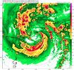
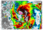
0z Friday is 7pm Thursday evening isn’t it?It seems like it will be making landfall later at 0z Friday instead of Thursday evening based off the GFS
-
Hello, please take a minute to check out our awesome content, contributed by the wonderful members of our community. We hope you'll add your own thoughts and opinions by making a free account!
You are using an out of date browser. It may not display this or other websites correctly.
You should upgrade or use an alternative browser.
You should upgrade or use an alternative browser.
Tropical Hurricane Helene
- Thread starter SD
- Start date
SnowwxAtl
Member
It's 8p...it's in GMT time...I forgot.0z Friday is 7pm Thursday evening isn’t it?
tractor girl
Member
Man I just can't buy that. I'm old enough to remember Hugo very well. It actually gave me my love for weather. It's forward speed was booking it and while Charlotte did see gusts to 70-80 ish range, Charlotte is only around 200 miles maybe from Charleston. This storm has to travel 300 miles to the Southern upstate and 400 miles to get up our way. And at the moment looks to be considerably weaker than Hugo at landfall and forward speed is about the same. I know no two storms are the same and other things are at play but I just don't see it. Maybe in the mtns above 3000 feet sure. Down here 50 tops is my guessThis GFS run is the scariest yet for upstate SC. 60mph gusts were bad enough, but this is showing 80mph for us now.
Something to note with these wind gusts that the models are showing, especially for the western Upstate and northern GA. I seem to remember reading after Irma in 2017 that there was a bit of a tunneling effect between the mountains to the north and the COC to the south that helped to drive those wind gusts down to the surface. I remember that with Irma the wind gusts that the models were showing 24 hours out actually did verify, which is something we typically don’t see inland. That plus the baroclinic enhancement that the models are showing with the ULL could mean a lot of the modeled wind gusts could verify
NEGaweather
Member
Sent from my iPhone using Tapatalk
Henry2326
Member
tractor girl
Member
Something I don't get is how most models are showing a more eastern track, but the pasta model shows more of a western track, then there are graphics like the one above from Fox 5 showing most of the severe to the WEST of the core center, which goes against all I've learned. There seems to be multiple differing trains of thought.
Although, honestly, none of this matters that much until we're clear of the Yucatan Strait
Although, honestly, none of this matters that much until we're clear of the Yucatan Strait
Hugo’s inland winds were generated solely by the fact that the storm was moving very fast inland and just didn’t have time to weaken down. The difference here is that the models are showing a strong baroclinic enhancement of the storm from the ULL just to the west along with a fast forward motion. That’s why we’re seeing these crazy low pressure numbers so far inland after the landfall. Now you’re right that it’s very unlikely that anything more than 35-45mph sustained winds would reach that far inland, but absolutely the potential would be there for 60-80mph gusts. Brent would know better than this but I remember that baroclinic enhancement caused Oklahoma City one time to get hurricane force gusts from a storm that made landfall on the central Texas coast around 24 hours earlierMan I just can't buy that. I'm old enough to remember Hugo very well. It actually gave me my love for weather. Its forward speed was booking it and while Charlotte did see gusts to 70-80 ish range, Charlotte is only around 200 miles maybe from Charleston. This storm has to travel 300 miles to the Southern upstate and 400 miles to get up our way. And at the moment looks to be considerably weaker than Hugo at landfall and forward speed is about the same. I know no two storms are the same and other things are at play but I just don't see it. Maybe in the mtns above 3000 feet sure. Down here 50 tops is my guess
Henry2326
Member
I'm with you....it's not making any sense especially when the 4 hurricane models are consistently saying the opposite.Something I don't get is how most models are showing a more eastern track, but the pasta model shows more of a western track, then there are graphics like the one above from Fox 5 showing most of the severe to the WEST of the core center, which goes against all I've learned. There seems to be multiple differing trains of thought.
Although, honestly, none of this matters that much until we're clear of the Yucatan Strait
Yeah this is a dynamic setup that I can't remember happening before. I will say if they do in fact verify to even 60mph along with 7+ inches of rain there will be widespread long lived power outages.Hugo’s inland winds were generated solely by the fact that the storm was moving very fast inland and just didn’t have time to weaken down. The difference here is that the models are showing a strong baroclinic enhancement of the storm from the ULL just to the west along with a fast forward motion. That’s why we’re seeing these crazy low pressure numbers so far inland after the landfall. Now you’re right that it’s very unlikely that anything more than 35-45mph sustained winds would reach that far inland, but absolutely the potential would be there for 60-80mph gusts. Brent would know better than this but I remember that baroclinic enhancement caused Oklahoma City one time to get hurricane force gusts from a storm that made landfall on the central Texas coast around 24 hours earlier
Drizzle Snizzle
Member
I guess the only good thing for those who may be without power is that summer is over so you don't have to worry about your house getting too hot.
The other thing is just where does this PRE tomorrow set up. Areas under that are going to have a very saturated ground before the storm winds ever approach. My area was in one of those PRE’s as Michael was making landfall in 2018 near Panama City. I got 4.3” of rain from it and then the next day when the actual storm came through, I ended up without power for 3 days.Yeah this is a dynamic setup that I can't remember happening. I will say if they do in fact verify to even 60mph along with 7+ inches of rain there will be widespread long live power outages.
iGRXY
Member
I’m preparing for the worst here. Consensus is 6-10” of rainfall and 30-40mph at least. Even GSP already has us at 6-8” of rainfall and they tend to start out conservative and work up as we get closer. Right up the road in Landrum it’s very nearly 10-15” for their forecasts. Really hoping we don’t lose the power but I don’t have much hopeThe flooding for NE GA and the western upstate of SC is going to be insane. Widespread 10+ inches seems likely at this point... followed by 40-50 mph gusts at minimum. Seems like a recipe for widespread/long lasting power outages.
Something I don't get is how most models are showing a more eastern track, but the pasta model shows more of a western track, then there are graphics like the one above from Fox 5 showing most of the severe to the WEST of the core center, which goes against all I've learned. There seems to be multiple differing trains of thought.
Although, honestly, none of this matters that much until we're clear of the Yucatan Strait
He is predicting for the Atlanta metro. If the center goes east of Atlanta the impact is lower and if west it’s higher.
The graphic isn’t the best, but that is what he is saying.
As much as I am less concerned about wind in the lowlands, I’m doubly afraid for the mountains.Something to note with these wind gusts that the models are showing, especially for the western Upstate and northern GA. I seem to remember reading after Irma in 2017 that there was a bit of a tunneling effect between the mountains to the north and the COC to the south that helped to drive those wind gusts down to the surface. I remember that with Irma the wind gusts that the models were showing 24 hours out actually did verify, which is something we typically don’t see inland. That plus the baroclinic enhancement that the models are showing with the ULL could mean a lot of the modeled wind gusts could verify
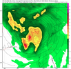
18z GFS max wind gust that I could find on the hourly plots I am sure there are some in between that are higher

Here is the loop
View attachment 092424.mp4

Here is the loop
View attachment 092424.mp4
severestorm
Member
It just hit me that most of us also are gonna fire off in this event with abnormally high soil moisture after the last month. That will make things even worse.
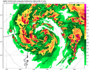
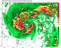
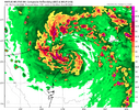
HAFS is back to sub 940 lol

