• Hello, please take a minute to check out our awesome content, contributed by the wonderful members of our community. We hope you'll add your own thoughts and opinions by making a free account!

Tropical Hurricane Francine

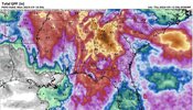
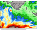
I’m very skeptical, but hard to describe what 15+ inches of rain would do to downtown Atlanta
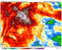
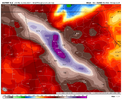
Looks like a nam snowstorm map lol. I agree with you, I think North Georgia and Atlantas totals are based on CAD and even that hasn’t turned out well lately.
 
It seems as though this Storm weakened very fast!
It wasn't very strong to begin with. I don't think it truly was a Cat 2. It looked like a strong tropical storm, not a hurricane. In any case, it made landfall in the almost best possible spot to avoid much damage. I think it was hyped pretty good.
 
Looks like a nam snowstorm map lol. I agree with you, I think North Georgia and Atlantas totals are based on CAD and even that hasn’t turned out well lately.
I'd probably cut those totals by about 2/3rds. However, if training of storms happens due to the stalling progression of the remnants of Francine, some locally heavy amounts could materialize. That 15" is over three days and it's been really dry so I bet the ground can handle it.
 
Yeah, and over most of the same area too. It'll probably end up around 4-5 inches though unless a major band parks in the area.

Edit: it is still there on the 6z Euro too, but slightly farther east.
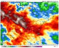
NBM has widespread 3" to 4" amounts for Atlanta. I think it would be very welcome. I'm discounting the Euro output for now.
 
Yeah, and over most of the same area too. It'll probably end up around 4-5 inches though unless a major band parks in the area.

Edit: it is still there on the 6z Euro too, but slightly farther east.
Can you show it? Thanks
 
I know whamby, but I’ll believe those rainfall totals when I see them. So far I’m not convinced. Both NAMs are fairly dry through the weekend. When I say dry, I mean < .5”
 
Reed Timmer in the eyewall at Covodrie, LA with 6-8 ft of storm surge and 100 mph winds.

When and if you are logged in, it will take you to the video.

 
Pulled from the day 2 WPC Excessive Rainfall Discussion. Similar things mentioned for Day 3 as well.

“The combination of these features will likely result in a corridor of persistent low level convergence over TN/AL/GA. We should have plenty of moisture and instability in place as well, and thus a
notable flash flood risk could continue. We will carry a higher end Slight risk across portions of TN/AL/GA with this update. Depending on what happens on day 1 (impacting soil and streamflow
conditions) can not rule out needing a MDT risk over a portion of this area. However there is a bit more uncertainty on convective details by Friday compared to Thursday, and so would like to
continue to evaluate future high res model runs, as well as see how convection evolves today, before making any decision on an
upgrade. Either way flash flooding appears possible, and a locally considerable threat could evolve.”

Link
 
My current situation:

giphy.gif
 
The radar right now south of Birmingham looks wicked. Gotta really watch for spin ups.
I am south of Birmingham right now and can tell you that the radar is a little misleading. I hurried home from the gym to beat the line of storms and it hasn't even thundered or lightninged. Just some light rain and windy. Maybe I'm not far enough south though. I'm only about 7 mi from downtown.
 
Can someone explain to me how we in Raleigh get rain effects from a tropical system 1000miles away and inland
 
Can someone explain to me how we in Raleigh get rain effects from a tropical system 1000miles away and inland

I could be wrong but I think some of it was from the front the other day. Even when it was still in the Gulf i noticed the front on the east side of it
 
Our retired meteorologist in Atlanta put out a fb post apologizing for the forecast of heavy rain. Said he talked to the NWS and they are baffled as to why we didn’t get the expected rain. Said the wedge was to strong to allow warm front to move north with the moisture.🤷🏻‍♂️
 
Our retired meteorologist in Atlanta put out a fb post apologizing for the forecast of heavy rain. Said he talked to the NWS and they are baffled as to why we didn’t get the expected rain. Said the wedge was to strong to allow warm front to move north with the moisture.🤷🏻‍♂️
They should have known better when they got in real time. When the first wave doesn't materialize, the models do not have a correct handle on the dynamics. They should have called an audible when that happened, plus taking into account the extremely dry air, and very strong CAD in place. His predecessor just keeps putting up 80% chances for rain all the while pointing at his future radar with nothing on it. It boggles the mind. Drought begets drought, always. When you have a summer pattern with that bubble ridge over Memphis, we will be dry and hot, it never fails.
 
They should have known better when they got in real time. When the first wave doesn't materialize, the models do not have a correct handle on the dynamics. They should have called an audible when that happened, plus taking into account the extremely dry air, and very strong CAD in place. His predecessor just keeps putting up 80% chances for rain all the while pointing at his future radar with nothing on it. It boggles the mind. Drought begets drought, always. When you have a summer pattern with that bubble ridge over Memphis, we will be dry and hot, it never fails.
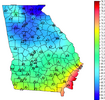
Maybe whamby- but all I got to stay is these "wedges" better show up this winter. Period. And that's on Mary Had A Little Lamb!
 
Our retired meteorologist in Atlanta put out a fb post apologizing for the forecast of heavy rain. Said he talked to the NWS and they are baffled as to why we didn’t get the expected rain. Said the wedge was too strong to allow warm front to move north with the moisture.🤷🏻‍♂️
Sure breeds confidence when your local mets are “baffled”
 
Back
Top