I will say this, per recon we have a heading change now.
-
Hello, please take a minute to check out our awesome content, contributed by the wonderful members of our community. We hope you'll add your own thoughts and opinions by making a free account!
You are using an out of date browser. It may not display this or other websites correctly.
You should upgrade or use an alternative browser.
You should upgrade or use an alternative browser.
Tropical Hurricane Dorian
- Thread starter RBR71
- Start date
accu35
Member
Gfs keeps coming south
Looks more than a jog too.

I will say this, per recon we have a heading change now.[/QUO
Which way?
accu35
Member
Anyone got icon? Stuck on hr 42
Anyone got icon? Stuck on hr 42
Same here
GeorgiaGirl
Member
GFS is now stronger at 66 than it was previously and it looks a hair slower again.
It does look like Dorian has been moving more WNW vs. NW the past hour or so.
JaxHurricane12
Member
Also initiated way too weakGFS is now stronger at 66 than it was previously and it looks a hair slower again.
I think that upper level low will actually be the Monkey wrench with this Hurricane.At hour 54 the ridge does not appear as strong as 18Z.
Looks like WPB inbound on GFS so far
AS FAR AS GOING UP THE EAST COAST?Impressive.
Brent
Member
are the models trending towards the HMON /s
GeorgiaGirl
Member
GFS and GFS Legacy now almost in the same spots. The legacy is just 18 MB stronger.
I think taking 10 MB off on the GFS is probably fair.
I wonder if we can actually manage to lessen impacts if we get a further south recurve. Because some of these runs that I've seen are significant impact.
I think taking 10 MB off on the GFS is probably fair.
I wonder if we can actually manage to lessen impacts if we get a further south recurve. Because some of these runs that I've seen are significant impact.
Tracking due west at 90hr, landfall will be around Jupiter. S/W flatter. This run may see the gulf.
Ridging out in the western US is a little stronger on this 00z GFS run.
Oh crud, FV3 showing rapid strengthening just before landfall.
That is a pretty big change with the trough over the Great Lakes at 108hrs.
Snowflowxxl
Member
I think the GOM is definitely still in play
um....its still moving almost due west.

I think this could be GOM bound on **this** run. There really is nothing to pull it northward atm
Brent
Member
well the 0z runs are not off to a good start for a good solution and they had the plane data
GeorgiaGirl
Member
I kinda think this run is about to reenter the GOM briefly...
and I was wrong. Just heads up the peninsula now, but this definitely did not bring clarity. Now time to see what the damage is storm wise for this run.
and I was wrong. Just heads up the peninsula now, but this definitely did not bring clarity. Now time to see what the damage is storm wise for this run.
accu35
Member
Each gfs run is getting little closer to the gulf
Much stronger high to the north on the GFS.
The last frame or two, you can see a slight WNW movement in my opinion!? Still looks gulf bound
Tracking due west at 90hr, landfall will be around Jupiter. S/W flatter. This run may see the gulf.
THAT IS WHERE MY MOTHER LIVES JUPITER. WHEN CAN I DEPENP ON A MODEL(S). I MAY NEED TO GO AND GET HER SOON. WHEN IS A GOOD TIME TO DEPEND ON THE MODELS. THANK YOU!!!
Brent
Member
Ukmet not so much an outlier anymore

00z CMC is south and slower out to hr 24 so far vs 12z.
The UK has been rock solid on that track thr last three runs I think.
00z GFS Legacy not terribly far off from the 12z Euro tracking around the Eastern FL Coast.
THAT IS WHERE MY MOTHER LIVES JUPITER. WHEN CAN I DEPENP ON A MODEL(S). I MAY NEED TO GO AND GET HER SOON. WHEN IS A GOOD TIME TO DEPEND ON THE MODELS. THANK YOU!!!
I think you can assume with a pretty good degree of certainty that the area will be impacted. That said how much wont be known until a few hours before landfall. Unless it grows you can probably assume a hurricane as compact as Michael.
WHAT YALL WANT FROM THE ICON??
GeorgiaGirl
Member
IF this is a possible solution, hopefully the recurve corrects even further south and at least means that there isn't huge impact across the southeast.
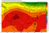
That high seems interesting.

Blue_Ridge_Escarpment
Member
Now that’s the kind of look I want to see in Jan here in WNC.That high seems interesting.
View attachment 22418