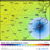
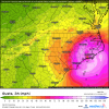
MORE WEST WITH THE RECENT RECON INFO ALSO SOME 96+KNT WINDS ON THE SE AND NE QUADRANTS
-
Hello, please take a minute to check out our awesome content, contributed by the wonderful members of our community. We hope you'll add your own thoughts and opinions by making a free account!
You are using an out of date browser. It may not display this or other websites correctly.
You should upgrade or use an alternative browser.
You should upgrade or use an alternative browser.
Tropical Hurricane Dorian
- Thread starter Metwannabe
- Start date
BHS1975
Member
Well that 00Z Euro run was a game changer for us up in NC if correct...had 80-100 mph gust over almost all of eastern NC with the center making landfall over Swansboro moving more NE up into the Pamlico Sound.
Maps?
Sent from my iPhone using Tapatalk
Downeastnc
Member
Webberweather53
Meteorologist
Even very minute changes in Hurricane Dorian's track would drastically change the severity of direct impacts in central-eastern NC esp for those along the I-95 & US HWY 1 corridors.
If the westward shift in the EPS continues, could definitely envision a scenario where tropical storm force winds make it to areas like the Triangle which currently aren't under a tropical storm watch.


If the westward shift in the EPS continues, could definitely envision a scenario where tropical storm force winds make it to areas like the Triangle which currently aren't under a tropical storm watch.


Blue_Ridge_Escarpment
Member
I could be seeing things but based on IR looks like a pretty good jog west
JUST WEST OF 79.5°W AND APPROX 29.2°NI could be seeing things but based on IR looks like a pretty good jog west
Definitely reorganizing. Wont ever be close to what it was, but watch for a Wilma type outcome.
Recon actually shows a NNE jog recently


Cadi40
Member
Yes, he’s safe. I believe it was posted earlier.
Henry2326
Member
fwiw HWRF has the eye rake the SC coast and make landfall around Georgetown SC, then a second landfall on the southern side of cape fear
B
Brick Tamland
Guest
Today is going to be critical for the track of Dorian. Schools and such are going to have to make decisions soon about whether to close or not.
Henry2326
Member
So I guess this would be welcome to Dorian's final act?
Henry2326
Member
Brasiluvsnow
Member
Dorian looks to have really slowed once again , wont this give it time to strengthen again,I mean not to Cat 4 or 5 but possibly Cat 2 or maybe even Cat 3 ,I would think so ?
Last edited:


