-
Hello, please take a minute to check out our awesome content, contributed by the wonderful members of our community. We hope you'll add your own thoughts and opinions by making a free account!
You are using an out of date browser. It may not display this or other websites correctly.
You should upgrade or use an alternative browser.
You should upgrade or use an alternative browser.
Tropical Hurricane Dorian
- Thread starter Metwannabe
- Start date
Henry2326
Member
NCSNOW
Member
- Joined
- Dec 2, 2016
- Messages
- 9,546
- Reaction score
- 18,993
0z nam is west of 18z
Sent from my SM-G975U using Tapatalk
Also 923mb sitting about 50 miles SE of Savannah on pivotal
ForsythSnow
Moderator
The 3KM again is not reliable for pressure. Use the 12 KM. That shows a more reliable 962 mb.Also 923mb sitting about 50 miles SE of Savannah on pivotal
Good divergence over NC should be a decent shield of rain

Sent from my SM-G975U using Tapatalk

Sent from my SM-G975U using Tapatalk
Not huge I guess but Dorian looks closer to the Fl peninsula then the NAM initialized or has during it's run0z nam is west of 18z
Sent from my SM-G975U using Tapatalk
Little slower and nice westward expansion of the rain shield

Sent from my SM-G950U using Tapatalk

Sent from my SM-G950U using Tapatalk
Starting to see a solid jog toward the coastline right now
Henry2326
Member
3k nam is getting more rain on the northern and western side. We may be seeing the models start to show a more expensive area of rain farther west.Little slower and nice westward expansion of the rain shield
Sent from my SM-G950U using Tapatalk
Sent from my SM-G975U using Tapatalk
Downeastnc
Member
Little slower and nice westward expansion of the rain shield
Sent from my SM-G950U using Tapatalk
925MB winds on the NAM are 80-90 mph at 1800-2400 ft over most of eastern NC and 50-80 mph and a little higher up over the I-95 corridor, how efficiently those winds mix down will be critical....

Also that track of the 3K NAM is
I can see why the models are closer and closer to the coast in short term and long term
Henry2326
Member
Tropical Storm Watches 1 county away from RAH now!!!
Downeastnc
Member
3K NAM just plows into NC almost NNE never makes the turn ENE ends up over Belhaven on the last frame I saw....this is much further NW with the track than the GFS/ICON/EURO/UKIE by a good 50-75 miles
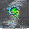
I swear on satellite, it’s moving WNW!?
ForsythSnow
Moderator
Almost looks like that on radar the last 10 or so frames.I swear on satellite, it’s moving WNW!?
I'm in the tropical storm watchTropical Storm Watches 1 county away from RAH now!!!
Sent from my SM-G975U using Tapatalk
Downeastnc
Member
I swear on satellite, it’s moving WNW!?
Its really hard to track storms with large irregular eyes as the uneven edges make it look like it is doing all kinds of stuff.....generally I would say he is moving NW....


