CentralALWX
Member
POST-TROPICAL CYCLONE DELTA ADVISORY NUMBER 25
NWS WEATHER PREDICTION CENTER COLLEGE PARK MD AL262020
400 PM CDT SAT OCT 10 2020
...DELTA BECOMES A NON-TROPICAL LOW...
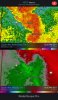
...HEAVY RAIN THREAT CONTINUES...
SUMMARY OF 400 PM CDT...2100 UTC...INFORMATION
----------------------------------------------
LOCATION...33.7N 90.0W
ABOUT 80 MI...130 KM WSW OF TUPELO MISSISSIPPI
ABOUT 250 MI...400 KM SW OF NASHVILLE TENNESSEE
MAXIMUM SUSTAINED WINDS...30 MPH...45 KM/H
PRESENT MOVEMENT...NE OR 55 DEGREES AT 12 MPH...19 KM/H
MINIMUM CENTRAL PRESSURE...998 MB...29.47 INCHES