jeremyt
Member
I think it’s more of a fact that they can’t post sob stories to sm!Thank goodness this is not a winter storm. If many of us end up with 2" (and not 12") we'll be fine. Snow is a different animal.
I think it’s more of a fact that they can’t post sob stories to sm!Thank goodness this is not a winter storm. If many of us end up with 2" (and not 12") we'll be fine. Snow is a different animal.
Too be honest I didn't think she could get back to 60mph and it gives me some slight hope that I'll be east of center and that's where the winds are. Maybe I'll squeeze out a gust or 2 to TS force tonightNot you specifically it's the just typical let's cancel events before they start stuff. We all do it from time to time but there's still 48hrs to go here so it's weird to me
Just prepping for winter!This thread sucks
Fox has their own Weather Channel ?Fox News Weather is better. they actually talk weather.
I am in Georgia and was supposed to get 2-3" and I didn't get a single drop. Today there's barely a cloud in the sky. The models are awful !IK I wasnt supposed to get but 4-6" over here IN CLT Metro but yea..... umm I havent seen a drop and sun is out
Yes and it's a lot better than the weather channel. I've noticed some of the weather channels old talent is now on Fox weather.Fox has their own Weather Channel ?
Bryan Norcross is on there. I always remember him from Andrew in 1992.Fox has their own Weather Channel ?
Mike Seidel is now with Fox Weather.Yes and it's a lot better than the weather channel. I've noticed some of the weather channels old talent is now on Fox weather.


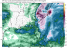
Maybe these models meet in the middle when it comes to totals. I think 6" to 8" is a good bet as of now for the Triangle area. If Debby does strengthen to near hurricane status again (70 MPH winds) or a little higher I think the NWS may have to adjust the wind forecasts upward a bit.The GFS seems pretty reasonable in terms of distribution, if we believe the more western track in the guidance of late. However, I think it's amounts may be a bit low.
View attachment 149624
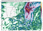
On the other end of the spectrum, you have the Canadians. It maintains a much wider swath of rain on the north and east side. Without the system recovering, I would lean against this solution. I definitely think the widespread 8+" amounts are high. Maybe in spots but the model has a rather large area of extremely high totals. It seems overdone, based on radar trends.
View attachment 149625
I know the forecast is that most of the heavy stuff moves in tonight. But I'm skeptical that the system is going to be organized enough to bring in the Canadian/RGEM totals over such a wide area.
Well it’s obviously not as bad as models projected. It never is seems like. Forecasts are being pulled back all over.Nothing bad has ever came of calling a bust midway through an event
I think it's a tall order for it to strengthen at this point. But we may get under a band for a while like SD said. I don't see any consolidation of the precip shield, even close to the storm, down in SC...with the exception being along the NC coast near Cape Hatteras. Maybe it all fills in later?Maybe these models meet in the middle when it comes to totals. I think 6" to 8" is a good bet as of now for the Triangle area. If Debby does strengthen to near hurricane status again (70 MPH winds) or a little higher I think the NWS may have to adjust the wind forecasts upward a bit.
Myrtle getting hammered now! Live coverage on TWC , looking legit TS now!I think for areas along and east of us1 the system is going to be defined by if we see these convecrive tails develop from offshore into the circulation. If they don't then yes the highn end rain totals will bust high, if they do then we have real problems tomorrow with rounds of 1-3 inch per hour rains with embedded tornadoes/supercell structures as sb cape increases on the E and NE and eventually SE side of the circulation. If we get one that has limited movement for a few hours it will easily drop 3-6+ inches of rain on top of what looks like 1-3/2-4 with the main band of rain tonight.
You can see the NAMs, rgem and arw2 really hit us hard with these even the less impressive fv3 hires and gfs hint at them.
