• Hello, please take a minute to check out our awesome content, contributed by the wonderful members of our community. We hope you'll add your own thoughts and opinions by making a free account!

Hurricane Debby

12Z UKMET: Whereas the 0Z went in just NE of CHS, the 12Z is a little further NE ~midway between CHS and Georgetown. Then goes NNW to near Charlotte then turns NNE to inland in the NE US:

TROPICAL STORM DEBBY ANALYSED POSITION : 32.0N 79.4W

ATCF IDENTIFIER : AL042024

LEAD CENTRAL MAXIMUM WIND
VERIFYING TIME TIME POSITION PRESSURE (MB) SPEED (KNOTS)
-------------- ---- -------- ------------- -------------
1200UTC 07.08.2024 0 32.0N 79.4W 996 36
0000UTC 08.08.2024 12 32.6N 79.3W 995 32
1200UTC 08.08.2024 24 33.6N 79.5W 997 34
0000UTC 09.08.2024 36 34.7N 80.6W 999 32
1200UTC 09.08.2024 48 37.8N 79.9W 999 31
0000UTC 10.08.2024 60 42.2N 76.6W 996 34
1200UTC 10.08.2024 72 47.1N 70.2W 990 34
0000UTC 11.08.2024 84 49.7N 64.9W 989 37
1200UTC 11.08.2024 96 50.0N 57.0W 992 35
0000UTC 12.08.2024 108 CEASED TRACKING
 
Again. People will see more rain. Massive totals are less likely, imo from what I see.

Some modeling shows much heavier banding than others. Some of those models had over 15 inches of rain for places already though.
 
12Z UKMET: Whereas the 0Z went in just NE of CHS, the 12Z is a little further NE ~midway between CHS and Georgetown. Then goes NNW to near Charlotte then turns NNE to inland in the NE US:

TROPICAL STORM DEBBY ANALYSED POSITION : 32.0N 79.4W

ATCF IDENTIFIER : AL042024

LEAD CENTRAL MAXIMUM WIND
VERIFYING TIME TIME POSITION PRESSURE (MB) SPEED (KNOTS)
-------------- ---- -------- ------------- -------------
1200UTC 07.08.2024 0 32.0N 79.4W 996 36
0000UTC 08.08.2024 12 32.6N 79.3W 995 32
1200UTC 08.08.2024 24 33.6N 79.5W 997 34
0000UTC 09.08.2024 36 34.7N 80.6W 999 32
1200UTC 09.08.2024 48 37.8N 79.9W 999 31
0000UTC 10.08.2024 60 42.2N 76.6W 996 34
1200UTC 10.08.2024 72 47.1N 70.2W 990 34
0000UTC 11.08.2024 84 49.7N 64.9W 989 37
1200UTC 11.08.2024 96 50.0N 57.0W 992 35
0000UTC 12.08.2024 108 CEASED TRACKING
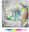
NHC advisory at 2 has Debby at 32.4, 79.1 .. however, Recon center fixed closer to where the UKMET model initialized.

Nevermind. Last pass locates it on the advisory.
recon_AF309-0904A-DEBBY (1).png
 
Typical coastal/ENC footprint. At least this time we don’t have to argue where the Rain/snow line is going to set up. A lot of rain for the triangle. I’ll be shocked if my area (GSP) picks up those 2-3” numbers TWC is talking about. That just isn’t how these things normally shake out.
 
Sun peeks,possibly will aid in instability and help ignite these bands as they pivot around.
 
.75" for the event so far.
Ice Cube Movie GIF
 
Nasty little line in Savanna metro foggy and poor visibility rains. Could barely hold that water. Thankfully Walterboro SC rains are not headed this way cause that would have caused up to reach 20”+ major issues.
 
Back
Top