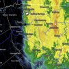
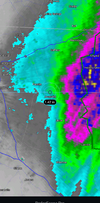
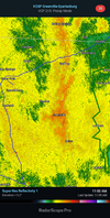
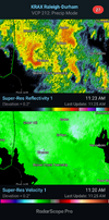
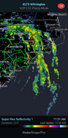
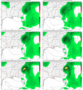
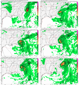
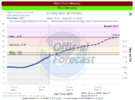
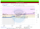
That band going from Clayton to well offshore is going to really spike rain totals in the NE part of the state today
-
Hello, please take a minute to check out our awesome content, contributed by the wonderful members of our community. We hope you'll add your own thoughts and opinions by making a free account!
You are using an out of date browser. It may not display this or other websites correctly.
You should upgrade or use an alternative browser.
You should upgrade or use an alternative browser.
Hurricane Debby
- Thread starter Brent
- Start date
I’m glad I cut my grass last night. Some of yalls 25 year old mower blades trimming over your septic drain field are going to be in trouble this weekend
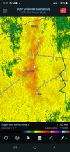
Shetley is getting smoked. Looks like I'm going to bust from Spartanburg up to Gastonia with my less than one inch prediction. Guess I busted from Greenville south too. Figured they'd at least get some rain. They aren't going to get a drop from Greenville down to @Stevo24Wonder how the shetley drought is going
snowc
Member
snowc
Member
Thank lord!Hmm the worst of it seems to be about over for areas N and E of clt.
snowc
Member
No red boxes seen on DD5K.That storm in Sampson county about to move into harnett might be a problem shortly
Looks like the rain is going to be wrapping up around the Raleigh area within the hour, outside of a widely scattered basis. Main band is pivoting northward.
Downeastnc
Member
Well here comes the sun
View attachment 149715
Not sure if that is a good thing or a bad thing.
Downeastnc
Member
Shaggy
Member
Sun popped out here and immediately enhanced a band coming right up the cape fear riverNot sure if that is a good thing or a bad thing.
NoSnowATL
Member
But is it heavily filtered or lightly filtered sun?Well here comes the sun
View attachment 149715
Downeastnc
Member
As of yesterday morning’s update I had received 10.3” from Debby. I’ve since had an additional 0.6” to give me a Debby grand total (over 3 days) of 10.9”, easily the largest amount from a single event here since Matthew of Oct 7-8, 2016.
Together with the 10” I got 7/19-8/3 from PM convection, I’ve received 20.9” during just the 20 day period of 7/19-8/7. Thus, any possible heavy rains from tropical or other during the next few weeks could be extra problematic.
Together with the 10” I got 7/19-8/3 from PM convection, I’ve received 20.9” during just the 20 day period of 7/19-8/7. Thus, any possible heavy rains from tropical or other during the next few weeks could be extra problematic.
- Joined
- Jan 23, 2021
- Messages
- 4,603
- Reaction score
- 15,199
- Location
- Lebanon Township, Durham County NC
Shetley drought in shambles
I’m at 5.32” since midnight which put me over 20” since 7/1. It will be interesting to see how much of that band to the west holds together and if pivots back through CLT metro as the center begins moving north
Shaggy
Member
I've had a touch over 15 this week and had 11.5 from our 2 weeks of drought busting rain.I’m at 5.32” since midnight which put me over 20” since 7/1. It will be interesting to see how much of that band to the west holds together and if pivots back through CLT metro as the center begins moving north
No more hurricanes please......at least for 3 weeks
Yeah if there’s another tropical system to deal with in the next couple weeks, the central and eastern Carolinas could be in real trouble.I've had a touch over 15 this week and had 11.5 from our 2 weeks of drought busting rain.
No more hurricanes please......at least for 3 weeks
These "light" bands on radar aren't playing around. If you're getting under the yellow & red bands, you're getting crushed today.
Cary_Snow95
Member
Suns out in Cary
The sun looks like its about to break through the clouds here at the house. I have 5.15 inches of rain in the gauge which is a little less than I anticipated. It looks on radar like Wake County will get a break from the rain for at least a couple of hours at least.
Last edited:
New tornado watch out until 8 pm.
ORNADO WATCH OUTLINE UPDATE FOR WT 614
NWS STORM PREDICTION CENTER NORMAN OK
1245 PM EDT THU AUG 8 2024
TORNADO WATCH 614 IS IN EFFECT UNTIL 800 PM EDT FOR THE
FOLLOWING LOCATIONS
NCC013-015-029-031-041-049-053-055-061-063-065-069-073-077-079-
083-091-095-101-103-107-117-127-131-133-137-139-143-145-147-177-
181-183-185-187-191-195-090000-
/O.NEW.KWNS.TO.A.0614.240808T1645Z-240809T0000Z/
NC
. NORTH CAROLINA COUNTIES INCLUDED ARE
BEAUFORT BERTIE CAMDEN
CARTERET CHOWAN CRAVEN
CURRITUCK DARE DUPLIN
DURHAM EDGECOMBE FRANKLIN
GATES GRANVILLE GREENE
HALIFAX HERTFORD HYDE
JOHNSTON JONES LENOIR
MARTIN NASH NORTHAMPTON
ONSLOW PAMLICO PASQUOTANK
PERQUIMANS PERSON PITT
TYRRELL VANCE WAKE
WARREN WASHINGTON WAYNE
WILSON
That's a prudent call extending the tornado watch by the NWS in consideration of all of the activity that has already occurred today.New tornado watch out until 8 pm.
- Joined
- Jan 23, 2021
- Messages
- 4,603
- Reaction score
- 15,199
- Location
- Lebanon Township, Durham County NC
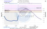
Crabtree Creek at the mall is a foot away from minor flood stage
Things have seemed to quiet down for now.
snowc
Member
Will this be the last for now?Things have seemed to quiet down for now.
Sun is coming out here. Wonder if that will spark more storms.
Shaggy
Member
Winds have gotten gusty since the breaks came over. Nothing string but certainly briskSun is coming out here. Wonder if that will spark more storms.
Shaggy
Member
Actually ILM airport is Gusting mid 40s right now. I'm 5 or 6 miles SW of there
iGRXY
Member
I’ve been getting smoked for 6 hours now. However said Spartanburg county wasn’t going to get hardly anything that busted big time. Flash flood warning just to my east also. It looks like the heaviest axis has shifted to escarpment and upstate. Specifically Spartanburg County
Shaggy
Member
@lexxnchloe I'm getting some of the biggest gusts of the entire thing right now. Some rippers hitting the house. I assume the sun is helping them mix down
That big band to the west of the COC ended up setting up a bit further west that guidance was showing. Most modeling was showing it setting up along and just to the east of the I-77 corridor. It’s still going strong though and from the naked eye, it looks like it would have to pivot back over CLT metro as the center pulls northI’ve been getting smoked for 6 hours now. However said Spartanburg county wasn’t going to get hardly anything that busted big time. Flash flood warning just to my east also. It looks like the heaviest axis has shifted to escarpment and upstate. Specifically Spartanburg County
RDUHeatIsland
Member
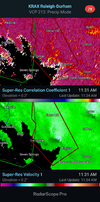
Confirmed tornado near Henderson

