• Hello, please take a minute to check out our awesome content, contributed by the wonderful members of our community. We hope you'll add your own thoughts and opinions by making a free account!

Tropical Global Model Runs Discussion 2017

12z gefs
60342c2075651ec260d815c38ff2a3e1.png


Sent from my iPhone using Tapatalk
 
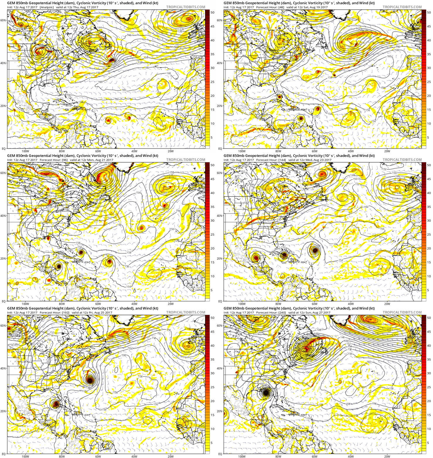
This far out it's just a wild model guess, but simply working off of modeling and suggesting no credence in a 9 day out possibility, should it come to fruition and end up in the Gulf, could be anywhere from south of Cedar Key to P'cola ...
We'll just watch and learn as time goes on ... :cool:
 
Last edited:
Euro at least looks to brlefly have Harvey, Irma, and Jose in the next week. 92L doesn't seem to last very long though

Would be on par with 2005 in number of storms anyway if that verified lol
 
The Euro and GFS are both getting stronger w/ 92L in the medium range... They show less interaction with the ULL and allow 92L to slip by but shear 93L for several days as it pushes into the central Atlantic.
Unknown.gif

Unknown.gif
 
12z UKMET develops 3 storms yet again with 92L traversing the length of the Greater Antilles and fixing to emerge in the Gulf largely in tact a week from now. Definitely the system worth watching and we'll need to see how it interacts with the ULL this weekend near the greater Antilles before being concerned about any particular scenario or risk to the US.
 
I think the squirrel this year isn't blind at all, and has been cured, but is still nearsighted at times. :p We shall see next year if this is true, but I think the CMC's days of being crazy and developing 5 hurricanes at once are over.

Maybe there has been some improvement, but I think it i still retains a lot of its craziness as I think it still overdevelops often, which I suspect is due largely to it not treating shear correctly. I first heard JB calling it "Crazy Uncle", a great name. Another possibility: the "Anthony Scaramucci model"?
 
Maybe there has been some improvement, but I think it i still retains a lot of its craziness as I think it still overdevelops often, which I suspect is due largely to it not treating shear correctly. I first heard JB calling it "Crazy Uncle", a great name. Another possibility: the "Anthony Scaramucci model"?

We need the mooch over on this board. Omgd it would be gold . He would get rid of all of us


Sent from my iPhone using Tapatalk
 
I find it interesting that JB yesterday posting pics of hurricane running up the EC and then today Ryan stating limited hurricane activity.... seems the example of the 2 extremes to me. Appears he is basing this tweet entirely on the EPS

Maue.jpg
 
I find it interesting that JB yesterday posting pics of hurricane running up the EC and then today Ryan stating limited hurricane activity.... seems the example of the 2 extremes to me. Appears he is basing this tweet entirely on the EPS

Maue.jpg

But if you look at the gefs and the Canadian ensembles . They look rather meh as well. Sure there are a few members of each that develop but nothing overwhelming .

The Canadian ensembles aren't near as excited as the CMc

Plus JB was using the CFSV2 !!!!!! I mean that's like using the JMA for a day ten blizzard


Sent from my iPhone using Tapatalk
Intensity wise yes but track wise it there is some support for a possible US visit (although a weak system if a system at all). You, I and everyone on here knows that JB's tweet is bs using the CFSV2 but to the general public that read it all they saw was a massive storm on the EC and Ryan is more accurate no doubt but too early to dismiss it altogether as well.

Personally I like your tweet better, very active but no immediate threat to US.... active yes, keep an eye on it yes, need to worry no. Good job take the jet for a spin :cool:
 
For the record , I'm not saying Ryan is correct . Just stating the obvious when it comes to his way of forecasting vs the way JB does it


Sent from my iPhone using Tapatalk
 
I say we all gulf coasters, is about to run out of luck soon. Just an uneducated guess.
 
Too bad we can't just have one storm at a time. If we get 10 to form soon, I will be writing 2 articles at the same time and tracking the model instances for 2 storms. At least Gert is on its last day I think.
 
I find it interesting that JB yesterday posting pics of hurricane running up the EC and then today Ryan stating limited hurricane activity.... seems the example of the 2 extremes to me. Appears he is basing this tweet entirely on the EPS

Maue.jpg

Hyping events like hurricanes are not a good idea 8 to 10 days out w/how poorly models handle weather that far out. For now...I would take a weaker solution of what the CMC is putting out for the GOM.


Sent from my iPhone using Tapatalk
 
A third system behind Nine and 92L is looking less and less likely for now, and the CMC by the way was picking up activity from that wave north of Haiti and the Dominican Republic.
 
Wanna see some divergence?
Click here and go to "Loop Models by Day" in the upper left (pink) and hit day 7:
https://ruc.noaa.gov/hfip/tcgen/
Pick a model, roll 2 dice ...


If I had a dollar
for every ace I've drawn
I could arm a town
The size of Abilene ...
 
Last edited:
And the NHC only has it at 70%. Probably because of the ULL to its north and the dry air hammering it. Any scans show anything?
I was just fixing to get to sleep -- been a real long day. Will check with eyes and mind more wide open before Mr. Sol gets up ...
 
Back
Top