NBAcentel
Member
A More amped first system is no beuno since it means stronger/further south 50/50 lowI’ve been watching that front slow way down (as you just posted). Does it have any real affect on our Wednesday system?
A More amped first system is no beuno since it means stronger/further south 50/50 lowI’ve been watching that front slow way down (as you just posted). Does it have any real affect on our Wednesday system?
Plus, if the NE gets snow cover, we can maximize the effects of a CAD.A More amped first system is no beuno since it means stronger/further south 50/50 low
For my areaGFS HAS ONSET SNOW
Sent from my Pixel 3 using Tapatalk
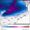
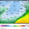
Anyway this translate to more of a snow event for central Piedmont of NC?Wave pattern amplifying more on the 12z GFS so far, likely gonna translate to even stronger/colder CAD on this run.
This trend can stop now, thanks.
View attachment 57249
Not at all. Could possibly translate to more of a sleet stormAnyway this translate to more of a snow event for central Piedmont of NC?
Figured that was gonna happen sooner or later
heres what That dec 2002 ice storm looked like if y’all aren’t familiar View attachment 57256
If I'm not mistaken didn't that storm start out with snow and ip?heres what That dec 2002 ice storm looked like if y’all aren’t familiar View attachment 57256
Here's the ERA5 analysis for the storm. That one started out with a lot of snow over NC.If I'm not mistaken didn't that storm start out with snow and ip?
Sent from my Pixel 3 using Tapatalk


Yeah I thought so. Don't think we will see the snow part but maybe sleetHere's the ERA5 analysis for the storm. That one started out with a lot of snow over NC.
View attachment 57260
ECMWF ERA5 (Reanalysis) | 12/04/2002, 03:00pm | USA
Historical weather maps from 12/04/2002, 03:00pm, USA - Significant Weather | ECMWF ERA5 (Reanalysis)weather.us
Here's the ERA5 analysis for the storm. That one started out with a lot of snow over NC.
View attachment 57260
ECMWF ERA5 (Reanalysis) | 12/04/2002, 03:00pm | USA
Historical weather maps from 12/04/2002, 03:00pm, USA - Significant Weather | ECMWF ERA5 (Reanalysis)weather.us
Also, temps were the mid-low 20's when the storm started across central NC. This time around, things are much more marginal.Here's the ERA5 analysis for the storm. That one started out with a lot of snow over NC.
View attachment 57260
ECMWF ERA5 (Reanalysis) | 12/04/2002, 03:00pm | USA
Historical weather maps from 12/04/2002, 03:00pm, USA - Significant Weather | ECMWF ERA5 (Reanalysis)weather.us

Wow the strength of some of those CAD signals going all the way into Georgia ... leads me to believe we could have a long way to go with this one (in terms of how much that high can trend even colder and closer)Of course the ice storm trends inside 100 hours
View attachment 57265
It's quite early for himBrad p starting to honk
So Brad P lolWont say who, but a certain met just tweeted out a lot of cold rain for Tuesday Wednesday system. Said some ice could mix in for favored CAD areas. LOL I can’t even.
That was a good one! We had a couple good ice storms back in the early 2000’s here. I can still close my eyes and remember the sound of branches snapping. I stayed at my buddies, either 2000 or 2002, and half a tree fell and slammed his chimney in the middle of the night. Nearly knocked the house off the foundation. Fun times.heres what That dec 2002 ice storm looked like if y’all aren’t familiar View attachment 57256
