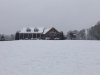
Snow falling on the westside of Spartanburg per friends
-
Hello, please take a minute to check out our awesome content, contributed by the wonderful members of our community. We hope you'll add your own thoughts and opinions by making a free account!
You are using an out of date browser. It may not display this or other websites correctly.
You should upgrade or use an alternative browser.
You should upgrade or use an alternative browser.
Wintry February 7-8 Winter storm
- Thread starter Six Mile Wx
- Start date
iGrey_X
Member
Starting to see flurries here in northern Spartanburg county. I’d say 15-20 more minutes and we should be cooking with grease.
Sctvman
Member
Basketball still on in Cullowhee...
Jessy89
Member

So happy
Sent from my iPhone using Tapatalk
NBAcentel
Member

Wulfer
Member
3.5 is above Chattanooga's average snowfall!
Moderate small snow flakes. Come on I need a half inch damnit!
mydoortotheworld
Member
You’re living my dream. I love that restaurant and I can only imagine the cozy feeling you’re getting having breakfast with snow pouring outside. I’m on a plane to Miami so of course I’m unlucky enough to be missing out, enjoy the good stuff while it lasts!!I chased. I’m at the flying biscuit in Alpharetta! It’s awesome!
Henry2326
Member
Really? I thought the snow falling line was further S than that. You mean 2 miles N of I-20, right?

Snow line 30 miles to my south!!! BOOM!
NBAcentel
Member
Actually seeing snow fall above me, wisps of virga above me
drfranklin
Member
- Joined
- Dec 1, 2016
- Messages
- 511
- Reaction score
- 760
just came back from Lidl, mod to heavy snow, sticking on ground, 34.1/25
LovingGulfLows
Member
- Joined
- Jan 5, 2017
- Messages
- 1,499
- Reaction score
- 4,100
Pretty much rain now. What a fun little event...maybe a little over an inch here. RGEM got the accmulations right towards the end here.
Sctvman
Member
Snow cutoff right now on 85 cameras is MM 56.5
34/30..wet bulb just above freezing I think. I need rates!
A flake every 3 seconds lol #winning
Sctvman
Member
Gilmer County
NBAcentel
Member
hrrr has sure folded this mornin 
Forevertothee
Member
Clinton
Temp 37
DP 28
Can the areas in the Upstate S of 85 get a coating?
Sent from my iPhone using Tapatalk
Temp 37
DP 28
Can the areas in the Upstate S of 85 get a coating?

Sent from my iPhone using Tapatalk
RIPPAGE!
Lots of little flakes flying around
NBAcentel
Member
It’s obvious where this is going, CLT will probably get the fair share aswell 
congrats sir! take picsSnow line 30 miles to my south!!! BOOM!
Jessy89
Member
Sons trying build snow man


Sent from my iPhone using Tapatalk


Sent from my iPhone using Tapatalk
Sctvman
Member
Flurries making it all the way to MM 77 now On 85.
D
Deleted member 609
Guest
You think south clt will snow or rainIt’s obvious where this is going, CLT will probably get the fair share aswell View attachment 33607
Webberweather53
Meteorologist
hrrr has sure folded this mornin View attachment 33606
Events like this w/ modest low-mid level warm advection and gentle isentropic upglide often overperform.

GeorgiaGirl
Member
Another relative dropped more pictures. Based off them, I pretty confidently can say parts of La Fayette, GA got 2" of snow this morning. Honestly think they barely missed on more, but 2" is better than 0" lol.
Wish I could post them. Think I'll try again in a few.
Wish I could post them. Think I'll try again in a few.
Webberweather53
Meteorologist
You think south clt will snow or rain
Snow. South Charlotte (esp the SC side of the metro) will probably perform much better in this storm than the north side.
Triplephase93
Member
3.5-4 inches in Hixson Tn
drfranklin
Member
- Joined
- Dec 1, 2016
- Messages
- 511
- Reaction score
- 760
ground nearly covered; temp 32.9; roads clear
mod to heavy snowfall
mod to heavy snowfall
It’s obvious where this is going, CLT will probably get the fair share aswell View attachment 33607
Incredible how the physics dumped into the HRRR is slower than what Is actually happening. 950 for the win I guess. Be nice for us Crown Towners to get a surprise.
accu35
Member
I'm very excited you guys got to see snow, this is awesome. What seems like a little system turned into a nice snowstorm. I haven't see snow yet this year, but I'm not worried my Time will come again.
Well over 3 inches here, measured in several spots and got between 3.25-3.75. Woot!
LovingGulfLows
Member
- Joined
- Jan 5, 2017
- Messages
- 1,499
- Reaction score
- 4,100
Video of it snowing at it's peak here in Northern Rockdale:
Couple of pictures by the end of it...nothing spectacular compared to other folks, but I'm pretty satisfied.


Couple of pictures by the end of it...nothing spectacular compared to other folks, but I'm pretty satisfied.
NBAcentel
Member
Incredible how the physics dumped into the HRRR is slower than what Is actually happening. 950 for the win I guess. Be nice for us Crown Towners to get a surprise.
Yeah, after seeing naders around a few days ago, lol
GeorgiaGirl
Member

Credit to my uncle. La Fayette, GA
3rd surprise in that general area in the 2010-2020 stretch, but first snow since early December 2017 I think, I'm not 100% sure.
drfranklin
Member
- Joined
- Dec 1, 2016
- Messages
- 511
- Reaction score
- 760
perfect snow here: ground turning white but roads are clear
Rosie
Member
Right at 6” here?