Watching the radar in Northern MS, Amory, MS will likely be changing over to snow within the hour.
-
Hello, please take a minute to check out our awesome content, contributed by the wonderful members of our community. We hope you'll add your own thoughts and opinions by making a free account!
You are using an out of date browser. It may not display this or other websites correctly.
You should upgrade or use an alternative browser.
You should upgrade or use an alternative browser.
Wintry February 7-8 Winter storm
- Thread starter Six Mile Wx
- Start date
Morristown gives us a 40% chance of rain/snow, but I'm guess that's just to cover our higher elevations. Only a high of 38 for tomorrow. It's funny how off they were about temps only a few days ago for Friday. They were calling for upper 40s as little as 3-4 days ago.NWS Huntsville is not too excited about it overall, and doesn't even mention Huntsville proper in their current discussion. I am watching that N MS moisture blob and temp/dp here is down to 43/42
JLL1973
Member
Snowing big flakes here
A few flurries for us will change this winter's grade from an F- to just an F. I'm desperate enough to accept an F at this point.
Storm5
Member
Central tenn looks like the place to be tonight
Sent from my iPhone using Tapatalk
Sent from my iPhone using Tapatalk
Ilovesnow28
Member
I probably should of snow chase to Tennessee tonight dang
I would chase but I'm off tonight and already half in the wine bag. Not a good idea at this point. I'm rooting just to see a stray flake. Temps are too warm over here I think. Plateau kills us yet again.I probably should of snow chase to Tennessee tonight dang
Last edited:
StormStalker
Member
38 degrees here in NW Bama. Hoping we can get a mix or changeover soon.
Crossville, Tn would be the ideal spot.I probably should of snow chase to Tennessee tonight dang
Clem282340
Member
I’m hoping the upstate see some snow out of this system this weekend
Clem282340
Member
Which short range model should we be watching
accu35
Member
lol, The one who shows the most.Which short range model should we be watching
BufordWX
Member
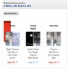
FFC biting the bullet in giving me a low chance to see rain/snow tomorrow and Saturday. We shall see!
View attachment 33310
Surprised to see a similar forecast for Atlanta too, but only for Saturday.
JLL1973
Member
Nice flakes falling. Ground is covered
StormStalker
Member
We got some big wet snowflakes mixing in now.
MRX has two separate chances for CHA, one overnight, then another Sat morning. Small little disturbance coming out of Missouri.
what's your temp?Nice flakes falling. Ground is covered
JLL1973
Member
34 on my weather stationwhat's your temp?
Ron Burgundy
Member
ghost1
Member
I have wet snowflakes and rain in about a 50/50 mixture just N of Florence AL... 36°
Ilovesnow28
Member
This is the 0z WRF-ARW2 for Saturday...that's a good looking mini snow storm, I'll take it!


Sent from my SM-A102U using Tapatalk


Sent from my SM-A102U using Tapatalk
Ron Burgundy
Member
I just blanked my bank account, and went all in on this map... wish me luck.This is the 0z WRF-ARW2 for Saturday...that's a good looking mini snow storm, I'll take it!

Sent from my SM-A102U using Tapatalk
olhausen
Member
John1122
Member
Off and on mix here so far. Middle Tennessee areas are colder than even the Plateau here so far.
41 degrees and rain at my house.. Not staying up for this one. The early Dec car topper was more exciting.
Clay
Member
About an inch of wet snow here in Nashville, about to taper off. Stuck to the everything except the asphalt!
Dry air quickly moving in from the west/southwest. Done deal.
Clay
Member
If that last band near the TN River can hold up we might squeek out another .25". Liquid ratios should be pretty decent. That'd put us at 1-2" area wide. Not bad considering a dusting to .5 was forecasted.Dry air quickly moving in from the west/southwest. Done deal.
We now have more snowfall on the season than alot of cities on the East Coast LOL!
olhausen
Member
It’s pretty crazy how quick that dry air came in. I was easily on my way to 2 plus inches if it had held together and continued to snow as hard as it was. Oh well I’m still extremely happy with the plastering I received tonigh!!If that last band near the TN River can hold up we might squeek out another .25". Liquid ratios should be pretty decent. That'd put us at 1-2" area wide. Not bad considering a dusting to .5 was forecasted.
We now have more snowfall on the season than alot of cities on the East Coast LOL!
StormStalker
Member
Getting a decent snow shower here. Rooftops turning white and sticking to cars. Roads just wet.
BufordWX
Member
BufordWX
Member
LovingGulfLows
Member
- Joined
- Jan 5, 2017
- Messages
- 1,499
- Reaction score
- 4,100
Best run of the 3km NAM yet. I’m really getting intrigued by this one, but not completely sold just yet.
Yeah NAM went sort of crazy this run.


It does seem to be trending colder with the initial temps, especially in the mid levels, but it is the NAM and it tends to over amp these systems and trend on the colder side of verification.
campamy
Member
Just woke up to a decent sleet shower here. Temp 39.
NBAcentel
Member
John1122
Member


