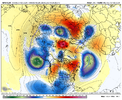
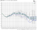
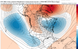
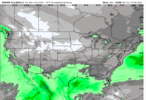
yes, if the ETA and Dr. NO were lock in step thats a wrap!!! EE Rule....sh** I feel like the models did a better job back in the day vs now sometimes.
-
Hello, please take a minute to check out our awesome content, contributed by the wonderful members of our community. We hope you'll add your own thoughts and opinions by making a free account!
You are using an out of date browser. It may not display this or other websites correctly.
You should upgrade or use an alternative browser.
You should upgrade or use an alternative browser.
Pattern February 2024
- Thread starter SD
- Start date
You might want to check againIt’s cute and all to gaze at the day 12+ ensembles but eventually we going to need some op runs with the magic.
This ain’t it.
View attachment 144943
lexxnchloe
Member
It’s cute and all to gaze at the day 12+ ensembles but eventually we going to need some op runs with the magic.
This ain’t it.
View attachment 144943

lexxnchloe
Member
Phases late and smokes the MA and Northeast
That one stil chaps my ass! I think the Euro was literally spitting out 24” totals 24 hours out for me! Got 1” of sleet with 1-4” dusting at end! ?That one entered the U.S. in N California before moving east and amplifying over the southeast
View attachment 144930
WolfpackHomer91
Member
Phases late and smokes the MA and Northeast
Ummm
 that looked pretty good to me
 Sent from my iPhone using Tapatalk
griteater
Member
This whole sequence is spectacular looking really. Low latitude STJ in the Pacific and across the CONUS. Increasing high latitude blocking. 50/50 low production in the NW Atlantic. Big Scandinavian ridge set to retrograde into Greenland


lexxnchloe
Member
This whole sequence is spectacular looking really. Low latitude STJ in the Pacific and across the CONUS. Increasing high latitude blocking. 50/50 low production in the NW Atlantic. Big Scandinavian ridge set to retrograde into Greenland


tonysc
Member
Ahh the great Southeastern Snowstorm February 9-11 1973. The biggest Snowstorm I've ever seen here in Greenwood, SC. Over a foot imby. It was wonderful.Here is a set of 6 storms that I have matching this type of setup of split flow with a low latitude wave running west to east into Baja. The composite images are when the wave hits the Baja coast
View attachment 144934
View attachment 144935
View attachment 144936
View attachment 144937
View attachment 144938
View attachment 144939
View attachment 144940
View attachment 144941
View attachment 144942
Twister
Member
That Trough gonna Break down and the Ridge gonna move away from the NW. Therefore the Pattern Change everyone is talking about the 2nd half of Feb will be muted. I'd bet right now most innthe SE especially outside of the Mountains will likely see highs in the 40s and 50s, With several 60s thrown in. I guess we move on to Magnificent March as Spring Approaches.
Sent from my SM-S911U using Tapatalk
Sent from my SM-S911U using Tapatalk
CNCsnwfan1210
Member
Need to dislodge that cold air over Alaska where yesterday high temps were in the 40-50 below zero range. Break off some of that and send it south!
Sent from my SM-A136U1 using Tapatalk
Sent from my SM-A136U1 using Tapatalk
rburrel2
Member
iGRXY
Member


Lol you're trying too hard at this point.
I’m not trying to be rude, but this is basically a repeat of how we’ve failed the past 4 years. The PV is too far west and it will not work for us without supreme luck IMO. That’s a western southeast and Mid-Atlantic north winter look IMO. PV must be anchored further east for us to score (but then not too far east or we fail that way too).Could you draw it up any better than this? Picture frame worthy
View attachment 144949View attachment 144950

