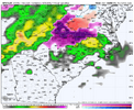
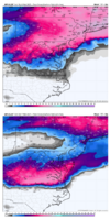
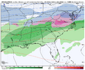
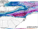
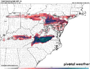
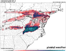
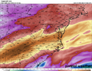
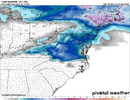
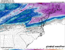
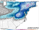
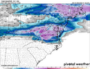
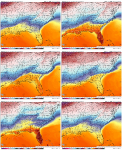
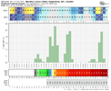
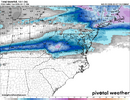
Curious if the high res models start to sniff out more of a wedge at the surface with that one when we get closer in.
-
Hello, please take a minute to check out our awesome content, contributed by the wonderful members of our community. We hope you'll add your own thoughts and opinions by making a free account!
You are using an out of date browser. It may not display this or other websites correctly.
You should upgrade or use an alternative browser.
You should upgrade or use an alternative browser.
Pattern February 11-13 2025
- Thread starter SD
- Start date
LukeBarrette
im north of 90% of people on here so yeah
Meteorology Student
Member
2024 Supporter
2017-2023 Supporter
just about spit out my drink at the gfs jump south
SnowmanVol99
Member
GFS trying to make it close even for parts of Tennessee.
NBAcentel
Member
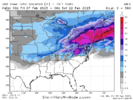
Maybe some data was ingested into model for 0z.Obviously not in the game down here in Atlanta but rooting for a miracle for the NC/VA folks. That was an insane shift for being 5 days away View attachment 167969
@BIG FROSTY is about to get 6” while the rest of us rain. 
The 00z GGEM also shifted south a good amount, though it’s not as far south as the GFS. The GFS is probably out to lunch, but it certainly piques the interest.
WolfpackHomer91
Member
The 00z GGEM also shifted south a good amount, though it’s not as far south as the GFS. The GFS is probably out to lunch, but it certainly piques the interest.
GFS Looks pretty 12Z ICON (ish) with the footprint. Curious to see if a higher number of members show a southern slide then I’d be interested. I think there was like 5 members on 12Z GEFS didn’t check 18Z. Also, not expecting much …. But we’re literally 70 miles from being in the southern extreme of that zone that’s not some world beating task for 5days … wishcasting sure but still.
Sent from my iPhone using Tapatalk
NBAcentel
Member
Luke 20+ Inches for the SWVA Boys on here
CNCsnwfan1210
Member
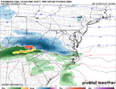
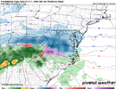
I bet you this is the last jump south, because it’s headed the right direction. Knowing our luck View attachment 167966View attachment 167967
Some many locales at 33 on the latest run
Sent from my iPhone using Tapatalk
Another one hundred miles south and Central North Carolina is back in business. It might not be the kind of business that many of us want though. Over an inch of freezing rain for us would be an ice storm for the ages. If the Euro starts to align with the latest GFS in its southward trend it might be time to start making some preparations to be without power for a while. Valentine's Day might have a romantic candlelight dinner in store for us for more reasons than romance.
Last edited:
Avalanche
Member
Oh snap that last sentence was golden humor!!!!Another one hundred miles south and Central North Carolina is back in business. It might not be the kind of business that many of us want though. Over an inch of freezing rain for us would be an ice storm for the ages. If the Euro starts to align with the latest GFS in its southward trend it might be time to start making some preparations to be without power for a while. Valentine's Day might have a romantic candlelight dinner in store for us for more reasons than romance.
Blacksburg has no mention of any freezing or frozen precip in my forecast, So they're not buying any southward shift.
MONDAY NIGHT
Mostly cloudy. A chance of rain in the evening, then rain likely after midnight. Cold with lows in the lower 30s. Chance of rain 70 percent.
TUESDAY
Rain. Highs in the upper 30s. Chance of rain 90 percent.
TUESDAY NIGHT
Rain. Near steady temperature in the mid 30s. Chance of rain 90 percent.
WEDNESDAY
Rain likely. Not as cool with highs around 50. Chance of rain 70 percent.
WEDNESDAY NIGHT AND THURSDAY
Rain. Lows around 40. Highs in the lower 50s. Chance of rain 80 percent.
Now ain't that just a beautiful forecast!
LukeBarrette
im north of 90% of people on here so yeah
Meteorology Student
Member
2024 Supporter
2017-2023 Supporter
The euro throws in a front end thump at least here in VA. That’s progress. Not buying the GFS we know how crappy this model is.
WolfpackHomer91
Member
We say
We say that....but technically it was first on the N shift. Adn for the slider i believe it was first to show the dumb extreme south trackThe euro throws in a front end thump at least here in VA. That’s progress. Not buying the GFS we know how crappy this model is.
Honestly I don't even want to see snow if 6" rain gonna fall right behind it.
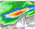
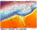
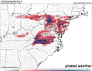
Fantastic preemergent wxAI with a beauty of a run...1.5" of rain at 33-34F...welcome to Feb in the SE
View attachment 167983View attachment 167984
WolfpackHomer91
Member
I still think CAD areas can work with this....33 4.5 days out isnt terrible. Plenty of time for a 2 degree 2m change to get a solid ice eventAI with a beauty of a run...1.5" of rain at 33-34F...welcome to Feb in the SE
View attachment 167983View attachment 167984
Even if the 33 degrees verified there would be areas in climatologically favored areas like rises in elevation and rural areas where temperatures could approach 32F or below. That would be enough to provide spotty ice accumulations for people in those areas.I still think CAD areas can work with this....33 4.5 days out isnt terrible. Plenty of time for a 2 degree 2m change to get a solid ice event
12z ICON looks similar to the 06z run except hammered SW VA even more than last run. NC/VA border still largely the dividing line, similar to the GFS.
I think this has the potential to be big storm for Roanoke, Blacksburg, etc. although it’ll also all get washed away by rain soon after. Although honestly I think sometimes we’re better off with rain than full sunshine for keeping snowcover.
I think this has the potential to be big storm for Roanoke, Blacksburg, etc. although it’ll also all get washed away by rain soon after. Although honestly I think sometimes we’re better off with rain than full sunshine for keeping snowcover.
rburrel2
Member
GFS has been oddly consistent with that Monday snow along the NC/VA border.
CNCsnwfan1210
Member
4 days out, I’m interested to see how much colder the models will trend…probably not much to make a big difference. NC still has skin in the game I believe
Sent from my iPhone using Tapatalk
12Z Nam is the coldest furtherest south with those temps up above us out to 84. That's one to watch to see if you can lasso a trend over the weekend. It will sniff the CAD the best. Like stated earlier whatever happens, its going to cold rain eventually and a lot of it. Where were these waves of multi day overrunning when the boundary was draped across GOM in January. UGH! Maybe BF and the VA boys can get lucky enough to get hammered, post us some pics.4 days out, I’m interested to see how much colder the models will trend…probably not much to make a big difference. NC still has skin in the game I believe
Sent from my iPhone using Tapatalk
WolfpackHomer91
Member
Just wait for the frzn outputs if it trends to 30 for Two days ....that will be in the epic model image feedWild...GFS has GSO at 32-33F with 1.5" of rain Tues/Wed. It's probably a good thing we don't have a solid cold feed to our north.
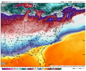
View attachment 167996
Problem the cold isn't deep...it's 32F in northern VA and 33 in Greensboro. If it was mid 20's in northern VA we probably could have a real problem on our hands.Just wait for the frzn outputs if it trends to 30 for Two days ....that will be in the epic model image feed
For Raleigh, we haven't had an impactful ice storm since Dec 2002. We've had light glazing events time to time. But maybe points further west than Raleigh could be impacted.
LukeBarrette
im north of 90% of people on here so yeah
Meteorology Student
Member
2024 Supporter
2017-2023 Supporter

