-
Hello, please take a minute to check out our awesome content, contributed by the wonderful members of our community. We hope you'll add your own thoughts and opinions by making a free account!
You are using an out of date browser. It may not display this or other websites correctly.
You should upgrade or use an alternative browser.
You should upgrade or use an alternative browser.
NBAcentel
Member
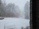
Not getting far from 1” of snow
Webberweather53
Meteorologist
You think it will hold together and translate east or dry up?
It should hold together enough as it moves east that you see some snow.
I swear Dallas/Paulding is like the Roxboro of the ATL area. It always finds a way to snow there. They do really well with streamers breaking containment. Fringed here but it's been flurrying for the last 2.5 hours which is pleasant to look at!
Snow flurries now. Got a 10am meeting, unfortunately.
TigerStrong
Member
Yeah it definitely lost intensity by the time it got to us. Par for the courseLooks like this thing fell apart as it was going through Meck
astroworld123
Member
Flakes are flying again in Raleigh
Sent from my iPhone using Tapatalk
Sent from my iPhone using Tapatalk
SnowNiner
Member
Last hour had light/moderate snow in Huntersville. Maybe .6 inches maybe? Beautiful to look at, but not sticking to roads, or sidewalks much. Sun angle must mean business.
Bigedd09
Member
Man that band really weakened as it came south. But hey, congrats to Greensboro
How’s the main roads up there @FallsLake ?
Webberweather53
Meteorologist
Most of the forcing for ascent for this burst of snow this morning is in the low levels.
This also explains why some of you have started seeing precip before any returns showed up on radar. That’s simply because a lot of the forcing for ascent is below the height of the radar beam.
It is cold & saturated enough in the low levels just below the DGZ to at least see some sleet/graupel before the DGZ fully saturates and is properly lifted, which then changes things to snow
We have some flurries down this way over the last 30 minutes, maybe we can catch at least the tail end of that line as it moves through.
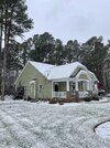
You have a beautiful home Grit!
LickWx
Member
Horrible, sheets of ice some roads like old falls are impassable . Come this way if you dare!How’s the main roads up there @FallsLake ?
Still snowing, not huge flakes, but winding down, sun is gonna make an appearance here soon. That was a soild hour an some change of heavy snow. Over an inch
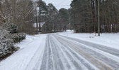
Snow packed. I'll try to get some pics in a little bit.How’s the main roads up there @FallsLake ?
TigerStrong
Member
Yeah pretty much the same here. Maybe a little less. Supposedly 29 degrees here but only partial stickage on paved areasLast hour had light/moderate snow in Huntersville. Maybe .6 inches maybe? Beautiful to look at, but not sticking to roads, or sidewalks much. Sun angle must mean business.
Well, after being shut out yesterday. I got about .2-.4 inches this morning with snow still falling. Beautiful out there! @DixieBlizzard how did you do? I’m at 1800ft
SimeonNC
Member
There seems to be a little bit of backbuilding west of Shelby I think
10am meeting ended after 5 minutes, hell yeah. With weenie colored glasses, I can see that line pivoting as it moves NW to SE and training over MBY. 
Crazy that after 3.5”+ of snow, I have a patch of dry road out front because the asphalt is so warm and a lot of the snow came close to noon (although the road in general is quite icy). Wish some more snow would’ve come during the very late afternoon or evening last night, but oh well! Haha. I sound ungrateful! Good thing with anything we get today is that it’s going to be heavy if it comes, and it’ll be snow on top of snow.
Crazy that after 3.5”+ of snow, I have a patch of dry road out front because the asphalt is so warm and a lot of the snow came close to noon (although the road in general is quite icy). Wish some more snow would’ve come during the very late afternoon or evening last night, but oh well! Haha. I sound ungrateful! Good thing with anything we get today is that it’s going to be heavy if it comes, and it’ll be snow on top of snow.
Tsappfrog20
Member
Looks like this band might make it to me in Youngsville!!

Sent from my iPhone using Tapatalk

Sent from my iPhone using Tapatalk
WFFaithful
Member
1.5" of very fluffy snow! We had half an inch yesterday.
norcarolinian
Member
Still snowing lightly. Looks like one more heavier band developing over Winston should swing thru here over the next hour.
Webberweather53
Meteorologist
Highest ZR total I’ve seen so far from this storm is 0.32” near Goldsboro. Oof
lcpdk
Member
Every time I think it's done in Kernersville, we get another burst. We are in a little dry notch right now, maybe that last band will come through to top it all off.Still snowing lightly. Looks like one more heavier band developing over Winston should swing thru here over the next hour.
CNCsnwfan1210
Member
Flurries are getting a tick heavier in Lucama NC (SW Wilson county)
Sent from my iPhone using Tapatalk
Sent from my iPhone using Tapatalk
WolfpackHomer91
Member
I believe we are Wrapping Up here... Storm Total 1.8" Mooresville NC Linwood Rd/HWY 152 @Webberweather53 .... again (2" would look cooler on the Map  )
)
Snow on top of snow, what a time to be alive. Holding steady at 26 degrees too.
NBAcentel
Member
the hardest it’s snowed so far atm
atlantasweetie
Member
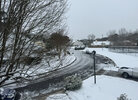
I have flurries on the South side. I'll take it at this point. Happy that everyone got something this Winter.Wasn’t expecting anything near ATL so this is a win for the NW sideView attachment 171074
Sctvman
Member
NBAcentel
Member
SnowwxAtl
Member
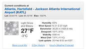
I can confirm it is snowing at ATL airport!
Starting to come down pretty good now.

