NBAcentel
Member
Icon gonna be a decent snow event in CLT with a bigger event in Raleigh
@Rain Cold Yea, it looks same placement wise.....but yes weakerSo incoming weaker
Icon and Euro are on top of each other
This is a good post honestlyAs of now, I would favor warning criteria snow around 3-6” Statesville-Salisbury-Winston-Greensboro and advisory for Surry-Wilkes-Yadkin- 1.0”. Charlotte-Mooresville-Asheboro-Raleigh could see warning criteria in any of those areas given Fronto-genesis and brief window of 1-2” rates overnight Wednesday regardless of waves of sleet/warm nose. Thursday should feature spillover with mtn snow surviving into the foothills with minimal accumulations and snow showers making it all the way to Raleigh Thursday wouldn’t be ruled out. -
No, why would you assume that?So incoming weaker
Wow…holy crap
Bumping this to show that you don't have to have a phase around here to get a great stormIt's the northern stream causing the issue. The southern stream left alone would be a widespread high end winter storm just like the January system would have if it was left alone
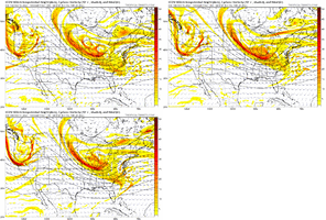
This could go bigger....this trend is showing up in Euro too.Final from the icon. It goes ham with the backside snow associated with the northern stream ULL View attachment 169856View attachment 169857View attachment 169858


My father in law’s beach cottage up in KDH has its second shot @ 9” in less than a month while I sit here in a snow hole. When I drive up in July it will be 90 with biting bugs on the beach from a westerly wind. Sick worldFinal from the icon. It goes ham with the backside snow associated with the northern stream ULL View attachment 169856View attachment 169857View attachment 169858
Really not far off from something bigger just with those small ticks at H5. And still lots of time. A couple more trends with that energy like that -and along/east of 77 will start to see jumps from that, and bigger totals for the favored areasThis could go bigger....this trend is showing up in Euro too.
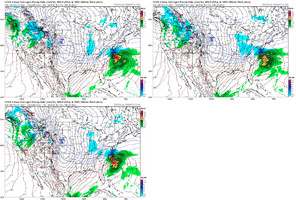
View attachment 169860View attachment 169861
For folks further back that are struggling this is needed to see anything more substantial then a minor event, so this should be the hope for a bigger solution vs losing the confluence and phasing for amperageOne more of these and we are going to start seeing some mid teen totals printing outView attachment 169863
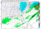
Sheesh12hr totals for the streamer stuff on the rgem.. still going at the end of the run btw.
View attachment 169865

yeah icon has me at 11" in the latest run and im likeeee... please dont tease me like thatIcon with 15 inches here
I need to lay down after that
It’s the ICON so usual caveats but that vort pass is sick…This could go bigger....this trend is showing up in Euro too.
View attachment 169860View attachment 169861

Fine tuning of this southern wave will be something to watch most definitely. Stronger sfc low center . Much more qpf.. common things to see in the near term trends.Really not far off from something bigger just with those small ticks at H5. And still lots of time. A couple more trends with that energy like that -and along/east of 77 will start to see jumps from that, and bigger totals for the favored areas
what is that leftover back there?
Circa Feb 2014 ...Wrap around deform band
It usually starts around 10:37 I'd say.Is the GFS at 1030ish ?
18 hours of snow in NE NC/SE VA is HISTORICAL.
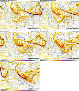
This looks like a better and more widespread version of the December clipper…. Similar orientation at H5 with the vort but more lift with the northern stream cutoff. Don’t sleep on this. Low DGZs/cold surface temps could be really effective View attachment 169868View attachment 169869View attachment 169871
For folks further back that are struggling this is needed to see anything more substantial then a minor event, so this should be the hope for a bigger solution vs losing the confluence and phasing for amperage
