D-Ray
Member
Flurries.....
At least from a temps perspective, this guidance is at least initializing a little better than the HRRR. As others have stated, the HRRR is really embarrassing itself right now - it can't even initialize surface temps correctly.FV3...let's see how this verifies. It's been ticking the snow line south. This did well for the early Jan event at the snow/sleet line.
View attachment 170732View attachment 170733

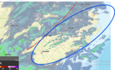
Ok I’m certainly looking thru snow colored goggles but this stuff blossoming over Fayetteville seems 1) well ahead of schedule 2) heavier than forecast
I can confirm it is producing at the ground !Ok I’m certainly looking thru snow colored goggles but this stuff blossoming over Fayetteville seems 1) well ahead of schedule 2) heavier than forecast

Mixing line is well south of forecast as well, woh, looks like all of wake county will not mixWow, looks much better than earlier runs
Sent from my iPhone using Tapatalk
It’s gameday. We hug
Why this model is even funded is beyond me
Unless I am reading the map incorrectly, mesoscale analysis makes me think the low is developing a tad further to the south than what was forecast. Meaning to get as close as some of the models have been showing to the outer banks, it would need to track more NNE than Northeast. Aka may effect the angle of warm nose. Just something I think to watch.
Never say never.Mixing line is well south of forecast as well, woh, looks like all of wake county will not mix
Imo latest FV3 and HRRR are moving snow line slightly southYeah it wouldn't take much to turn this from a sleetfest to a decent snow hit...it's probably wishful thinking since it never bust in our favor
