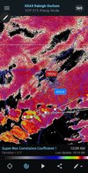
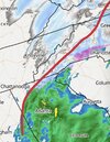
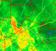
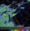
I'll let you guys know how they goThe cells from Fayetteville are taking direct aim at Wake
-
Hello, please take a minute to check out our awesome content, contributed by the wonderful members of our community. We hope you'll add your own thoughts and opinions by making a free account!
You are using an out of date browser. It may not display this or other websites correctly.
You should upgrade or use an alternative browser.
You should upgrade or use an alternative browser.
My coworker in KY got 4-5". We had a nice bout of light flurries, tiny flakes, and it's really doing much right now in New Hill, NC (SW Wake County)
Last edited:
They were definitely heavy just south of you, but I am mixing hereI'll let you guys know how they go
NCWeatherhound
Member
We've got a sleet/rain mix in central Harnett Co. 31/ 25
Coming down pretty good
- Joined
- Jan 2, 2017
- Messages
- 1,566
- Reaction score
- 4,279
Flakes mixed in with rain at the house via my cameras. Sprinkling at ONS at work
Had some graupel and a few flakes here in Atlanta briefly as rain started. All rain now. Best of luck to all our NC friends today/tomorrow!
Shadow of the Apps
Member
Stead light snow in Rutherfordton, NC more that I expected as we were the middle of the snow hole since Sunday.
rburrel2
Member
CNCsnwfan1210
Member
All snow now in Kenly nc
Sent from my iPhone using Tapatalk
Sent from my iPhone using Tapatalk
astroworld123
Member
Coming down pretty good
Raleigh weather force field has been deactivated for today
Sent from my iPhone using Tapatalk
JP152
Member
shoalswxlady
Member
Nice little winter wonderland in Tuscumbia. Snow is beautiful. I would love for someone to tell me when the last time it snowed in North Alabama in February, that left snow on the ground.
4pm? But some are already seeing snow well ahead of schedule?
Sent from my A600DL using Tapatalk
BHS1975
Member
Sorry bro. Gonna mix up here too eventually.
Webberweather53
Meteorologist
3 straight events with well before modeled precip onset
And just about all of them had at least some warm advection involved.
D-Ray
Member
Light to moderate snow with decent size flakes...temp is 38
Hope the NC/VA crowd gets smoked. Y’all deserve an over performer after the pain this one has put everyone through and I hope it happens 


Bigedd09
Member
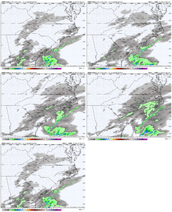
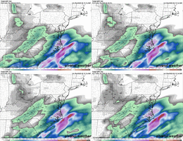
HRRR still trending weaker with the energy tomorrow morning.
Looks like the HRRR is now getting the 0.1” QPF contour back to the Triad. What a terrible model.
We back to this. Going to be a long day of going back and forth i thinkDropping half dollars
Isn’t this sort of a trade off with today’s system? Like the weaker it is the less of a kicker it is for today’s system? So a stronger system today generally averages to a weaker system tomorrow, and vice versa?HRRR still trending weaker with the energy tomorrow morning.
Well crap I was holding out hope for that ULLHRRR still trending weaker with the energy tomorrow morning.
Starting to converge to a King GFS solution?
Webberweather53
Meteorologist
The back and forth model changes inside day 1-2 with this storm have been utterly crazy.
CNCsnwfan1210
Member
Mostly snow with big flakes and a few sleet pellets mixed in here in Kenly
Sent from my iPhone using Tapatalk
Sent from my iPhone using Tapatalk
All snow in that band near Falkland, good day for an afternoon drive touring the northern Coastal Plain. I’m probably one of the only idiots around here who carries snow chains.Yeah if the QPF is right on the nams etc we gonna have problems if it's all sleet.
Bigedd09
Member
Me too. Was a lot weaker on 6z NAM. Pretty much doesn't even show up on the RAP. and much weaker every HRRR runWell crap I was holding out hope for that ULL
lcpdk
Member
Eastern Forsyth County NC seems to be ground zero for the dry slot. We've got nothing.
iGRXY
Member
Snowing at the house. Been going for about 20 minutes
I'm honestly shocked that most of us have ended up with similar final calls. Anyone who gets this one remotely close should go in the HOF of winter forecasters lol.The back and forth model changes inside day 1-2 with this storm have been utterly crazy.

