• Hello, please take a minute to check out our awesome content, contributed by the wonderful members of our community. We hope you'll add your own thoughts and opinions by making a free account!

Wintry Feb. 19-20

I guess when your resolution is coarse enough to ignore most of the meso changes you are consistent
I sometimes wonder if there’s some positives to that, like so it’s not overreacting to small changes that end up being inconsequential in the end. I don’t know.

Anyways, time for my terrible final call.

CLT: T-0.5”
GSO: 0.5-1.5”
NE Chapel Hill (MBY): 1-3”
Durham: 2-4”
RDU: 2-4”
PGV: 1-3”
@RBR71: 4-8”
Moyock: 8-12” (could be higher, but it’s hard to snow that much and compaction may cut totals)
ORF: 8-12”
RIC: 3-6”
 
I sometimes wonder if there’s some positives to that, like so it’s not overreacting to small changes that end up being inconsequential in the end. I don’t know.

Anyways, time for my terrible final call.

CLT: T-0.5”
GSO: 0.5-1.5”
Chapel Hill (MBY): 1-3”
Durham: 2-4”
RDU: 2-4”
PGV: 1-3”
@RBR71: 4-8”
Moyock: 8-12” (could be higher, but it’s hard to snow that much and compaction may cut totals)
RIC: 3-6”
Moyock will get 17-25”. The band will set up over Moyock and not leave until Friday
 
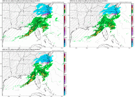
Probably can’t find a more consistent model for this storm. It may be consistently wrong, but it’s consistent, considering how volatile most of the guidance had been.

View attachment 170761
Im watching that myself.. The FV3 was as consistent. They been locked on, never changed once inside 84hrs.
 
Im watching that myself.. The FV3 was as consistent. They been locked on, never changed once inside 84hrs.
You’re right about the FV3, too. I’ve not used that as much myself so I don’t know if it’s useful or not, TBH, but it’s been pretty dang locked in and relatively bullish.

One issue I can think now is that if WAA precip is arriving earlier and potentially heavier than expected, does that imply that there will be more WAA and thus mixed precip later today for folks who weren’t expecting it? We do know WAA always finds a way.
 
@Myfrotho704_ Has your temp been dropping? Mine has

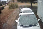
I’m at 33 Here off Hwy 152 , I saw a stray flake …. I’ve seen enough I’m on my way to Southern States to get the Husky some food …. I’m gonna be snowed in till Saturday ! Better safe than sorry!


Sent from my iPhone using Tapatalk
 
Last edited:
Call me a wishcaster but I still think an inch or even more is completely possible in CLT with this initial event
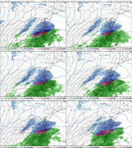
Hopefully that back edge holds the line or sets up a little northwestward from most modeling when the transfer takes place. HRRR keeps inching westward which is hopefully good (do we trust it now?) We're gonna see the stuff down to our southwest in NE Georgia start slowly fizzling out once the Atlantic low takes over. But I'm still also holding out hope that the ULL is going to surprise some people in the morning.
 
We are approaching peak solar radiation as we near the noon hour. Not going to help accumulations combined with near freezing BL temps at the moment, especially on roadways. Assuming precip picks up in the afternoon, conditions for accumulations, especially on the roadways, will pick up as we head into the mid to late afternoon, though. Just not a factor you want to overlook in mid to late February, not that it can't stick and won't stick, but it will cut accumulations a bit, especially if rates are not heavy and / or spotty or uneven.
 
Back
Top