All snow Chatsworth as well. Ground covered
-
Hello, please take a minute to check out our awesome content, contributed by the wonderful members of our community. We hope you'll add your own thoughts and opinions by making a free account!
You are using an out of date browser. It may not display this or other websites correctly.
You should upgrade or use an alternative browser.
You should upgrade or use an alternative browser.
GSP should issue an advisory at least for the far Northern counties of SC. Wild.
Been seeing flakes on my ring cam for the last while now. 34.9
Wulfer
Member
Cyclogent, you nailed it man! Good job with your prediction yesterday! I'll be sure to pay more attn to those HREF flows in the future!The models are underdoing precip.....that's the hill I am willing to die on for this storm lol. And here's why.
PW probability maps from the SPC. The latest HREF has greater than 90% chance of PW's exceeding 0.5" all the way up to the Kentucky and Virginia borders, and that's even with Gulf coast convection. Moisture is fine, plenty to go around. That doesn't solve for questions on temps or precip types, (that's somebody else's hill lol) but getting confident the board sees more precip than what is modeled.
Also like how this tongue of 0.5-0.8 PW pivots around and then tightens up over NC, thing of beauty. Somebody in NC is getting crushed.
View attachment 170404
View attachment 170405
View attachment 170406
View attachment 170407
View attachment 170408
CHA airport officially with 1" on the ground as of 7am. That gulf convection can kiss it.

SimeonNC
Member
It's nowcasting time
Wulfer
Member
Anyone in Huntsville Al. right now that can report if its snowing right now? Radar shows a pretty good green back line (right now) before precip ends.
.5 knocking on my doorstep. I still think bust potential is high with this one and on the high side. Maybe wishcasting but developing coastals are impossible to pinpoint and you'd think it will be close enough to the coast to get moisture fairly far NW
SimeonNC
Member
Idk if it means anything but someone in WV on a discord server I'm in reported thundersnow
Snow looks to be ending in Huntsville, maybe an hour or two early.
- Joined
- Jan 2, 2017
- Messages
- 1,566
- Reaction score
- 4,279
Anyone in Huntsville Al. right now that can report if its snowing right now? Radar shows a pretty good green back line (right now) before precip ends.
Live Webcam Memorial Parkway, Huntsville, Alabama - United States
Live webcam from center of Huntsville following Meridian Street and beautiful Whitesburg Drive through Downtown.
 www.iplivecams.com
Agreed...you should go stare out the window and look for a sign of snow.It's nowcasting time
SimeonNC
Member
We got a nice wedge going on. 
LukeBarrette
im north of 90% of people on here so yeah
Meteorology Student
Member
2024 Supporter
2017-2023 Supporter
I can’t believe it, it’s actually snowing at a moderate clip here in Blacksburg. Looks like just a little more than a coating currently
Blue_Ridge_Escarpment
Member
Can’t even get hour 1 forecast right. Good grief.
SimeonNC
Member
I didn't say it to be mean, just saying. It's better to watch the radar, meso analysis, check for reports upstream ect. than to watch the models at this point. SorryAgreed...you should go stare out the window and look for a sign of snow.
- Joined
- Jan 2, 2017
- Messages
- 1,566
- Reaction score
- 4,279
Blairsville

CNCsnwfan1210
Member

10z HRRR
Sent from my iPhone using Tapatalk
Downeastnc
Member
DP at PGV crashed from 32 to 23 in the last hr the cold air feed is legit this time.
Brandon10
Member
Oh the warm nose.....go away. ENC will be an ice rink at this rate

ForsythSnow
Moderator
Cooked before it even started raining. The dry air is real. Already warming too.

Nice snow escaping into the Piedmont already. Lot of models had this area bone dry yesterday 
Maybe 1.25" in Huntsville. Looks like we're done though.

Last edited:
Bigedd09
Member
Charlotte to statesville has been virga/snirga capitol of the world this winter lolThe old favorite...this radar always fun, always looks like 4-6" for everyone
View attachment 170683
SimeonNC
Member


Twister
Member
Well then if that's the case then we should see snow before long in NW upstateBlairsville
View attachment 170681
LukeBarrette
im north of 90% of people on here so yeah
Meteorology Student
Member
2024 Supporter
2017-2023 Supporter
I can’t believe it, it’s actually snowing at a moderate clip here in Blacksburg. Looks like just a little more than a coating currently
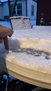
This that high ratio powder
- Joined
- Jan 23, 2021
- Messages
- 4,603
- Reaction score
- 15,199
- Location
- Lebanon Township, Durham County NC
where is @Rain Cold when you need himNice snow escaping into the Piedmont already. Lot of models had this area bone dry yesterday View attachment 170684
rburrel2
Member
hrrr and the rap are pointless to look at for qpf even a few hours before an event. All they've done is flopped around wildly only to finally end up where the Euro/EPS has been for 2-3 days.(and they only got there within a couple hours of verification).
Mahomeless
Member
- Joined
- Oct 17, 2023
- Messages
- 900
- Reaction score
- 2,158
A lot of clowning on MPing in North AL....very little precip hitting the ground, and most of it is rain....some sleet here and there.
rburrel2
Member
It's probably going to be too warm in the last 1,000 feet around the ATL area, but they look like they are gonna get in on the next precip maxima... Wouldn't be shocked if higher elevation places just north and west of atlanta mix with snow under the heaviest incoming returns.
Snow in HuntsvilleAnyone in Huntsville Al. right now that can report if its snowing right now? Radar shows a pretty good green back line (right now) before precip ends.
Attachments
blueheels2
Member
I’m goin to open the blinds and play video games and drink coffee here in Rolesville. Maybe I see a flake.Agreed...you should go stare out the window and look for a sign of snow.
CNCsnwfan1210
Member
Good luck to everyone today, tonight, and tomorrow (lol) hope everyone is able to score somehow some way
Sent from my iPhone using Tapatalk
Sent from my iPhone using Tapatalk
Almost Nowcast time boys and girls.
Can confirm snow decent ATM. Cold Rain where you at?Nice snow escaping into the Piedmont already. Lot of models had this area bone dry yesterday View attachment 170684
Showmeyourtds
Member
For some strange reason, FFC has expanded the WWA to the SE by a county row. Not sure what the logic is for this. Way too warm for anything here.
Nomanslandva
Member
Just started here. Decent looking band just to my south. All I can hope now is for models to be wrong here because they have all really dried up. Radar at Hickory looks like they should get a good burst too.