SimeonNC
Member
Do you have an 850 you can post?

Do you have an 850 you can post?


Maybe on radar but nothing just west of Winston Salem or in WinstonNice snow escaping into the Piedmont already. Lot of models had this area bone dry yesterday View attachment 170684
Yea id say thats a tad off there lolYall the hrrr is garbage.
Here's the current run for ATL area... and here's the current radar.
Looks like flood warnings needed for Northern ATL burbs and rap says they get .00 to .01
View attachment 170703View attachment 170704
 ..... UNLESS it zaps all that as soon as it transfers after while
And precip just starting to develop along that fgen area too
And precip just starting to develop along that fgen area too

Sadly, ATL isn't a touch colder which would have given this area another overperformer. Even then, I wouldn't be surprised to see some mix under those heaver returns for a while.Yall the hrrr is garbage.
Here's the current run for ATL area... and here's the current radar.
Looks like flood warnings needed for Northern ATL burbs and rap says they get .00 to .01
View attachment 170703View attachment 170704
lolSomebody post that GRAF thing
Somebody post that GRAF thing
Precip winding down here. Looks like 1.6", with most of that falling over a 3 hour period.
View attachment 170693
View attachment 170691
Looks like places just west of ATL are down to 35 under those heavier returns. Problem is the 850mb WAA is pushing in generating all the precip and looks like it's putting this area above freezing at that level per CC radar. Probably a little better chance of mixing with snow as that heavy batch pushes a little farther North and East though.Sadly, ATL isn't a touch colder which would have given this area another overperformer. Even then, I wouldn't be surprised to see some mix under those heaver returns for a while.
Good morning. I slept in, knowing I wouldn't miss anything. It's 33 with a DP of 30. Extremely light snow is falling. No accumulation. This is probably all we're going to get.where is @Rain Cold when you need him


Geez what a bust for the ATL area.Posting these as I like to come back and see which model handled precip the best. 3km/12km mostly on top of each other. I do think the precip is a little further NW.
View attachment 170706View attachment 170707
You better send us lots of reports and pictures. It’s pretty bleak for the rest of us.Yeah NAMs improved slightly and at least here, neither show mixing as an issue any longer. Also radar starting to look much better as well, should really see precip explode in next couple of hours if the coastal is gonna do it's thing

Hrrr finally has a couple hours of snow here, albeit is doesn’t add up much here. But it’s 37F… cooked

I'll see what I can do but tbh I think tomorrow has potential to be an over-performer, don't lose hope yetYou better send us lots of reports and pictures. It’s pretty bleak for the rest of us.
We might wetbulb close to freezingHrrr finally has a couple hours of snow here, albeit is doesn’t add up much here. But it’s 37F… cooked
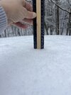
And its not frozen baby powder like that mess in Jan I can actually visually see the flakes in your photoLight tk moderate snow now falling here. Won't amount to much, but you really can't complain when snow is falling from the sky.
View attachment 170711