• Hello, please take a minute to check out our awesome content, contributed by the wonderful members of our community. We hope you'll add your own thoughts and opinions by making a free account!

Pattern Failboat February

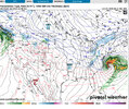
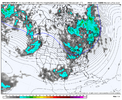
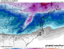
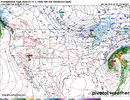
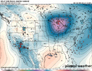
I'm watching the 8-11 day period for a possible event and then just beyond that for a potentially bigger event somewhere along the east coast. Active pattern with cold air returning. There looks like there may be enough amplitude in the pattern to allow at least a traditional phasing situation...maybe more.

Showing the AI, which goes on to phase, but it's OTS.

Spring is coming, but probably not till after mid month. MJO just hibernating on the cold side for a change. Models have been too aggressive trying to kill it, so we'll see.

View attachment 171186
View attachment 171187
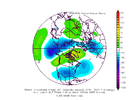
March P1 is certainly a wintry look across the south. MJO been doing work, why not continue? (Here's your hopium @WolfpackHomer91!)
MarchPhase1gt1500mb.gif
 
a3b0191043214cb00471d0356eb9a263.jpg

PNA stays positive for most of the extended range
End of the graph if it’s right

Sent from my iPhone using Tapatalk
More nuetral. There. Second week march heads negative
 
RainCold that is a good look in the 8-11 window. You think we would have enough of a Cold Air Source?
Gun to head, the northern mid-Atlantic into New England would likely be favored for any event that occurs there. BUT it is a long way out, so things could trend favorably in the cold air dept. for more of us. We'll just have to watch it.
 
In watching the Pac Jet in recent winters, this is one of the most abrupt jet retractions I've seen (on both GEFS and EPS). I would assume this leads to the pattern becoming more wavy and stormy and upper low-y...and eventually the action moving west (ski trip out west for mid/late March?). Think we'll need to try and cash in before that if there is any cold air to be found (as others have mentioned)....but paging other opinions regarding the abrupt jet retraction.

A2PIU6W.gif

MJO forcing orbiting back into the Indian Ocean & Maritime Continent with a big negative East Asia Mountain Torque (low SLP over the east slopes of the Tibet Plateau) lends itself to a big pacific jet retraction as it runs out of viable westerly momentum sources to keep it amped up. Probably will see a sudden pattern shift to a -PNA/SE ridge around mid-month, because it will take a little time for the downstream wave guide to fully adjust.

This year will certainly reinforce the paradigm of March "coming in like a lion" then "out like a lamb"
See any favorable severe weather pattern setting up by sometimes in march ? Especially western half the south ?
 
Only got to 39 overnight, low temp prediction busted by several degrees.

22 predicted (which is similarish to January) for tomorrow night, but I wonder if whether we end up not in the ballpark, it’ll certainly depend on the way today goes on any warmup.

Yeah, these thoughts were wrong, it's too late for me to check, but my dad was wondering yesterday if whether the cold front was 6 hours late?

25 at the house and 22 in the low lying area near the airport.

Actually getting fairly close to similar averages to February last year after a very warm start.
 
See any favorable severe weather pattern setting up by sometimes in march ? Especially western half the south ?
I think it's all farther west this year, in tornado alley. Drought is going to be the story from New Orleans and Memphis through the Carolinas this spring and summer. Actually, this will probably be for I-40 and south from coast to coast.
 
I think it's all farther west this year, in tornado alley. Drought is going to be the story from New Orleans and Memphis through the Carolinas this spring and summer. Actually, this will probably be for I-40 and south from coast to coast.
Starting here most march into all April mid south regions being under gun Little Rock Memphis. Tupelo Birmingham and Nashville . Before things move to the alley In may
 
I think it's all farther west this year, in tornado alley. Drought is going to be the story from New Orleans and Memphis through the Carolinas this spring and summer. Actually, this will probably be for I-40 and south from coast to coast.
you have a very dry sense of humor, pal.
 
Back
Top