WolfpackHomer91
Member
Verbatim ....a 996LP over Cheraw SC I feel isn't the track for most of us but hey ...
Lots to iron out here. Small nuances take you from the winter storm sector to tornado alley fairly quickly. Massive late season storm is starting to look likely for someoneVerbatim ....a 996LP over Cheraw SC I fell isn't the track for most of us but hey ...


That doesn’t suckEuro had a cutter overnight but the GEFS looks nice

Yeah I’d like to see this Feb 20-ish system streak west to east (the GEFS look) instead of being a wound up bomb. Basically, a lower latitude version of today’s storm that is hitting DC. Nashville would like the wound up bomb


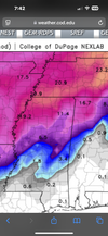
what is it this winter, with them southern wave messing everything up.This look is very doable with a few minor changes. Once again we really want that southern wave left alone to really win regionallyView attachment 168303

You know dang well the EURO AI will be 1000% accurate this go roundThe Euro AI hasn't like this storm at all. Maybe that's a good sign?
The overnight Pangu/Euro Graphcast look interesting though. They both look like some sort of snow to ice scenario with wedging. (just guessing with no qpf/surface maps.)

I have a feeling that EPS is more right...all winter that ridge has wanted to pull back further west. But with that said...it's snowed multiple times in place very far south this winter.Yeah I’d like to see this Feb 20-ish system streak west to east (the GEFS look) instead of being a wound up bomb. Basically, a lower latitude version of today’s storm that is hitting DC. Nashville would like the wound up bomb

Yeah. The se ridge in play. That would be perfect trackWhat a historic run for the midsouth. I’ll have to save this one.
It's the northern stream causing the issue. The southern stream left alone would be a widespread high end winter storm just like the January system would have if it was left alonewhat is it this winter, with them southern wave messing everything up.

This looks to be one of those systems I should keep half an eye on, in case there are any shifts further south. Wouldn't that be something, to see snow twice on the Gulf coast in the same winter!This is the one time I think the CFS shows the realistic outcome. 6z GFS also has the dual high pressures but runs the primary low up through the central Carolinas. If we get this configuration, I would bet on the miller A (or hybrid) from the gulf to off the coast.
View attachment 168316

You wouldn't want that to amp up anymore. That is a nice strong high but it's way off to the NW.ICON has a southern slider developing at hr 180. A cold snow through Arkansas/North Mississippi with a weak wave moving West to East. Pretty ideal.
Really hate the ridge nudge showing up next week. This looks like a swing in system. (cold air swinging in with the storm) for a lot of the Southeast. Mid South does well with these, East of the Apps struggle. Lot of watching to do.ICON has a southern slider developing at hr 180. A cold snow through Arkansas/North Mississippi with a weak wave moving West to East. Pretty ideal.
Ar kansas buried again and again! Maybe just maybe it won't cut but that sure seems to be the mantra lately and going forwardReally hate the ridge nudge showing up next week. This looks like a swing in system. (cold air swinging in with the storm) for a lot of the Southeast. Mid South does well with these, East of the Apps struggle. Lot of watching to do.
It could be, but the verdict is still out on that. Icon is faster than other guidance with the wave. Of course, a slower solution leaves more room for a lobe of the PV to get hung back and start interacting with the southern wave which can screw us.Really hate the ridge nudge showing up next week. This looks like a swing in system. (cold air swinging in with the storm) for a lot of the Southeast. Mid South does well with these, East of the Apps struggle. Lot of watching to do.
Yeah it’s late arriving cold. Even with the flat icon, you can see it’s not really pumping heights out front, it’s just late to the party. Higher border elevations would do fine. We would not.Really hate the ridge nudge showing up next week. This looks like a swing in system. (cold air swinging in with the storm) for a lot of the Southeast. Mid South does well with these, East of the Apps struggle. Lot of watching to do.
We're getting nuked on that run, IMO.Yeah it’s late arriving cold. Even with the flat icon, you can see it’s not really pumping heights out front, it’s just late to the party. Higher border elevations would do fine. We would not.
It'll be a storm to watch. I think more opportunities will emerge even after that one.Yeah it’s late arriving cold. Even with the flat icon, you can see it’s not really pumping heights out front, it’s just late to the party. Higher border elevations would do fine. We would not.