Darklordsuperstorm
Member
yesAs in winter weather?
Idk let’s ask himCanadian has ATL over 75 for 6 consecutive days. Even the staunchest winter lover will smile and enjoy that.
Sent from my iPhone using Tapatalk
NoCanadian has ATL over 75 for 6 consecutive days. Even the staunchest winter lover will smile and enjoy that.
Sent from my iPhone using Tapatalk
Well as much as I do love winter (snow) this one has had so many cold wet rainy windy days (CAD/Wedge with no "payoffs" I m ready for some dry warm days
He was spot on all year on his winter forecast from back in October but most only follow his tweets not his videos to see and hearBastardi threw in the towel today…
I beg to differ. I never want to trade winter weeks for spring or summer weeks. The weather we have coming up is ridiculous.Canadian has ATL over 75 for 6 consecutive days. Even the staunchest winter lover will smile and enjoy that.
Sent from my iPhone using Tapatalk
You need to move to the North Pole.I beg to differ. I never want to trade winter weeks for spring or summer weeks. The weather we have coming up is ridiculous.
I beg to differ. I never want to trade winter weeks for spring or summer weeks. The weather we have coming up is ridiculous.
Svalbard would be a great place for you.I beg to differ. I never want to trade winter weeks for spring or summer weeks. The weather we have coming up is ridiculous.


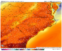
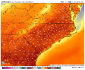
Actually still looks the same to me next Thursday, most guidance is upper 70s/80Well the current model runs are backing off the temps just a notch for later in the week. The GFS showing low to mid 70s for most on Thursday, a pretty good drop; looks like maybe some clouds. Euro backed off just a couple of degrees for Thurs as well, but both models bring in the relieving cool front quicker after and look a bit wedgier. The CMC is still the hottest, showing widespread 80s, but even that has backed down a couple of degrees (ICON similar). All 3 indicate a return to more seasonable temps after that. Nothing wintry but at least more typical and refreshing.


Negative PNA with a -NAO will be fun for severe loversEPS has trended much warmer early March, thanks to the very persistent -PNA, December 2021 is a great example of torching during a -NAO thanks to a -PNA, EPS mean temps are already widespread 60s during this time, some members already have 70sView attachment 133392>View attachment 133393View attachment 133395>View attachment 133394View attachment 133396
Yours are different maps, I'm just going off the 18z images from previous runs.Actually still looks the same to me next Thursday, most guidance is upper 70s/80 View attachment 133397View attachment 133398
Yeah when you look at the eps plumes there are cooler members but nothing supporting cold and snow, all of the noise in the day 8-10 disappeared as wellEPS has trended much warmer early March, thanks to the very persistent -PNA, December 2021 is a great example of torching during a -NAO thanks to a -PNA, EPS mean temps are already widespread 60s during this time, some members already have 70sView attachment 133392>View attachment 133393View attachment 133395>View attachment 133394View attachment 133396
