Edward Nygma
Member
33 degrees and rain is worse. Way worseNothing is more miserable than a cold pattern that delivers nothing.
Where's the fun in that?I'm tired of all the unpredictable systems. Can we get one that can actually be forecasted?
Definitely lining up like the Weathernext. Let's RAGE as Mitch says!
Yeah that's a better look at what's happening. And its the same trend we had with this current storm. The wave progression slows with the downstream blocking and you will encourage a more amped system to develop. Didn't help us on this one to stay all snow here. Here, with the baroclinic zone further south, an overrunning event would be at best along the Gulf coast (like last year). Need the amp this time.Yes sir. Trough axis is backing up and more energy is digging into it.
View attachment 189074
Haha I definitely read that in Mike Tyson's voice! Banter, I know.Definitely lining up like the Weathernext. Let's RAGE as Mith says!
That falls in my category of nothing, lol. Some models had ILM near 70 today and missed by 36 degrees.33 degrees and rain is worse. Way worse
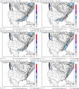
Looks stinkin great. But why the gfs? How much to swap the signal to the Weathernext ensembles? Like a reverse card in UNO. We get one a winter.
Does this help the moisture form west Instead of the east coast?Euro picking up the southern wave again like AI shows. 50/50 low trending north a bit.
View attachment 189084
Need the southern low to hold its own. The classic models have been losing it for the last day or so. AIFS and Google are still holding enough of it for a phase. Would still like that to trend some more to really pull this in. Still got time.
12z not out yet, but it has been ticking a bit more suppressed / more late bloomerAgree that would be best, as timing up a phase is such a pain and rarely works out. This time with super blocking and -nao maybe that changes. Worked for this week too to have a little interaction.
Funny how GEFS was all for it the last 2 days and it switches. Anybody see the GEFS hybrid? That seemed to be on it as well.

12z not out yet, but it has been ticking a bit more suppressed / more late bloomer
View attachment 189101
Don’t hate it considering our big dog snow is currently pushing the sleet line to Allentown PA
Nothing is more miserable than a cold pattern that delivers nothing.
Really I'm just being a negative Nancy and my post belongs in banter.That model had a 1-2 inch mean across a lot of Alabama. It was posted earlier this morning.
SD opened up a new thread for next weekend - the Machine Learning Mauler storm thread
Link?
Sent from my iPhone using Tapatalk
Nope, the zr is advancing filling in all along the line of the rain. Strong, stubborn cad. I just love cad, it makes winter a blast, or can.The zr is two miles ne of me, and the squall line is here. That's how close the cads play is. Edit: Now three incursions closer to me..out it front of the main force. It's a curiosity. I'm thinking that rain will errode the zr, but strange things happen with this storm.
Well, cads battle was lost a mile from my yard. The last band of rain is thru me. It was amazing to watch, considering I fed my winter weather obsession via early morning weather reports to pilots out at the airport. That's the best I had. Pilots reporting snow at 1000 feet. Get me all excited, lol. Now I can watch it unfolding right in front of me, and verify by looking out side. The weather artist in me thinks that last heavy rain wanted to bounce, was in communication with that freezing line, urging it on. It was so close to bouncing and I'm pulling for them to meet. What? A lot more than just a few of you think you sway the out come of games by yelling, lol.The zr is two miles ne of me, and the squall line is here. That's how close the cads play is. Edit: Now three incursions closer to me..out it front of the main force. It's a curiosity. I'm thinking that rain will errode the zr, but strange things happen with this storm.
Check out the 18z Euro but be sure to do it in private.
Sent from my Pixel 10 Pro XL using Tapatalk
I don’t have access can you show it please
Sent from my iPhone using Tapatalk
It’s in the mauler storm thread.
You holding out on us?Those Weeklies tho.
And that control snowfall bro
Those Weeklies tho.
And that control snowfall bro
That's all?
Best I got. What's the SDNext model saying?That's all?
