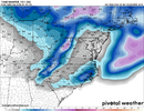
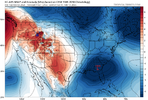
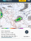
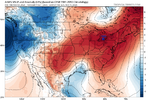
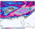
We’ve got to do warm and dry or cold and snow. No in between please. Got to make a decision here
-
Hello, please take a minute to check out our awesome content, contributed by the wonderful members of our community. We hope you'll add your own thoughts and opinions by making a free account!
You are using an out of date browser. It may not display this or other websites correctly.
You should upgrade or use an alternative browser.
You should upgrade or use an alternative browser.
Pattern Fab Feb
- Thread starter SD
- Start date
I think we know what the “compromise” is. Ask @Rain Cold .We’ve got to do warm and dry or cold and snow. No in between please. Got to make a decision here
Congrats, Winchester, VA!
-NAOs suck for warmth especially in late winter and spring
The biggest challenge for a big NC snowstorm on Val. Day is going to be the progged -PNA by the model consensus (opposite of what the last storm had) as only 10% of the 6”+ storms since 1950 that occurred at RDU and/or GSO were when the PNA was sub -0.5:
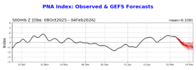
Sub -0.5 PNA for 6”+ snowstorms RDU/GSO
-0.8 1/22-24/1954
-0.8 3/2-3/1960
-1.1 2/12-13/2014
-0.7 1/6-7/2017
In contrast, there have been 4 times as many (16) that occurred with a PNA of +0.5+.
This analysis has nothing to do with major icestorms, which I’m assuming on average have had better results than big snows when there’s a -PNA.
BrickTamland
Member
I see why Euro is called the king now. It just bounces around so much it has to get it right eventually.
BrickTamland
Member
Actually, you're right. GFS did pick up this past weekend's storm pretty far out. The totals might have not as been as big as it showed for everyone, but that was mostly because of the dry slot that wasn't picked up until about 24 hours out.Worked out pretty well on last 2. In the ball park, just a little heavy with icing
LukeBarrette
im north of 90% of people on here so yeah
Meteorology Student
Member
2024 Supporter
2017-2023 Supporter
This feels like a Northeast hit to me. Not a lot of deep cold to work with.
rburrel2
Member
What does weathernext say for day 9?
rburrel2
Member
Looks bad but in reality you’ve got “high pressure” centered over the perfect spot in Ohio/Pa/New York, just need it to be a little stronger. A little more wave separation would help but it can’t come with a further north storm track.wet fart View attachment 193631
It’s raining. First time we’ve gotten non-frozen precip in a couple weeks if I remember right?
rburrel2
Member
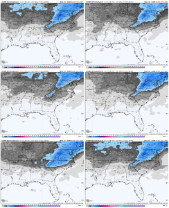
So I guess the GFS isn't on its own with this deal?How did no one post this? Y’all are asleep at the wheel in here. 2-3 inch mean on the day 9 threat
View attachment 193640
How did no one post this? Y’all are asleep at the wheel in here. 2-3 inch mean on the day 9 threat
View attachment 193640
I’d be extra careful with the Euro AIFS clown maps. The WxBell Euro AIFS snow maps overdo snow due to algorithm problems that I discovered when noting heavy snowstorms of individual members way out in the Gulf with 2m temperatures in the 60s-70s. I don’t know for sure that the problem is solely with WxBell because it could be tied to the Euro AIFS, itself.
NBAcentel
Member
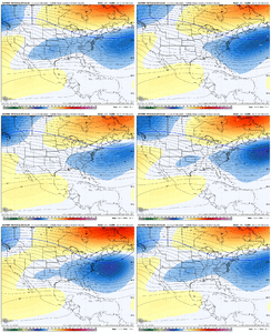
Made sure to look at burgs site to see if the mean was legit and it kinda is lol. Makes sense though this run has a stronger -NAO, starting to pop a Rockies ridge, a deep low in the Atlantic that suppresses the track, and a southern plains trailing southern stream wave. Shortened wavelengths ftw, even with a mean trough over B.C. The post 40 y/o+ Pamela Anderson patternHow did no one post this? Y’all are asleep at the wheel in here. 2-3 inch mean on the day 9 threat
View attachment 193640
Cad Wedge NC
Member
Yeah, this one might have legs.So I guess the GFS isn't on its own with this deal?
Bigedd09
Member
Made sure to look at burgs site to see if the mean was legit and it kinda is lol. Makes sense though this run has a stronger -NAO, starting to pop a Rockies ridge, a deep low in the Atlantic that suppresses the track, and a southern plains trailing southern stream wave. Shortened wavelengths ftw, even with a mean trough over B.C. The post 40 y/o+ Pamela Anderson pattern View attachment 193642
A nice classic borderline heavy wet snow event would be awesome. Feels like we haven’t had that in a while
Sent from my iPhone using Tapatalk
The server I generate WeatherNext on ran out of space, so I had to clear it up but I have the downloader & plotter running now. Just looking over other models, I think that the threat around Valentines day may have legs. Worth watching at the very least.
The ole GFS, despite as much as I dog it, and probably still will. Has turned into a pure bred Blood hound this winter season, It;s sniffed the past 2 out from way out in left field. Doesn't mean it's gonna continue to do so accurately. But this pattern hasn't toyed with it, like most patterns tend to do med-long range, for some unknown reason.So I guess the GFS isn't on its own with this deal?
" They say the models see the Big ones coming from a mile away"
RBR71
WOW
to many others to name
RBR71
WOW
to many others to name
WolfpackHomer91
Member
Lets go for a 8" Snow / 1" Sleet / 1/4" ICE event here and head to the house.
Plus....8" Puts me at a 2 foot season lol
Plus....8" Puts me at a 2 foot season lol
Think this could legitimately impact central/northeast GA, or just mood flurries? tia for weathernext inputsThe server I generate WeatherNext on ran out of space, so I had to clear it up but I have the downloader & plotter running now. Just looking over other models, I think that the threat around Valentines day may have legs. Worth watching at the very least.
rburrel2
Member
Looks like the 18z gfs ai is going for it. Colder with a better 50/50 and faster wave.
rburrel2
Member
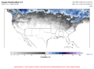
Isn't that just for the 24-hour period leading up to February 15th, though? Not that there is a signal there otherwise, either.
Ends up in suppression depression, which I guess is where we want it this far out? Verbatim, looks like it would be cold enough for snow for N GA / AL, nevertheless, though 2m temps are on fire, which I'm not sure I buy.
There's no signal for snow in the southeast in the entire run.. outside of the little NC event tonight.Isn't that just for the 24-hour period leading up to February 15th, though? Not that there is a signal there otherwise, either.
The ole GFS, despite as much as I dog it, and probably still will. Has turned into a pure bred Blood hound this winter season, It;s sniffed the past 2 out from way out in left field.
To be fair, the GFS has sniffed out like 20 of the last 5 snowstorms.
MRKEVIN7575
Member
What phases support cold and storminess in the south and se in mid February and March? Anyone have an idea?
Last edited:
Iceagewhereartthou
Member
Btownheel
Member
What the heck happened to this?
I still want to understand what happened to create that just so we know what synoptics to look for lol.
Brent
Member
What the heck happened to this?
It is crazy we went from teens for highs to 70s for highs haha
Like not even normal it has to be extreme
MRKEVIN7575
Member
I think the only way its going to get cold this far south is with a -epo or less -pna rest of the winter. Im hopeful we get one more opportunity, but im scared we get cold when it will be too warm lolIt is crazy we went from teens for highs to 70s for highs haha
Like not even normal it has to be extreme
Last edited:
Brick" They say the models see the Big ones coming from a mile away"
RBR71
WOW
to many others to name
Stevo 24
Tennesseestorm
Phase 3, right where we headed. Cold late Fab Feb, March, and April inbound. Sorry, no early spring, expect a lot of cold rain events and maybe snow for some.What phases support cold and storminess in the south and se in mid February and March? Anyone have an idea?
MRKEVIN7575
Member
Its crazy that its feb 4th and already hoping end of February gives us a chance lol. ULL become more prevalent over actual low pressuresPhase 3, right where we headed. Cold late Fab Feb, March, and April inbound. Sorry, no early spring, expect a lot of cold rain events and maybe snow for some.

