iGRXY
Member
Well you aren't God so you don't know. So leave it at that.Can't handle the Truth
Well you aren't God so you don't know. So leave it at that.Can't handle the Truth
Of course it'll be more cold weather. Possibly very cold, teens low 20s here and there. But as far as winter weather goes I'd agree the odds are against us. A lot of reasons for that. Considering how bad February has been lately is one. But that's based on feelings. But real evidence against us is the -PNA showing up. Makes it very hard to get winterstorms here. And it may be a long term -PNA. Finally GSP is above average for snowfall and has had 2 events. Areas north of GSP in Spartanburg county are well above average. Hard to ask for anymore and one to two events is usually all this area gets in a winter. So if I was a betting man I'd say its done too. Maybe some close calls but I'd put the odds of getting an inch or more of snow from here on at 30%.I'm speaking solely for us Upstate Folks, And yes if I was a Betting man I'd bet us upstate folks is done with winter weather this year as far as anything that amounts to anything. I'd be willing to bet there's more above normal temps than cold around here from here on out.
But yet I get jumped on by some when I speak against winter weather around here especially as time goes on with warmer weather in the future. I don't get itOf course it'll be more cold weather. Possibly very cold, teens low 20s here and there. But as far as winter weather goes I'd agree the odds are against us. A lot of reasons for that. Considering how bad February has been lately is one. But that's based on feelings. But real evidence against us is the -PNA showing up. Makes it very hard to get winterstorms here. And it may be a long term -PNA. Finally GSP is above average for snowfall and has had 2 events. Areas north of GSP in Spartanburg county are well above average. Hard to ask for anymore and one to two events is usually all this area gets in a winter. So if I was a betting man I'd say its done too. Maybe some close calls but I'd put the odds of getting an inch or more of snow from here on at 30%.
Never claimed to be and neither is anyone else even the ones that thinks it's going to snow around here every other week. Alm you got to do is look at patterns and Climo. We're headed into unfavorable for our areaWell you aren't God so you don't know. So leave it at that.
I do think we have seen the worst of the cold ,best chance of another shot of a winter storm looks be last week February . This negative pna will hang around till then. March comes around time start thinking bout severe spring storms anywaysCan't handle the Truth
Starting to look like a central MS, AL special with a little spillover into West GA. I saw Glen Burns post to keep an eye on this system.too many possibilites for the ensembles to show much but the AIFS is a little svr setup next friday. OG euro has nighttime dixie slop around then
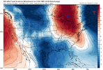
View attachment 193590
View attachment 193591
View attachment 193592
.png)
.png)
.png)

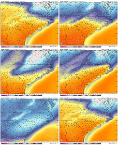
Not a ton of cold tap to work with but the flow is still jammed a bit here which is a leading indicator. This timeframe is still bouncing around a bit but at least a finger of high pressure wedged between two Lows seems to be a common theme over the last several cycles. Coupled with a muted ridge
Gfs for next Friday
Sent from my iPhone using Tapatalk

I love when cold air gets knocked loose from the poles. Is that a meteorological term?SnowbirdBob out of control again this morning. Heat on hold. Pattern loading
View attachment 193588
I thought it was supposed to be 85 degrees by then? Wen torch?
Gfs for next Friday
Sent from my iPhone using Tapatalk
GFS loves to show these storms 10 days out more than any other model.
Gfs for next Friday
Sent from my iPhone using Tapatalk
I am just happy that it will be cold. I absolutely hate winter torches. Snow will be a plus.GFS loves to show these storms 10 days out more than any other model.
I love the “bulge” of high pressure terminologyI love when cold air gets knocked loose from the poles. Is that a meteorological term?
Common theme. Pattern retrogression. Been there all season.one of the things that stood out to me the most in this morning's modeling was the AIFS jumping around on Tuesday of next week
View attachment 193581
But it is figuring out H5
View attachment 193582
That's a springtime vibe right there. Day that could go for 65-70 potentially foiled by random little shortwave of showers
Seems like the key to something mid Feb is just keeping seperation as waves enter the west coast and not phasing/merging the pacific/southern stream out there to create a mega west through. If you keep separation it speeds up wave timing with the attendant vortex to our NE waiting around
OopsYup that’ll almost do it. SE Canada vortex with a trailer wave. View attachment 193617View attachment 193618View attachment 193619

-NAOs suck for warmth especially in late winter and spring
Worked out pretty well on last 2. In the ball park, just a little heavy with icingGFS loves to show these storms 10 days out more than any other model.
