Mr. Golf
Member
modernweenie View attachment 95790

modernweenie View attachment 95790

I honestly have a hard time getting excited about or buying into modeled events before mid-December, unless we're talking about the upper Midwest or northeast. That's not to say a winter storm couldn't happen here, but anything more than token flakes or some sleet pellets now is quite rare, no matter the base state of ENSO.Great raincold. If niñas are usually front loaded, hopefully we get action going soon.
Bring it to the great state of Arkansas. ??
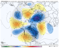
Night and day, given the GEFS has been steady I'm more inclined to believe the OP is going to be all over the place until we near verification or the Ens follow.View attachment 95796GEFS seems to be cooler than the GFS


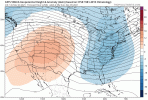
It never ceases to amaze me how an Op model can be a complete 180 from its own ensembles. I know I blast the GFS plenty, but in all honesty this something we’ve seen lately from the Euro as well.Night and day, given the GEFS has been steady I'm more inclined to believe the OP is going to be all over the place until we near verification or the Ens follow.

Not to mention the GEFS has trended stronger over time toward a stronger ridge out west and stronger trough in the eastView attachment 95798
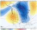
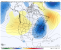
I made the mistake of getting caught up with the warmer solutions a week ago Because Im never comfortable with a Persistent AK vortextrending to what we’ve had for about a month now, a western ridge/trying to get a +PNA going, and there’s a TPV in Canada which will enhance colder temps in Canada, this pattern could get interesting for the first week of December, it would be nice to see that ridge try to tower towards the NW territories, but hey a western ridge would work with this TPV. Been seeing a reflection in the snow mean View attachment 95799View attachment 95800View attachment 95801
Goes from phase 6 into the cod. I thought we want to see it in phase 7? Larry, do u see the BC after gefs top right corner? That's the bias corrected I meant earlier
A low amplitude MJO is not really something to worry about or get overly excited about. Lots of other pattern drivers at work out there.
Also, the western ridge may break down for a time, but we may also see blocking develop. There's some pretty good cold air building up over northern North America. Wouldn't take a lot to tap it.
Phase 6 MJO in a La Niña isn’t bad at all, In fact it’s pretty good and matches what the GEFS is showing View attachment 95806View attachment 95807View attachment 95808View attachment 95805
This euro run however in the medium range is quite warmer, watch the pacific tho looks like we’ll stay with eventually trying to get back to a +PNA View attachment 95809View attachment 95810
Setting ourselves up for a dec 8-9 storm again lmaoHere’s comes a +PNAView attachment 95813View attachment 95814
Calm down Fro, don't get too excited. The NE ridge is going to cause this one to cut.Setting ourselves up for a dec 8-9 storm again lmao


Oh I know that, I’m talking about after the cold airmass settles, but geez the euro dumps it to our westCalm down Fro, don't get too excited. The NE ridge is going to cause this one to cut.
U meant gfs fro lolOh I know that, I’m talking about after the cold airmass settles, but geez the euro dumps it to our west
Gfs is west also then lol
If that were to go out another 12 hours, the cold would be spilling into the rest of the east coast, and then like you said would possibly set the stage for something a couple days later… perhaps a weak low developing along the front boundary in the northern Gulf
Could look worse could look better at the end of the day something interesting is coming to our weather pattern soonNot exactly a fan of this View attachment 95819
As long as we get our early December stormThe dreaded backwards L look with a western US/Arctic connection that’s dreaded, hopefully this keeps getting pushed back, pretty classic strong PV pattern View attachment 95820
We will probably get real warm, but the million dollar question is for how long? Hopefully not longThe dreaded backwards L look with a western US/Arctic connection that’s dreaded, hopefully this keeps getting pushed back, pretty classic strong PV pattern View attachment 95820
I just don’t see it, besides a weak stretched PV event towards NA in early December, the H5 pattern is the opposite of what you want for a weak SPV with a -WPO, you want a trough over the Bering sea like last year, along with a ridge towards the Barents Sea, in time that weakens that strat PV, the strat PV is not just good at delivering cold into the lower latitudes, but it highly promotes -AO/-NAO, it’s hard to get sustained blocking with a strong PV, the good news tho is we’re in a -QBO right now which means the SPV could be more susceptible to weakening
