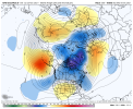
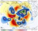
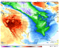
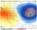
-
Hello, please take a minute to check out our awesome content, contributed by the wonderful members of our community. We hope you'll add your own thoughts and opinions by making a free account!
You are using an out of date browser. It may not display this or other websites correctly.
You should upgrade or use an alternative browser.
You should upgrade or use an alternative browser.
Pattern December to Remember
- Thread starter SD
- Start date
cd2play
Member
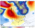
If we could sneak in an ULL….View attachment 95687
Not terrible
SnowNiner
Member
View attachment 95682
If there's a pattern to dislike it's probably this guy. Too cool to be warm too warm to snow.
Well December looks like it's going to start pretty warm right out of the gate. Hopefully the ensembles will flip soon. My fear is this year is going to be last year without the -NAO. Bad pacific with no blocking......??

Need to slosh that green blob over to this sideView attachment 95687
Not terrible
SnowNiner
Member
Let's hope it's sniffing something out, and not just sniffing glue. GEFS says it's rubber cement from 4th grade.

It's going to take a couple days for the models to figure out on what happens after the +EAMT that is supposed to start after Thanksgiving. Euro has it more favorable while the GFS has it less favorable as a -PNA pattern develops per GFS.
cd2play
Member
Looks like a red chalupa.Let's hope it's sniffing something out, and not just sniffing glue. GEFS says it's rubber cement from 4th grade.

LukeBarrette
im north of 90% of people on here so yeah
Meteorology Student
Member
2024 Supporter
2017-2023 Supporter
Had a couple storm threats within the 240 that we could work with.Much better GFS run incoming!
View attachment 95707
Cad Wedge NC
Member
Certainly better than previous runs. Right now, it looks like just another cold chasing moisture setup. However the overall pattern does look promising.well lookie what we have here, a little something to wake up to on a cold frosty morning. it's a way out in fantasy land (probably gone on the next run), although the ridge along the west coast and an Atlantic block is a good look in an overall pattern that has potential
Webberweather53
Meteorologist
If the cold air that’s chasing the precip is coming out of Siberia and the Arctic and there’s enough resistance to the flow offshore, it can certainly work in a big wayCertainly better than previous runs. Right now, it looks like just another cold chasing moisture setup. However the overall pattern does look promising.
If we get a 12z repeated fantasy storm this forum better be going more crazy than it did for the 06z.. the excitement is pitiful for a first fantasy of the season
D
Deleted member 609
Guest
It'll be gone for 12z... I guarantee it.If we get a 12z repeated fantasy storm this forum better be going more crazy than it did for the 06z.. the excitement is pitiful for a first fantasy of the season
tennessee storm
Member
So will the colder air to be honest. We facing a pretty positiveIt'll be gone for 12z... I guarantee it.
so will colder air I. Bet. The , epo strongly positive and models are just now playing catch up to it… first half December looks warmer than average to me could possible even torch at times unfortunately.It'll be gone for 12z... I guarantee it.
cd2play
Member
I don’t want a December 2011 redux.So will the colder air to be honest. We facing a pretty positive
so will colder air I. Bet pretty , epo strongly positive and models are just now playing catch up to it… first half December looks warmer than average to me could possible even torch at time unfortunately.
tennessee storm
Member
Not to even menthon the mjo seems to be heading II don’t want a December 2011 redux.
Towards the warmer phases
cd2play
Member
The MJO has been killing us the last few years (with the exception of about 2 weeks last February).Not to even menthon the mjo seems to be heading I
Towards the warmer phases
L
Logan Is An Idiot 02
Guest
If I remember correctly the southeast saw a decent snow in a warm phase not to long ago. I think it was Georgia and the upstate of SC So it can still happen even in a warmer phaseNot to even menthon the mjo seems to be heading I
Towards the warmer phases
tennessee storm
Member
Yeah and not going in the good direction now either that we wantThe MJO has been killing us the last few years (with the exception of about 2 weeks last February).
tennessee storm
Member
Also fighting a epo not so favorable either not going help thingsIf I remember correctly the southeast saw a decent snow in a warm phase not to long ago. I think it was Georgia and the upstate of SC So it can still happen even in a warmer phase
12z GFS delivers the goods to LA/MS on hrs 318 and 324. Nice to see fantasy grade snows showing near MBY this early in the season.
WXinCanton
Member
Here you go you snow starved heathens


- Joined
- Jan 5, 2017
- Messages
- 3,779
- Reaction score
- 5,990
Flurry watch for that weekend!Here you go you snow starved heathens

Some GEFS did hint at the big UPPER level low action as well so definitely an interesting time period
ForsythSnow
Moderator
6/20 for N ga is definitely more than I was expecting for that time period. Add 1 if you go 2 more days but then it's so far in fantasy land that it's bound to change. I'd say the time frame is worth watching just being at around day 11 right now but we'll need the components to hold if anyone outside the mountains even wants to see a flake. Could be different by 18Z or tomorrow but the GEFS and end of the 10D EPS seems to be close to something at least regarding cold.
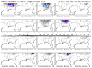

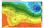
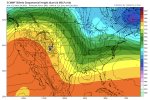
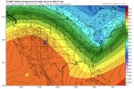
Interesting turn of events as the EURO actually ejects the piece of energy out SW and pulls it into the low that forms in 100 hours or so … still things are way too warm for anything to happen but that’s the first of that look I’ve seen on models. We would need a much more wound up system for anything fun to happen
Interesting turn of events as the EURO actually ejects the piece of energy out SW and pulls it into the low that forms in 100 hours or so … still things are way too warm for anything to happen but that’s the first of that look I’ve seen on models. We would need a much more wound up system for anything fun to happen
Webberweather53
Meteorologist
Interesting turn of events as the EURO actually ejects the piece of energy out SW and pulls it into the low that forms in 100 hours or so … still things are way too warm for anything to happen but that’s the first of that look I’ve seen on models. We would need a much more wound up system for anything fun to happen
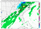
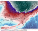
This actually looks plenty cold enough to me to yield a rain/snow mix in parts of the eastern NC. If the wave amps more + yields more cold advection on the NW side and legit precip falls back into the trailing air mass, the 850s will drop even further than shown here as will surface temps.
NBAcentel
Member
NBAcentel
Member
NBAcentel
Member
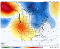
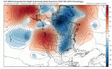
Source region is cooling off nicely+AO/+NAO/-PNA/+EPO… View attachment 95750
By far a better Pacific configuration w/ the +PNA.This run still might get interesting towards the end View attachment 95751
NBAcentel
Member
The early December storm returns

