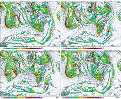
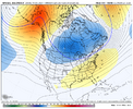
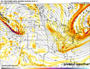
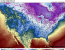
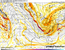
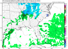
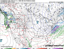
It's like having two baseball teams riding around on their busses with blind drivers looking for the ball field. But it's better than no teams and no ball field like as is usually the case.There’s a wave to our south and a cold airmass right on top of us. Squash city currently. Can we find a way to amplify or phase? Doubt it. But i’ll stand firm in that it’s not nothing
-
Hello, please take a minute to check out our awesome content, contributed by the wonderful members of our community. We hope you'll add your own thoughts and opinions by making a free account!
You are using an out of date browser. It may not display this or other websites correctly.
You should upgrade or use an alternative browser.
You should upgrade or use an alternative browser.
Pattern December Dud 👀
- Thread starter SD
- Start date
They are going to phase. I demand it and I won’t take no for an answer this time.It's like having two baseball teams riding around on their busses with blind drivers looking for the ball field. But it's better than no teams and no ball field like as is usually the case.
Kinda like the Navy/ARMY Game just played? /SarcIt's like having two baseball teams riding around on their busses with blind drivers looking for the ball field. But it's better than no teams and no ball field like as is usually the case.
Have two booked nowCruisetime
LukeBarrette
im north of 90% of people on here so yeah
Meteorology Student
Member
2024 Supporter
2017-2023 Supporter
Webberweather53
Meteorologist
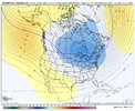
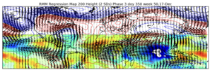
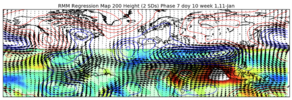
The Pacific onslaught on this GFS run is just insane. The MJO alone isn’t going to fix that problem. The MJO moving out of the Maritime Continent and across the Pacific (6-7-8) is a process that adds momentum into the Pacific Jet. Having the jet already energized isn’t a good starting point. So, we need to take a step back there before we can move forward. Something has the jet really energized so far here in early winter. You can see here on the 2nd image where the subtropical jet along 30N was weaker than normal from late Oct to early Nov, but has been stronger than normal since late Nov. The MJO has been in 5-6 during that time, not where you would expect to see an extended Pac Jet. Also, there hasn't been strong + East Asian Mtn Torque either. * Throws hands up *


A lot of this pacific onslaught is also attributable to Indian Ocean convective anomalies, which actually teleconnects to an extended Pacific jet & +EPO/Alaskan vortex in December & is a major contributor to the +U in the subtropics.
Turning off &/or muting the Indian Ocean's influence will be key to slowing the subtropical Jet over East Asia & getting the Pacific jet to retract in this particular case, especially in the absence of El Niño.
Webberweather53
Meteorologist
NCSNOW
Member
SimeonNC
Member
Does the Icon still have a warm bias when it comes to 2m temps because wow0Z Icon is cold throughout SE on this frame. Just not enough energy this run
View attachment 155971
View attachment 155972
NCSNOW
Member
I feel like we do this little rigamarole every winter but I’ll just go ahead and say it anyway. The Canadian almost nuked ENC on that run
Now is the part where y’all chase it to verification and talk about how if it were “X number of miles closer to shore it would be the storm of the century.” And “coastal precip shield should be more expansive.”
I’ll try my best to bitter cast this Christmas miracle to your doorstep.
Now is the part where y’all chase it to verification and talk about how if it were “X number of miles closer to shore it would be the storm of the century.” And “coastal precip shield should be more expansive.”
I’ll try my best to bitter cast this Christmas miracle to your doorstep.
I’m looking and everything is just so damn fast. NASCAR flow. It’s gross
The most beautiful part of winter in the SE. You can always depend on 33.6 and lgt rain.
Sent from my iPhone using Tapatalk
Sent from my iPhone using Tapatalk
Nomanslandva
Member
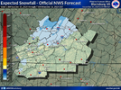
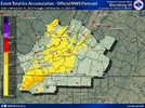
32 and mostly rain here. Did see a few rain drops bouncing a few minutes ago.View attachment 155956
View attachment 155957
First CAD event of the winter will bring some freezing rain, sleet and light snow to the region. Not sure I expect to see any snow here in Blacksburg but can't bet against the brilliant minds of NWS Blacksburg (I've shadowed there haha).
NCSNOW
Member
strongwxnc
Member
Yes sir. 36.4 this morning with light liquid. SE at its best.The most beautiful part of winter in the SE. You can always depend on 33.6 and lgt rain.
Sent from my iPhone using Tapatalk
Hey Mark good to see you posting. Had the same temp to your North. 36° light rain. My least favorite weather to say the least.Yes sir. 36.4 this morning with light liquid. SE at its best.
Op euro dropped mby below 40 Friday night and didn't go back above until midday Christmas day. Nothing else has been that cold so far

