-
Hello, please take a minute to check out our awesome content, contributed by the wonderful members of our community. We hope you'll add your own thoughts and opinions by making a free account!
You are using an out of date browser. It may not display this or other websites correctly.
You should upgrade or use an alternative browser.
You should upgrade or use an alternative browser.
Pattern December Dud 👀
- Thread starter SD
- Start date
I feel like this is close, but that warmer period 27-2nd is definitely going to be longer. Probably can push all of that out another week or so I bet.My snapshot pic from the BAM Wx video yesterday. I still think this high level forecast is on board to play out.
View attachment 155947
LukeBarrette
im north of 90% of people on here so yeah
Meteorology Student
Member
2024 Supporter
2017-2023 Supporter
Gotta shift the ridge axis west yallAlright, let’s cook.
View attachment 155939
GolfishardIknowit70
Member
I said that 2 weeks ago lolGotta shift the ridge axis west yall
GolfishardIknowit70
Member
Bamwx made a tweet about the -epo is coming back quicker than we believe. We shall seeMy snapshot pic from the BAM Wx video yesterday. I still think this high level forecast is on board to play out.
View attachment 155947
Last edited:
Drizzle Snizzle
Member
I’ll be surprised if the cold blast lasts until Dec 26th. I’m not even sure it lasts until the 24th.My snapshot pic from the BAM Wx video yesterday. I still think this high level forecast is on board to play out.
View attachment 155947
tennessee storm
Member
Bam is wanting some clicks lolBamwx made a tweet about the -epo is coming back quicker than we believe. We shall see
That’s actually been Webb’s thinking from what I’ve read of his postsBamwx made a tweet about the -epo is coming back quicker than we believe. We shall see
Tarheelwx
Member
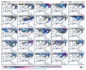
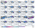
18z NAM is a major increase in ice for NC mountain folks.
TW
TW
This looks a lot like the overnight op and AI euro. I guess you can find some enthusiasm that this pattern would likely try to build a -nao in early January but with that pac look it would be a miller b hell. I personally think we are getting into the front part of the window where we are going to need to see positive changes at the end of the runs. If we revisit next week and the day 13-16 range is a train wreck with no signs towards a change or building to a change ill be concernedThe Pacific onslaught on this GFS run is just insane. The MJO alone isn’t going to fix that problem. The MJO moving out of the Maritime Continent and across the Pacific (6-7-8) is a process that adds momentum into the Pacific Jet. Having the jet already energized isn’t a good starting point. So, we need to take a step back there before we can move forward. Something has the jet really energized so far here in early winter. You can see here on the 2nd image where the subtropical jet along 30N was weaker than normal from late Oct to early Nov, but has been stronger than normal since late Nov. The MJO has been in 5-6 during that time, not where you would expect to see an extended Pac Jet. Also, there hasn't been strong + East Asian Mtn Torque either. * Throws hands up *


NCSNOW
Member
43-44 is all we could get out of the sun today. You can feel that 1045HP up in the NE.
On the brightside from a hemispheric perspective the late hours and days of the 12z gefs/geps is where we want to go. It will take time to build the cold but ural ridge, okhotsk/aleutian low, WC ridge is where we want to go
Last edited:
Webberweather53
Meteorologist
The Pacific onslaught on this GFS run is just insane. The MJO alone isn’t going to fix that problem. The MJO moving out of the Maritime Continent and across the Pacific (6-7-8) is a process that adds momentum into the Pacific Jet. Having the jet already energized isn’t a good starting point. So, we need to take a step back there before we can move forward. Something has the jet really energized so far here in early winter. You can see here on the 2nd image where the subtropical jet along 30N was weaker than normal from late Oct to early Nov, but has been stronger than normal since late Nov. The MJO has been in 5-6 during that time, not where you would expect to see an extended Pac Jet. Also, there hasn't been strong + East Asian Mtn Torque either. * Throws hands up *


The +U build up here is really coming from the warmer Indo-Pacific Warm Pool fueling more convection over the Indian Ocean to far West Pacific. This extra convection in a mean sense keeps the subtropical jet active by increasing the meridional temperature gradient in the upper troposphere, especially over the Eastern Hemisphere. The polar vortex visits we’ve had earlier this month in eastern N America also helps to flux westerly momentum equatorward explaining the strong southern jet over the Western Hemisphere too
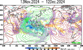
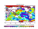
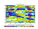
This warmer Warm Pool was one of the main reasons why I wasn’t sold on a classic -PNA type winter overall, even if we eventually try to go to that pattern later down the road in say February.
The one thing that really sticks out to me that has the potential to significantly mute the canonical La Niña -PNA pattern this year & isn't getting a lot of notoriety, is the warm North Indian Ocean.
A warm North Indian Ocean actually favors a positive PNA, in part because the excess convection here adds enough westerly momentum into the Pacific jet to kick the Aleutian ridge closer to the US West Coast.
View attachment 154391
View attachment 154393
View attachment 154394
Webberweather53
Meteorologist
I think we’re just fine in the longer term.
I could see the reverberating impacts of this jet extension hanging around a bit longer than say the euro weeklies are forecasting, delaying the onset of -PNA later in January perhaps.
I could see the reverberating impacts of this jet extension hanging around a bit longer than say the euro weeklies are forecasting, delaying the onset of -PNA later in January perhaps.
Yall please listen to the man. Sheesh.I think we’re just fine in the longer term.
I could see the reverberating impacts of this jet extension hanging around a bit longer than say the euro weeklies are forecasting, delaying the onset of -PNA later in January perhaps.
CruiseNice. Looks chilly down in Playa Del Carmen. We might have to take a trip back down there to escape this heat
Webberweather53
Meteorologist
There are multiple ways to get to the +TNH/-EPO pattern that’s very likely lurking around the corner in January.
The difference between the various model suites atm is more of an onset timing & duration question than a question of will it show up or not.
Most pathways back to some semblance of the stereotypical Nina configuration (-PNA) lead us back to the -EPO/+TNH pattern, meaning we will probably have to go through that at some point here.
What we can’t obviously have is an overextended pacific jet that makes everything very mild in N America, but I don’t think there’s enough additional gas in the tank/westerly momentum to make that happen on a consistent basis going forward especially as the MJO becomes muted by enso as it travels towards the central pacific and western hemisphere. If we were in a legitimate El Niño, I’d feel a lot differently about that.
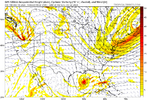
Need a deeper trough and farther north southern energy and either a much faster southern energy or much slower northern trough.That’s not nothing. Christmas miracle not out of the question View attachment 155954
There’s a wave to our south and a cold airmass right on top of us. Squash city currently. Can we find a way to amplify or phase? Doubt it. But i’ll stand firm in that it’s not nothingNeed a deeper trough ans farther north southern energy and either a much faster southern energy or much slower northern trough.

