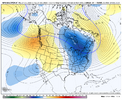
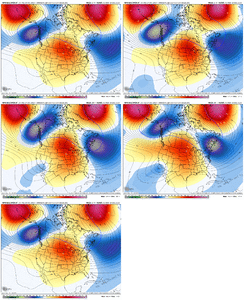
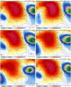
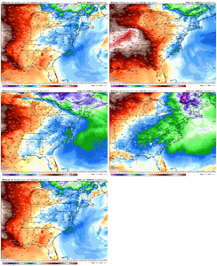
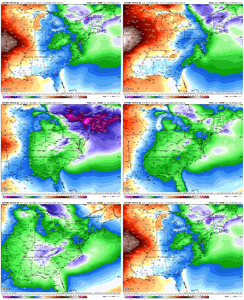
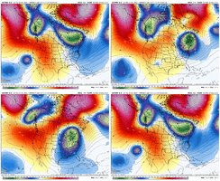
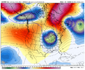
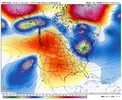
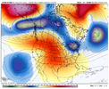
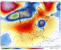
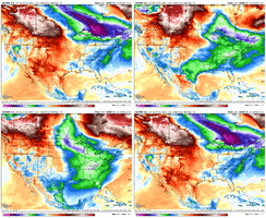
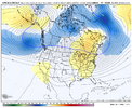
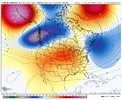
How does that happen!? Why did they pick the only fantasy map one to get our (GA weenies) hopes up?So only one member showed that. And that’s what it went with lol.
-
Hello, please take a minute to check out our awesome content, contributed by the wonderful members of our community. We hope you'll add your own thoughts and opinions by making a free account!
You are using an out of date browser. It may not display this or other websites correctly.
You should upgrade or use an alternative browser.
You should upgrade or use an alternative browser.
Pattern December Doldrums 2025 🎄 ❄️
- Thread starter SD
- Start date
It's a day 9+ threat. We all know it'll be gone by the next run, but now and then, something similar works out anyway.How does that happen!? Why did they pick the only fantasy map one to get our (GA weenies) hopes up?
NorthHillsWx
Member
So no support for op
You know there was a time when the EURO showed something like that at day 10 and it meant you had a decent chance of something to track.It's a day 9+ threat. We all know it'll be gone by the next run, but now and then, something similar works out anyway.
Iceagewhereartthou
Member
There was a timeYou know there was a time when the EURO showed something like that at day 10 and it meant you had a decent chance of something to track.
Back in it's prime
When it could really nail em down
But if you want snow tonight
It may have just enough
It's not as good as it once was
But hopefully it's as as good once
As it ever was.
GeorgiaGirl
Member
You know there was a time when the EURO showed something like that at day 10 and it meant you had a decent chance of something to track.
That kinda actually worked close to a year ago for a change. It showed two amazing runs day 10ish+ and then something verified at about the same time, but not the exact solution we were seeing in the long range.
The unfortunate issue though in this case is there's really no support for that overnight run, even by its own ensembles, and when we were going into January last year, we knew there was a good chance of a massive cold snap and this time it's going to be warm.
I take the warning shots by that EURO run, along with some similar earlier AIGFS and EMCFAI runs, as a heads up that the southern jet may be waking up. IF we can get a strong west-based -NAO to occur, we'll have some threats to track post-Christmas.You know there was a time when the EURO showed something like that at day 10 and it meant you had a decent chance of something to track.
jetstream30
Member
Webber does not seem too optimistic for January or February. Happy Official Winter Everyone and Happy Holidays! Let’s hope we are tracking a system by New Years.
*Flash*
Member
Exaggerated hyperbole and reverse jinxing are renowned strats of his. There's likely a hint of clickbait in those latest tweets. Personally, I advise you diversity your portfolio of who you listen to this time of year. Lot of credible voices out there, not all are doom and gloom on this first day of winter.Webber does not seem too optimistic for January or February. Happy Official Winter Everyone and Happy Holidays! Let’s hope we are tracking a system by New Years.
Last edited:
jetstream30
Member
Good advice. Thanks!
These doomsday Herculean Aleutian ridges don’t just disappear overnight. We’ve had winters that these have persisted.
But we can have fun tracking CAD events where highs are muted from the 60’s to the 40’s. That’s always fun in the heart of winter.
But we’ve already had 2 events…solid winter.
View attachment 178855
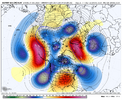
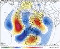
Ensembles have been locked in and haven’t budged. I guess models can do alright in the extended.
Winter might indeed be over. There is no way to know. But I personally do not think so, by any means.
Let me ask you guys a question. And I'm seriously asking. I hear this all the time:
"So and so thinks we're done." Or, "So and so is not optimistic for the rest of the winter."
When you hear that, does that honestly make you discouraged? I'm seriously asking.
Because about 95% of the time, about a week before, they were saying all kinds of optimistic things.
There is NOBODY on the planet that knows how the next 2 months will play out. It is ABSOLUTELY well within the realm of possibility that even if we end up warm, on balance, for the rest of the winter we will get a period or two that have a legitimate chance of snow and ice.
It kills me when "respected" entities post a bunch of optimistic stuff and then completely do a 180, that people forget the previous outlooks and just assume that the thing being declared now has to be the outcome.
A Kelvin wave from the 17th dimension on Neptune will save us. Trust the process.Winter might indeed be over. There is no way to know. But I personally do not think so, by any means.
Let me ask you guys a question. And I'm seriously asking. I hear this all the time:
"So and so thinks we're done." Or, "So and so is not optimistic for the rest of the winter."
When you hear that, does that honestly make you discouraged? I'm seriously asking.
Because about 95% of the time, about a week before, they were saying all kinds of optimistic things.
There is NOBODY on the planet that knows how the next 2 months will play out. It is ABSOLUTELY well within the realm of possibility that even if we end up warm, on balance, for the rest of the winter we will get a period or two that have a legitimate chance of snow and ice.
It kills me when "respected" entities post a bunch of optimistic stuff and then completely do a 180, that people forget the previous outlooks and just assume that the thing being declared now has to be the outcome.
Webberweather53
Meteorologist
Awesome we go from a mild pattern to cold and dry.
FoothillsWX
Member
Have some respect. Can’t be posting porn on a Sunday morning.Who ordered?View attachment 179444
Webberweather53
Meteorologist
Ensembles have been locked in and haven’t budged. I guess models can do alright in the extended.
View attachment 179445View attachment 179446
We can say all these nice things about winter not being over at this point or that no one knows what will happen, but if we do not move the Aleutian ridge, our goose is cooked.
I still cannot figure out when we’re going to able to move it & that says a lot.
Webberweather53
Meteorologist
We can say all these nice things about winter not being over at this point or that no one knows what will happen, but if we do not move the Aleutian ridge, our goose is cooked.
I still cannot figure out when we’re going to able to move it & that says a lot.
I figured maybe we could give it a nudge in mid to late January but I don’t think we’re doing enough in the tropics the next few weeks to eventually help kick it along.
So only one member showed that. And that’s what it went with lol.
The one member with a big snow is #30. So, it’s the op and one ens member with a big snow in that region. And then two other EPS members have a light snow (#12 and #34) for the same period/region. So, I’d call it 3 out of 50 (only 6%) EPS members at best for any measurable snow around then there. So, no matter how this is viewed, yes, the level of 0Z EPS support for the op snowstorm is tiny.
I guess God could choose to move it whenever he wants so we have that in our back pocket.We can say all these nice things about winter not being over at this point or that no one knows what will happen, but if we do not move the Aleutian ridge, our goose is cooked.
I still cannot figure out when we’re going to able to move it & that says a lot.
dsaur
Member
Thanks for the heads up! I've always liked the week after Xmas, close to New Years for my first chance at a decent storm, and it looks like there's a chance, at least. Cold air close by, maybe an impulse coming up from the gulf. The ingredients for a heart break close call, or nirvana. Snow this far out means sleet up close. I'm readySomeone alert Tony or at least his moles that the 0Z Euro in 9 days has his biggest snow since ????
@dsaur
Yeah really the only reason I’m at all interested is there have been a few runs of other models with something in that timeframeI take the warning shots by that EURO run, along with some similar earlier AIGFS and EMCFAI runs, as a heads up that the southern jet may be waking up. IF we can get a strong west-based -NAO to occur, we'll have some threats to track post-Christmas.
It may wind up being cold and dry, but it's definitely a nod to the EURO. In any case, it's a reminder that warm and dry is not set in stone, even in the middle range.Awesome we go from a mild pattern to cold and dry.
Webberweather53
Meteorologist
It may wind up being cold and dry, but it's definitely a nod to the EURO. In any case, it's a reminder that warm and dry is not set in stone, even in the middle range.
The major ensembles have hinted at a cold shot after next weekend for a while now, I’m not surprised
Let's see them.The major ensembles have hinted at a cold shot after next weekend for a while now, I’m not surprised
dsaur
Member
It always gets cold enough in winter for a storm, but the trick is is it raining when it's cold enough. Larry, is there a winter on record where it never got to freezing, or below?It may wind up being cold and dry, but it's definitely a nod to the EURO. In any case, it's a reminder that warm and dry is not set in stone, even in the middle range.
It always gets cold enough in winter for a storm, but the trick is is it raining when it's cold enough. Larry, is there a winter on record where it never got to freezing, or below?
Not in Atlanta. Highest lowest of Nov-Mar has been a few with 25.
Last edited:
I’m still a believer in “pattern going out” physics. Same concept as a severe outbreak as winter retreats in early spring. Like clock work. Snow events in the south can work the same way. You drop a hot pacific fart over the bulk of the lower 48 just before peak winter climo there will most likely be a big winter event to follow. Winter will winter at some point.
Webberweather53
Meteorologist
Let's see them.
This has been on my radar for a while now, not sure why everyone is acting surprised
Yeah odds are the 23rd and Christmas Eve are on the chillier side. Christmas Day we transition with the CAD eroding as the meridional pressure gradient reverses over the Apps. Then, Friday and Saturday are really mild. Maybe we get another parting cold shot that Sunday or Monday?
iGRXY
Member
just to piggyback off of RC. Just because things haven’t looked great and we have no idea what will happen 10 days from now let alone the remainder of winter which is probably another 2 1/2 months. The notion that the Aleutian ridge won’t move and nobody has any idea on what it’s going to take to move it is hogwash. I can promise you that while it may be difficult to break a pattern, they always break. We just went through about a 6 week stretch over solidly cold weather. Thinking that Aleutian ridge will be there the entirety of winter is ridiculous. Nothing is infinite in weather. I don’t have to be a meteorologist or climatologist to know that there’s never wall to wall cold or warmth. You are already seeing cold coming back into the pattern even with the Aleutian ridge. Idk what that means as far as snow or anything like that but I have no reason to think we should be punting January or anything like that. That’s nonsense
Must be those Big Johnson waves.The 12Z Euro is a clear outlier vs other op models and is stronger with the E trough than its prior runs as of this time: View attachment 179460

