Cad Wedge NC
Member
He will figure it out in a few days. It just takes him a little longer than most.Somebody in here should tell Brad things are trending colder…..View attachment 179155
He will figure it out in a few days. It just takes him a little longer than most.Somebody in here should tell Brad things are trending colder…..View attachment 179155
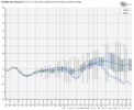
CAD for Twister?Ooooof! Zing.Clank.Doh
12z Euro for Jan 1View attachment 179169
March is gonna be a banger!I love it. Hope we get it for memorial day too
That look as possible as me hitting the powerball. @stevoonly one gets snow!Ooooof! Zing.Clank.Doh
12z Euro for Jan 1View attachment 179169
I’m downThat look as possible as me hitting the powerball. @stevoonly one gets snow!
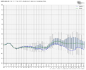
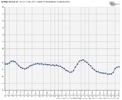
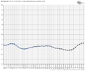
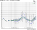
Am I missing something on these charts? They’re showing a -PNA continuing which we’ve had since about Thanksgiving.WE (including me) have been pretty negative about any colder regime coming anytime soon but the PNA (which I think is most important this time of year for colder weather in the SE) has taken an abrupt turn according th the weatherbell charts. These can, and probably will change ma ny times but they are an abrupt departure from what we have been seeing
View attachment 179164
View attachment 179165
View attachment 179166
View attachment 179167
View attachment 179168
Our new climo winter storms View attachment 179179
Outside of 1973 that’s how it works apparently. Florence to Norfolk has its little snow alley.If you aren’t in the mountains you Gotta be closer to the Atlantic Ocean instead of mountains ! Crazy
Sent from my iPhone using Tapatalk
Yeah baby, that's what I'm talking about; bullseye for the upstate! Take that, rest of the country!Ooooof! Zing.Clank.Doh
12z Euro for Jan 1View attachment 179169
This is only going to get worse. Voluntary water restrictions starting in SC now with a stage 1 drought declared for Lake Keowee. Most of this board will not remember 1986 but that is where this heading I'm afraid. We were the top national story that summer because of heat and drought. 1989 had been headed that way, but the pattern changed at the last minute. I do not remember a December this dry since 1985 and that led to a dry winter, spring, AND summer.Can’t build fire ant mounds when the ground is chaffed and cracked into a JHS mega drought View attachment 179186View attachment 179187

I can see that, we have mostly been bone dry. That southern stream has got to start getting active.This is only going to get worse. Voluntary water restrictions starting in SC now with a stage 1 drought declared for Lake Keowee. Most of this board will not remember 1986 but that is where this heading I'm afraid. We were the top national story that summer because of heat and drought. 1989 had been headed that way, but the pattern changed at the last minute. I do not remember a December this dry since 1985 and that led to a dry winter, spring, AND summer.

It will. It’ll just be middle of March.I can see that, we have mostly been bone dry. That southern stream has got to start getting active.
I think the negative PNA has a lot to do with that. If we can get a positive PNA going, that will open up the moisture from the southern branch of the jet stream and put that into play for us. If we can get some cold air in conjunction with that, look out.I can see that, we have mostly been bone dry. That southern stream has got to start getting active.
Yeahhhhh except there’s no sign of it going positive. Oh and don’t worry if it did you better believe that -nao will disappear.I think the negative PNA has a lot to do with that. If we can get a positive PNA going, that will open up the moisture from the southern branch of the jet stream and put that into play for us. If we can get some cold air in conjunction with that, look out.
Ha, yeah I’d say that’s the very definition of a retrograding block bullying the pattern. It has a Christmas 2010 look to it aloftHappy New Year!!
View attachment 179201
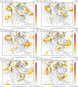
Starting to have that effect on the ens as well, starting to see some more west based -NAO tendencies esp on the EPS, also the pacific is trying to slow a bit, the more you can tuck that low near the PNW more back into the GOAK, the more amplified the pattern can get, I’d honestly take my chances with a big 50/50 low or Atlantic low hanging right near the EC and send a wave toward itHa, yeah I’d say that’s the very definition of a retrograding block bullying the pattern. It has a Christmas 2010 look to it aloft
View attachment 179204
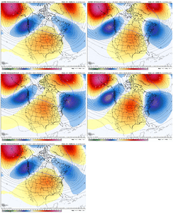
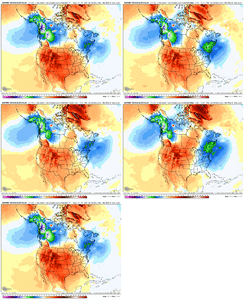
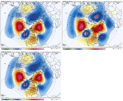
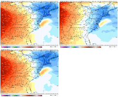
Twister is crying on the keyboard seeing that top imageHO HO Ho
View attachment 179211
4 days latter:
What a 3 day storm from the Euro: Giddy up
View attachment 179212
And you're probably kissing your Screen. Let me know if it happensTwister is crying on the keyboard seeing that top image
Still way to zonal flowWe made better movement overnight. Got work to do. Starting to see the impacts from our shifting of the NAO & AO. View attachment 179213View attachment 179214View attachment 179215
We made better movement overnight. Got work to do. Starting to see the impacts from our shifting of the NAO & AO. View attachment 179213View attachment 179214View attachment 179215

