iGRXY
Member
Sure am because it's winter and we like cold weather and a cold Christmas on this board.And you're probably kissing your Screen. Let me know if it happens
Sure am because it's winter and we like cold weather and a cold Christmas on this board.And you're probably kissing your Screen. Let me know if it happens
Need the -NAO to continue to push further west and it'll slow the progression and dig the North Atlantic troughing more and more south and west.We made better movement overnight. Got work to do. Starting to see the impacts from our shifting of the NAO & AO. View attachment 179213View attachment 179214View attachment 179215
I did more than kiss it.And you're probably kissing your Screen. Let me know if it happens
I’d like to see the the southern stream start to get a bit more active along with that,Need the -NAO to continue to push further west and it'll slow the progression and dig the North Atlantic troughing more and more south and west.
Brick is brickedI did more than kiss it.
Just because you do don't mean "Everyone" does. That's the problem here it's y'all way with cold or No way. Just because it's winter doesn't mean everybody wants it cold. Will you ever grasp that?? Nope you or others don't have enough sense to realize that not everyone likes cold and winterSure am because it's winter and we like cold weather and a cold Christmas on this board.
The -NAO should help get that started. Shifting the storm track south as well. My guess is as we transition out of the La Nina we should be able to start seeing at least a more active southern jet.I’d like to see the the southern stream start to get a bit more active along with that,
And you have zero sense to realize you're on a southern weather board where the overwhelming majority of the people want cold and snow. It's not that hard to grasp. But you're literally the only person that gets pissy when the board gets happy about cold during WINTER. If you like warm weather, fine. But you get entirely too in your feelings about being on a site where you're in the a very slim minority. That's just a fact.Just because you do don't mean "Everyone" does. That's the problem here it's y'all way with cold or No way. Just because it's winter doesn't mean everybody wants it cold. Will you ever grasp that?? Nope you or others don't have enough sense to realize that not everyone likes cold and winter


Biggest problem is see is the cold air presses way east of traditional Cad favored areas. Where Ne Ga and Nw Sc get the warm nose screw job. Very odd depiction to me. Would love to hear your thoughtsYeah the GFS & Euro are how you’d have to score in this pattern.
Slow-moving cut-off that gets timed up right with a west-based -NAO and 50-50 low. We’d likely have a hefty dose of CAD in the mix no matter how you’d slice it, barring that something actually showed up ofc.
It is the kind of setup that if done properly, would have a really high ceiling because of how slow the pattern is.
I quit if Roxboro gets 36 inches while I get 1An oldie example of how a west-based -NAO/-PNA can work in our favor if we play things right:
This is the 1922 Knickerbocker Storm which caused a roof collapse to the first movie theater in America. Also dropped 3 feet of snow in Roxboro, just a very slow moving and amped storm.
View attachment 179218
View attachment 179219
HO HO Ho
View attachment 179211
4 days latter:
What a 3 day storm from the Euro: Giddy up
View attachment 179212

The orientation of the wedge definitely has a big outcome your way. Usually those of us east of highway 25 are sitting pretty regardless, but your way definitely can get the screw job.Biggest problem is see is the cold air presses way east of traditional Cad favored areas. Where Ne Ga and Nw Sc get the warm nose screw job. Very odd depiction to me. Would love to hear your thoughts
Biggest problem is see is the cold air presses way east of traditional Cad favored areas. Where Ne Ga and Nw Sc get the warm nose screw job. Very odd depiction to me. Would love to hear your thoughts

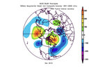
December 2010 was negative PNA and heavy AO/NAO. Any chance we can pull that off in January this year?
The AO trend is just as important...the aleutian ridge trying to build poleward
Past few runs of the AO tanking in the extended. Fingers crossed its right.
View attachment 179227
Some good stuff from JWall
Sent from my iPhone using Tapatalk
My Christmas Day forecast keeps getting warmer. Up to 73 now.It's nice to wake up and see an improved mood on this board. Nothing like a couple of long-range fantasy runs to perk up the weenies
Now let's see. This is just about the time frame (7-days) that the predicted SE torches have begun to trend colder of late. Let's see if we can bet the streak and at least get Christmas chilly.
Yeah the NAO will likely have to go big, and retrograde, with stout and well-positioned low underneath to overcome the blowtorch effects of the Aleutian Ridge -PNAYeah I disagree there. I think the Aleutian ridge is the main problem; blocking real cold our way and keeping the flow off the pacific due to the trough it creates. The -NAO is a secondary help to get us seasonal and wedgy, but I have little faith that it will bring us an actual storm.
To Kylo's point, hopefully it goes poleward and we really improve our situation.
Some good stuff from JWall
Sent from my iPhone using Tapatalk
GoodMy Christmas Day forecast keeps getting warmer. Up to 73 now.
And that cut off can be painfully sharp like January 2000 when you went from a foot of snow down my way to practically nothing north and west of 85It’s pretty normal for the upstate of SC into Charlotte to get screwed over when there’s a deep coastal cyclone involved. Those rarely work out well for the SW Piedmont of NC into the 85 corridor of SC
The thing I would point out is that we just saw a legit Arctic blast just a few days ago with the Aleutian Ridge in place. Now I’m not saying we should want it to stay there, but we can definitely get cold enough with it in that locationYeah I disagree there. I think the Aleutian ridge is the main problem; blocking real cold our way and keeping the flow off the pacific due to the trough it creates. The -NAO is a secondary help to get us seasonal and wedgy, but I have little faith that it will bring us an actual storm.
To Kylo's point, hopefully it goes poleward and we really improve our situation.
This -NAO/-PNA regime only works for NC. SC and points west will be mostly dry, unfortunately. We need at least a neutral PNA, BUT positive would be much better!An oldie example of how a west-based -NAO/-PNA can work in our favor if we play things right:
This is the 1922 Knickerbocker Storm which caused a roof collapse to the first movie theater in America. Also dropped 3 feet of snow in Roxboro, just a very slow moving and amped storm.
View attachment 179218
View attachment 179219
I mean I only get like 20 so I feel youI quit if Roxboro gets 36 inches while I get 1
GFS and Euro look pretty similar. Just wish it wasn't 2 weeks out.
Atleast it’s not a freezing cold rain. More of a lukewarm rain
What we need in the kitchen is new ingredients. We’ve been cooking with grandmas canned green beans for years.AIGEFs added to tropical tidbits. Just what we need, another cook in the kitchen