-
Hello, please take a minute to check out our awesome content, contributed by the wonderful members of our community. We hope you'll add your own thoughts and opinions by making a free account!
You are using an out of date browser. It may not display this or other websites correctly.
You should upgrade or use an alternative browser.
You should upgrade or use an alternative browser.
Pattern December Doldrums 2025 🎄 ❄️
- Thread starter SD
- Start date

CNCsnwfan1210
Member

Sent from my iPhone using Tapatalk

Sent from my iPhone using Tapatalk
Gfs pretty different at 90 lol
Classic

CNCsnwfan1210
Member
I’ll take these trends roughly ~3 days out or so.
Sent from my iPhone using Tapatalk
iwantsouthernsnow123
Member
Would like some more cold air, but we're definitely trending the right direction right now.
Blue_Ridge_Escarpment
Member
This is for Fro!

This is the first one I’ve been mildly interested in for our area.
iwantsouthernsnow123
Member
Agreed, the first one never stood a chance. I'd like for a stronger inital cold air source just to hold over until the main cold air comes through. Not sure if the CAD is going to hold on quite long enough to do so. If we don't get that, then we need that big push of cold air. One key factor about this system that hasn't been talked about too much from what i've seen is baja low.. these do some wild things sometimes.. --Trends have actually been postponing the stringing out of the baja energy, which can be huge for this system potentially in terms of getting the moisture in. I don't think it will be overamped and do what this one did just because of how far south the baja is placed. We just have to keep hoping that NS energy keeps digging. With CMC initially not looking as good with the baja low, I think this 0z GDPS run will be a miss.This is the first one I’ve been mildly interested in for our area.

Canadian is close, might have to stay up for euro now
CNCsnwfan1210
Member

Nice shot of cold air coming south on 12/12 per GFS
Sent from my iPhone using Tapatalk
CNCsnwfan1210
Member

Just a little improvement for the early week system on the 00z GEFS, still needs some work but there’s some time left.
Sent from my iPhone using Tapatalk
Tsappfrog20
Member
Looks like the Euro continues the trend not fully there but still plenty of time to continue to get better!
Sent from my iPhone using Tapatalk
Sent from my iPhone using Tapatalk
NBAcentel
Member
Euro Is really close to some ULL magic 

accu35
Member
What a cold Euro run
NBAcentel
Member
Welp 

trackersacker
Member
NBAcentel
Member
If we bridge that western ridge and -WPO/-EPO ridge, it’s gonna get legit cold 
CNCsnwfan1210
Member
Euro Is really close to some ULL magic View attachment 178035View attachment 178036

On Pivotal, it does show a little mix in western NC on the 00z Euro Monday afternoon.
Sent from my iPhone using Tapatalk
Yeh would be nice to dig this more West & further South. I'll be in the mountains next weekend & this is close. Bulk of energy is swinging North though.If we bridge that western ridge and -WPO/-EPO ridge, it’s gonna get legit cold View attachment 178039
6z GFS shows a major arctic blast on day 11/12. Our friends in Florida should finally see winter temps:
Dat 12:

Dat 12:
Bigedd09
Member
Take it for what it’s worth but the AI is getting even cooler and more precip for Monday 
Sent from my iPhone using Tapatalk

Sent from my iPhone using Tapatalk
Yep, here's the 6z:Take it for what it’s worth but the AI is getting even cooler and more precip for Monday
Sent from my iPhone using Tapatalk

CNCsnwfan1210
Member

CNCsnwfan1210
Member

Even the Euro is trending colder and trying to spit out some flakes on Monday
Sent from my iPhone using Tapatalk
CNCsnwfan1210
Member

All three major OP models have some decent cold shots in the next 10-15 days, and the GFS is still signaling a stretched polar vortex mid month.
Sent from my iPhone using Tapatalk
euro op brought barney out to play in fantasy land

let's see if we can keep sliding this on back west like we have been for a while now

also, wen torch

let's see if we can keep sliding this on back west like we have been for a while now
also, wen torch
Again, wen torch??


- Joined
- Jan 23, 2021
- Messages
- 4,603
- Reaction score
- 15,199
- Location
- Lebanon Township, Durham County NC
how it started:
.png")
How its going:

How its going:
Yep. I've been watching this, and the GFS OP has been persistently forecasting this stretch for quite a few runs and has support from its ensemble. Notably, the EURO ensemble has picked up on this weakening in the past few days as well. Bodes well for a cold Christmas week.
All three major OP models have some decent cold shots in the next 10-15 days, and the GFS is still signaling a stretched polar vortex mid month.
Sent from my iPhone using Tapatalk

just need some systems to grab a hold and ride on in.how it started:
How its going:
For us Georgia weenies, this morning's NAM is the first run showing just enough cold to allow for a little snow rather than drizzle or light rain with the next system. Just a tease, but I'm easy.

I'm not sure how we can get the Monday system to come back to life....it looks like we might be trending better moisture-wise, but it sure seems reminiscent of this system with no cold air feed until late, surface temps baking and dews in the 30s.
I think late next week into the weekend is a few adjustments away from something interesting. Really need this trough to dig more & further West. 
256wx
Member
I’ll take that run in north Alabama!For us Georgia weenies, this morning's NAM is the first run showing just enough cold to allow for a little snow rather than drizzle or light rain with the next system. Just a tease, but I'm easy.
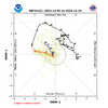
View attachment 178059
Want to see that ridge sharpen up out west, then we could be in business. The cold is in the pattern. The pattern is active. Those are two key ingredients. We either need to STJ to kick into gear, which may happen later in the month, or build the ridge out west. All the energy coming in over the top is flattening it down too much. Other alternative is it moves west a tad.I think late next week into the weekend is a few adjustments away from something interesting. Really need this trough to dig more & further West. View attachment 178060
CNCsnwfan1210
Member

Thanks Mitch for posting this on X… marginal temps but you can get a rain/snow mix out of this, 6z Euro
Sent from my iPhone using Tapatalk
It's fun we are at least tracking in early December & have a lot more cold on the horizon. Something big is coming eventually.
Brent
Member
It's fun we are at least tracking in early December & have a lot more cold on the horizon. Something big is coming eventually.
Yeah I dunno what everyone is complaining about
It's not even winter yet and we've had two winter events already
 like I don't know what people are expecting
I'm actually worried we'll get so cold the snow is in the Gulf again