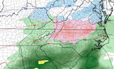
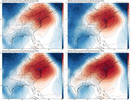
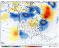
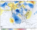
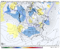
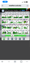
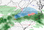
I think one more Euro run should do it.ICON looked icy, too. Time to start the first storm thread of the year for the N. Carolina and Virginia crew, don't y'all think?
-
Hello, please take a minute to check out our awesome content, contributed by the wonderful members of our community. We hope you'll add your own thoughts and opinions by making a free account!
You are using an out of date browser. It may not display this or other websites correctly.
You should upgrade or use an alternative browser.
You should upgrade or use an alternative browser.
Pattern December Doldrums 2025 🎄 ❄️
- Thread starter SD
- Start date
Met1985
Member
Oh yeah the models have all struggled. Flip flopping and having no consistency at all until we get down into like a 5 day window. It's kind of been like that this whole Fall.In fairness the EPS has really struggled as well until we get into the medium range. If you remember 2 weeks ago, the EPS was showing full on torch for the coming week
If the Euro bites again, mise well start a thread.
SimeonNC
Member
It's weird that the Canadian doesn't have it lol, usually the GEM model goes bonkers for any set up like this.
LukeBarrette
im north of 90% of people on here so yeah
Meteorology Student
Member
2024 Supporter
2017-2023 Supporter
Probably start one for Tuesday. Looks icy and will only trend that way as we get closer. Always doesICON looked icy, too. Time to start the first storm thread of the year for the N. Carolina and Virginia crew, don't y'all think?
the only model with significant wintry weather solidly south into NC i see is the gfs that people keep saying is horrible
Once the GFS goes back to a cold rain, people will call it horriblethe only model with significant wintry weather solidly south into NC i see is the gfs that people keep saying is horrible
i think a mix at onset is possible, but is that even significant? idk, i'm leaning towards VA north right now but we'll see. i really wish these snow maps stopped counting zr/ip as snowOnce the GFS goes back to a cold rain, people will call it horrible
not trying to piss in anyone's cereal but i am not impressed by how transient the wedging high is modeled currently
not trying to piss in anyone's cereal but i am not impressed by how transient the wedging high is modeled currently
that's where i am at. i hope it works out, but i'm just not seeing it for a thread right now, that's all. when we get to making a lot of threads for threats that don't pan out, it leads to confusion and stuff
Unreal energy. I live in the armpit of hell & trying to get excited for y’all. Lmaoo
goofus is the most optimistic about how far south it is at precip onset as well as keeping it lingering into sat AM hours and that's why you get a more exciting solution. i'm not saying barf yak oof toss yet, but for most of us this needs work to be much of anything. tweaking the timing by not a whole lot creates a much more intriguing output and that could certainly happen on any given model run sometime soon!that's where i am at. i hope it works out, but i'm just not seeing it for a thread right now, that's all. when we get to making a lot of threads for threats that don't pan out, it leads to confusion and stuff
SimeonNC
Member
The GEFS trending colder is a good sign though
The GEFS trending colder is a good sign though
The GFS has been known to be too fast with the northern flow, the fact that is is holding the cold in longer would be a good sign, hopefully
Webberweather53
Meteorologist
Too soon to start a thread. We’ve seen too many systems disappear less than 5 days out the last few yearsICON looked icy, too. Time to start the first storm thread of the year for the N. Carolina and Virginia crew, don't y'all think?
slightly weaker cold push/damming high on the 12z euro, and it is congrats VA CAD zones on this run
When the GFS and ICON are the only models in your camp showing wintery precipitation then I would put the thread on pause for now. Hopefully, the Euro and some of other models will join the party soon. Of course, the GFS could always swing back to a solution like the Euro was showing with just a cold rain for most of us in North Carolina and Virginia except for the western sections. It wouldn't be the first time that has happened. It would be nice to see what Google AI is showing for next weekend.
When the GFS and ICON are the only models in your camp showing wintery precipitation then I would put the thread on pause for now. Hopefully, the Euro and some of other models will join the party soon. Of course, the GFS could always swing back to a solution like the Euro was showing with just a cold rain for most of us in North Carolina and Virginia except for the western sections. It wouldn't be the first time that has happened. It would be nice to see what Google AI is showing for next weekend.
We need someone with academic credentials to get access to that data. It has to be applied for and then the data can be used for research purposes etc. Maybe Webb could get access, I'm not sure. I went to apply, but it's more than obvious they are targeting a certain demographic for the data aside from myself.
Also, it's likely just data, so plotting it without experience could be annoying for someone to do, tbh. I have a suspicion that these guys with their "in house best weather model" have access to it.
It's a fascinating week of seeing how model guidance responds to MJO progression.Are we in for December to Remember or will we stumble back to reality? Time will tell. Today is the last day of November. The month we have all waited for is now here.
Last edited:
accu35
Member
CNCsnwfan1210
Member
It's a fascinating week of seeing how model guidance responds to MJO progression.Are we in for December to Remember or will we stumble back to reality? Time will tell. Today is the last day of November. The month we have all waited for is now here.
The -NAO begins to really flex next weekend forcing the polar vortex south.
Sent from my iPhone using Tapatalk
I agree. I really think that this a VA threat. However I do wonder if this could be a table setter as we should really start to see the blocking near Greenland starting to flex and give a stronger south push of the PV. The good news is that this week should continue to build snowpack across the Midwest, interior NE and eastern CanadaThis is not really the ideal background pattern for anything more than a quick, nuisance event around here. If the block around Greenland was stronger, I'd be more interested. Or if we had a taller western ridge.
View attachment 177571
Twister
Member
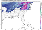
Well yeah I guess only if it wasn't the GFSView attachment 177573
Something to cheer us up
Cad Wedge NC
Member
Looks like a weaker system. Height lines are actually further south vs. last run, but surface is warmer. Go figure. Anyway, NWS just put rain and snow in my forecast for Friday. We'll see.slightly weaker cold push/damming high on the 12z euro, and it is congrats VA CAD zones on this run
Cad Wedge NC
Member
Welcome back, just in time to help track some December fun and games.Long time no see old friends. The pattern is definitely shaping up for possible glory this December. The MJO, the PV, the EPO. A lot of positives to take place next month. Will be fun watching it all unfold.
Cad Wedge NC
Member
I don't think all the models are factoring in the snowpack that will be on the ground during this timeframe. This will surely help to build confluence in the NE as well as keep the air from moderating. Look like the GFS is strengthening the high pressure vs. prior runs, possibly in response to the anticipated snowpack. I like how it is raising pressures back to the Midwest. That will help keep the storm track suppressed. I am surprised the Canadian isn't all over this. That model is usually the first to sniff out a potential CAD. I will be watching to see what it does in the coming days.Cold HP trending stronger. Position remaining the same.
View attachment 177562
Iceagewhereartthou
Member
I'll be pulling for you NC\VA guys this month; looks like you guys could have a couple shots at fun. 
the more snow we can get up into the ne, the better down the road for colder cad downstream. personally hoping they get a blizzard or 5 up thereI'll be pulling for you NC\VA guys this month; looks like you guys could have a couple shots at fun.
Twister
Member
If I was a betting man I'd Bet upstate SC sees Snow in DecI'll be pulling for you NC\VA guys this month; looks like you guys could have a couple shots at fun.
If I was a betting man I'd Bet upstate SC sees Snow in Dec
agreed. as long as we can keep the wave train rolling as things are looking, the precipitation will eventually meet the cold sooner, rather than later
Bigedd09
Member
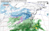
18z GFS still has some wintery precip, but it is slightly warmer (wetter) than previous runs:
View attachment 177576
Gonna cave to EURO very soon
Sent from my iPhone using Tapatalk

