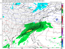
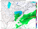
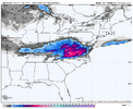
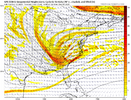
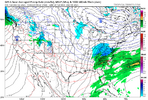
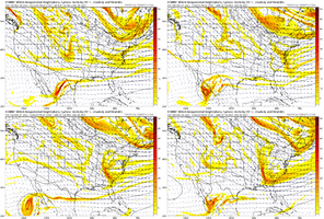
last year featured a lot a lot of threats with high leverage, "big dog" potential that fizzled some after we white knuckled a couple of model suites. it's a breath of fresh air to be looking at an uncomplicated wave with relatively clear winners and losers and low-ish potentialICON looks better for you...
View attachment 177696
-
Hello, please take a minute to check out our awesome content, contributed by the wonderful members of our community. We hope you'll add your own thoughts and opinions by making a free account!
You are using an out of date browser. It may not display this or other websites correctly.
You should upgrade or use an alternative browser.
You should upgrade or use an alternative browser.
Pattern December Doldrums 2025 🎄 ❄️
- Thread starter SD
- Start date
BrickTamland
Member
Seems to be a lot of uncertainty still and just 4 days out.ICON looks better for you...
View attachment 177696
packfan98
Moderator
RGEM


RGEM little slower with arrival of precip, makes huge difference. Good news: precip usually arrives sooner than progged, bad news: this is an onset wintry changeover to rain scenario. Best case ( east of elevation), car topper that gets washed away within an hour or 2. Worst case 33 and rain, without a single flake, zr or ip. I like the idea of a light wintry mix at onset before rainRGEM

packfan98
Moderator
Two hour school delay is my high water mark.RGEM little slower with arrival of precip, makes huge difference. Good news: precip usually arrives sooner than progged, bad news: this is an onset wintry changeover to rain scenario. Best case ( east of elevation), car topper that gets washed away within an hour or 2. Worst case 33 and rain, without a single flake, zr or ip. I like the idea of a light wintry mix at onset before rain
This does look interesting, got snow in my NWS point forecast. I hadn’t really been paying attention to this threat until now. Expect @BullCityWx to get 1-2” while I get a car topper. 
Bigedd09
Member
GFS is a bit colder than 06z
GFS colder but also weaker wave. Again weak system with light wintry at onset seems best case with this one
LukeBarrette
im north of 90% of people on here so yeah
Meteorology Student
Member
2024 Supporter
2017-2023 Supporter
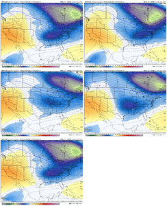
Yeah 850s were colder just before precip arrived, but we have a transient CAD high, precip slower and cold air quickly moves out. MehView attachment 177699
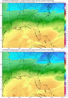
A lot less cold air on GFS
This what I was looking at @72
BAM weather is very bullish on a cold and stormy December. Well worth the watch.
SimeonNC
Member
I doubt the CAD erodes that quickly.Yeah 850s were colder just before precip arrived, but we have a transient CAD high, precip slower and cold air quickly moves out. Meh
This what I was looking at @72
View attachment 177700
LukeBarrette
im north of 90% of people on here so yeah
Meteorology Student
Member
2024 Supporter
2017-2023 Supporter
LukeBarrette
im north of 90% of people on here so yeah
Meteorology Student
Member
2024 Supporter
2017-2023 Supporter
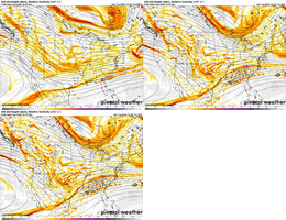
Euro had this a couple days ago / same time frame. BF posted. It had that 1032 HP parked over Buffalo and did a nice # / snow wise on all of us. We keep throwing darts with these waves coming up from our sw and sooner or latter we will time one just right with a HP. next week was looking like a clipper fest on latest Euro I viewed, so who knows at this point. The upslope areas at the least, should catch a few good ones here real soon if all this chatter keeps upView attachment 177701
GFS showing another system
Bigedd09
Member
If at first you don't succeed, try, try again:
View attachment 177704
Not sure how many more cold rains I can take lol
Sent from my iPhone using Tapatalk
37 and 1/4 mile visibility, heavy drizzle as we approach the noon time hour. Raleigh nws last night swears we will scattered the clouds out, see sun before 5 pm and rise into the low-mid 40's
Only 3 more months!Not sure how many more cold rains I can take lol
Sent from my iPhone using Tapatalk
You're in serious trouble if you're saying this now. New to the south?Not sure how many more cold rains I can take lol
Sent from my iPhone using Tapatalk
Bigedd09
Member
You're in serious trouble if you're saying this now. New to the south?
Yeah I know. Going to be a long winter. Hopefully we all score on 1 storm. That’ll make up for cold rains lol
Sent from my iPhone using Tapatalk
wow
Member
Dec 7-9 looks interesting. Remember the Euro picked up on it a few days ago for a couple runs.
Bigedd09
Member
Has I-40 north written all over it
Sent from my iPhone using Tapatalk
packfan98
Moderator
Done. SD beat me to it...Someone should create a storm thread for this Friday...most globals have this. Who feels lucky...
12/4-12/6 Storm Thread
BrickTamland
Member
Well, at least the pattern is active. Maybe we can score some winter precip out of one the systems. I like seeing a model show a storm more than 7 days out, then lose it, and then pick it back up again inside 5 days. Especially if it's the Euro and if another model picks it up, too, in between the Euro losing it and showing it again. Those scenarios are usually when we end up getting an actual winter storm. Of course, it could end up being cold rain again, but those scenarios usually give us the best chance at winter precip.
Shaggy
Member
This 2nd batch of rain has been much heavier and is really coming down @Avalanche. We needed this bad
ducketta27
Member

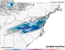
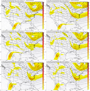
Why does Euro AI show this weird snow signal in central SC/GA… showing up in nearly all panels.
A bias? Overdoing the CAD?
Sent from my iPhone using Tapatalk
- Joined
- Jan 5, 2017
- Messages
- 3,771
- Reaction score
- 5,973
I'm in the land of perpetual 40's and rain and I'm loving every moment!
We have 90 days to score. Patience, grasshopper.Not sure how many more cold rains I can take lol
Sent from my iPhone using Tapatalk
Weird AI physics.
Why does Euro AI show this weird snow signal in central SC/GA… showing up in nearly all panels.
A bias? Overdoing the CAD?
Sent from my iPhone using Tapatalk
I don't see it on the 06z run from pivotal, but my best guess is it was picking up on another wave of moisture that was being squashed, but cold enough where it reached on the northern fringes, and everything else you see was before, but idk
Why does Euro AI show this weird snow signal in central SC/GA… showing up in nearly all panels.
A bias? Overdoing the CAD?
Sent from my iPhone using Tapatalk

