lexxnchloe
Member
I may have to reactivate the tropical thread


Why???? This is in no way a tropical systemI may have to reactivate the tropical thread


Little late in the season lolWhy???? This is in no way a tropical system

There has been a definite downward trend in 850 temps. Quite a bit of uncertainty of track and strength of LP....maybe something to watch?Wild how that’s a perfect track for the mountains but absolutely no cold air for them either

If I had to make a guess the path will be somewhere in the middle between the GFS and EURO. GSP noted that there has been fairly clear trend towards the GFS suite though the GEFS mean keeps the track just off shore. I’m definitely going to watch it. The wife and I are going up to Biltmore on Saturday and coming back Sunday afternoon. If the 850s trend the right way up there, it might be worth staying and extra day.The GFS has been inland for a couple days now, while Can and Euro have been consistently off the coast. GFS was late to the game with this past weekends event and advertised a far western track before correcting back east. Interesting to see which suite nails this one down and that may be a trend to keep in mind if we ever do get to track a legit threat this season.
Canadian is the closest to helping the mtn folk out

I think the humor escaped you. If i thought it was tropical i would have put it thereWhy???? This is in no way a tropical system
Wow!View attachment 138534
I’ll be either at Mount Mitch, sugar or beech this weekend.
Wow!I think the humor escaped you. If i thought it was tropical i would have put it there
Wow! Same guy posting the same thingGefs has slowly been pushing those 70 probs north each run, and now means at and after Christmas are in the 60s for much of the SE View attachment 138530View attachment 138531View attachment 138532View attachment 138533
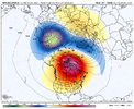
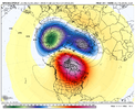
Love the smiley face look! Changes are afootWhen the big GOAK trough shuffles back to the Aleutians and we raise heights in AK, that’s when I’m sure winter storm prospects will appear. Just gotta wait, gotta have patience, we’re following a typical strong Nino progression, there not known for being good early on View attachment 138512View attachment 138513View attachment 138511
End up with the Joker look come verification time! ?
Wow, me posting weather in the weather thread has bothered you that much, wow ! as if I haven’t been posting about what I see favorable after this warmer pattern and one of the only ones doing that. Cry me a river.Wow! Same guy posting the same thing


Good ole cut off low season.I give it a couple of weeks before the -NAO makes a return. Really no sign of a strong vortex coming back anytime soon. I’d watch the evolution of those pacific waves undercutting the block around/past Christmas, and the Atlantic trough it may start to feed into. weak vortex just increases the oddsView attachment 138536View attachment 138537
Yep. Probably gonna be some severe to boot. Lots of SW flow over the SE post Christmas on the ensGood ole cut off low season.

CMC oddly enough is somewhat similar
Wow! that looks like something you'd see on mitchell or grandfather.19.8 at the house this morning with about the heaviest frost I've seen. Even the trees were rimed. I drove through freezing fog up to the jobsite in Blairsville and took a few pictures.
Yeah it backed in some end of storm snow. huh.CMC oddly enough is somewhat similar
It's just very sad.This in mid December! Mid-Atlantic weenie meltdown, gonna be epicView attachment 138542
It's just very sad.
The departures by end of the month are going to be outrageous, especially nw of here??What is it with warm Decembers lately... I had forgotten 2021 was 5 degrees warmer than the previous record here ? Christmas was also warm in 2015 2016 and 2019 here
Of course in 21-22 it snowed 10 inches after February 1st too.... So...
Not even a “northern fringe” snow for VT/NHThis in mid December! Mid-Atlantic weenie meltdown, gonna be epicView attachment 138542

Lol that’s the longest forecast I’ve ever seen from a TV station. That precipitous drop at the end seems silly.
Sent from my iPhone using Tapatalk
