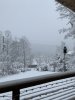
• Hello, please take a minute to check out our awesome content, contributed by the wonderful members of our community. We hope you'll add your own thoughts and opinions by making a free account!

Wintry Dec 8-10th Winter Storm

PS. A lot of times the tmax of the mid-level warm nose is between model layers as well. Saw this several times while at NCSU and we were launching soundings during winter wx. Only a 20-30mb thick warm nose, nwp can't see that with vertical levels every 50mb
 
Wonder if we might deal with the same situation the northeast had when snow total busted to high, different storms but still something to keep in the back of my mind
 
When do we start to sample these pieces of energy? I would imagine like always things will change once they get onshore and the models start to ingest them.
 
I'm still thinking a sleetfest here most of the time with front end snow since I'm in Salisbury which is normally a decent spot in these cad events
 
If the CAD is being underdone here, then very well that mix will extend further into GA.
Euro and Ukie look eerily similar..we’ve seen his movie before
And sometimes we find out that the most reliable characters in the movie are a fraud or were misleading. Or rather leading you off the cliff.

At this point, positions and strengths are what matter. Get the high where it is and the low across FL and it's a good setup.
 
Getting closer in Atlanta
66ca81e4ef9cf7dd9eea24847f28b74f.jpg
bf15f05e2d273f8323bfb6d1eef6a94e.jpg


Sent from my iPhone using Tapatalk
 
When do we start to sample these pieces of energy? I would imagine like always things will change once they get onshore and the models start to ingest them.

Probably get some of the data on tonight’s 0z runs.

Most likely tomorrow and probably not until tomorrow's 0z runs will we start getting a very good idea
 
It's a cascading failure that happens with global models and CAD east of the Appalachians. I've seen this time and time again as a long time NC resident. NAM will likely have a better thermo profile than the global models, but a lot of this happens in real time and therefore is very hard to forecast.

Prequil: GFS already shows geostrophic adjustment east of the mountains as the parent high slides to our north before the arrival of the precip early Sunday morning...so a CAD will already be in place (along with cold DRY air). The dryness of the air will definitely matter, but we won't know this until we see OBS most likely. So great, the model has no problem with this. Check out the image valid Sunday AM for MSLP, you can see the CAD there.

Now to the cascading failure part
1. Precip begins falling into the dry airmass (CAD), resulting in evaporation cooling. That very crudely represented in hydrostatic nwp, so it ends up not being modeled correctly and is often underestimated. To make matters worse, the GFS does not have parameterizations for phase changes, so all that refreezing into sleet that's going to be happening in and under the warm nose is not accounted for. The result? Lot's of latent heat release on top of the CAD resulting in a stronger warm nose than what's represented in the nwp. So at this point we now have a stronger, deeper, CAD and a warmer warm nose than forecast.

2. Here we go with feedback now. Not only are we getting QG forcing for ascent from the DPVA, but we have a very significant contribution from the WAA (synonymous to isentropic upglide), which especially drives precip on the front end. As a result of the stronger than forecast CAD, isentropic upglide is enhanced (more WAA than forecast), which results in a beefier warm nose than forecast. Already the gfs forecast some extreme WAA (see attached image) during the precip, and this is likely underdone.

So now our warm nose is very strong, and the CAD is extremely entrenched, which is considered high impact...so now it's going to take a lot more than WAA and a low to our east to erode the CAD.

3. NWP is notorious for eroding a CAD to quickly. Climo tells us it's going to stick around, so the fact that the GFS completely erodes the CAD by 18-21z Sunday is complete BS (see mslp image attached). There are certain synoptic patterns in which CAD erodes, and this is not one of them. So almost certainty the low will track further east than forecast (along the coastal front, edge of the CAD) and not do much to erode it.

All of this results in an almost impossible precipitation forecast, but it will do things like throw sleet all the way back to the Triad, even though you don't even see a hint about it in the global nwp. Could even result in there being more sleet further southeast than forecast before a complete changeover to rain. NAM is alot better with thermo profiles, but a lot of this will be now-casting during the event.

Who knows about totals, but imo, Raleigh gets some snow to start, then quickly to sleet and eventually rain, while the Triad will be extremely lucky to stay snow the whole time and not mix with sleet at some points. I don't buy these foot+ totals except for the extreme NW piedmont & mountains.

Thanks for your explanation. My feeling is that you base everything on the GFS and I don't trust ANY global model to make a flat statement like you made even though it is possible based of your reasoning. However, until the NAM and RGEM get into range I won't agree that it will go farther west than the Triad area. That is fine though, everyone including me make some flat statements that end up proven wrong.
 
Back
Top