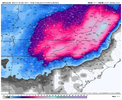
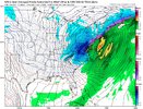
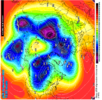
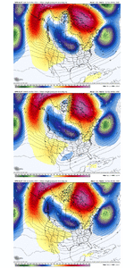
Never a good thing when the GFS op is the only one giving you hope. Although i didn’t think the turn around would be this fast maybe there would be enough time for models to turn around again but we will see.
-
Hello, please take a minute to check out our awesome content, contributed by the wonderful members of our community. We hope you'll add your own thoughts and opinions by making a free account!
You are using an out of date browser. It may not display this or other websites correctly.
You should upgrade or use an alternative browser.
You should upgrade or use an alternative browser.
Pattern Dazzling December
- Thread starter Rain Cold
- Start date
All you gotta do is look at the lakes, NE, SE Canada on the gfs versus the others. Either the gfs is the best or its wrong
Broken024
Member
Yep, agree. These phases we do way better at severe than snow. I’m favoring the slowing trend, on other models other than the GFS, severe weather could actually become a future threat lol, I’ve said it since Tuesday, I think inland runner/cutterProbably going to be a severe event by verification
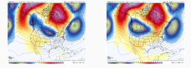
See the difference, GFS seperates the low and has a nice block in SE Canada and other models don't.
Yep pattern progression favors a cutter first then a winter storm threat. Seems like we do this every timeYep, agree. These phases we do way better at severe than snow. I’m favoring a slowing trend, on other models other than the GFS, severe weather could actually become a future threat lol, I’ve said it since Tuesday, I think inland runner/cutter
griteater
Member
Webberweather53
Meteorologist
I wouldn’t bet on anything more than trace to very light coating of snow outside the mountains & foothills in the Carolinas with the Dec 23rd system (at least not yet), unless we somehow end up close to the gfs and pull a rabbit out of the hat synoptically (x doubt). This has the feel of a storm that’ll probably end up too far NW & warm for most here, but still could squeeze out some snow flakes near the end because of how cold the trailing arctic air mass is.
The ensembles have been leaning towards this being more of an apps + OH valley + Lower Great Lakes + NE US event for a few days now (& the Continental scale pattern backs that up).
Don’t let yourself get sucked in or distracted by a few eye-catching, outlier goofus operational runs, especially because the real potential (imho) has been behind this storm ~Dec 25-28 ish
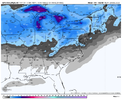
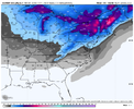


accu35
Member
- Joined
- Jan 5, 2017
- Messages
- 8,415
- Reaction score
- 9,889
Would this first storm favor more snow/ice places further west of the apps?I wouldn’t bet on anything more than trace to very light coating of snow outside the mountains & foothills in the Carolinas with the Dec 23rd system (at least not yet), unless we somehow end up close to the gfs and pull a rabbit out of the hat synoptically (x doubt). This has the feel of a storm that’ll probably end up too far NW & warm for most here, but still could squeeze out some snow flakes near the end because of how cold the trailing arctic air mass is.
The ensembles have been leaning towards this being more of an apps + OH valley + Lowe Great Lakes + NE US event for a few days now (& the Continental scale pattern backs that up).
Don’t let yourself get sucked in or distracted by a few eye-catching, outlier goofus operational runs, especially because the real potential (imho) has been behind this storm ~Dec 25-28 ish
View attachment 127008
View attachment 127009
Fail incoming on GFS Christmas storm.
Ukmet showed first and was kinda bashed, but it does well with pattern recognition and should never be discounted imho.Can see by day 3-4 models diverge. GFS v/s CMC. GFS seperates and CMC and others don't.
View attachment 127010
That's fine, it's probably so wrong on the 1st one it can't be trusted on the 2nd one and if it's right on the first most are going to be ok with it missing on the 2nd lolFail incoming on GFS Christmas storm.
bingcrosbyb
Member
That will shutdown the east coast for ChristmasHoly ---- ballsView attachment 127006
severestorm
Member
Wasn't there a model war with the last major Christmas storm? GFS caught it and the rest didn't then others caught it and GFS lost it then a few days before all models zeroed in on it?
Could be but the CMC fails on both.That's fine, it's probably so wrong on the 1st one it can't be trusted on the 2nd one and if it's right on the first most are going to be ok with it missing on the 2nd lol
Avalanche
Member
Yes, Brick alluded to that earlier.Wasn't there a model war with the last major Christmas storm? GFS caught it and the rest didn't then others caught it and GFS lost it then a few days before all models zeroed in on it?
yeah hate to say it but it's definite possibility. Still with the anomalous blocking setting up models gonna struggle, just like they do with CAD. I think we still will be fine just not sure when yetCould be but the CMC fails on both.

