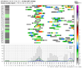
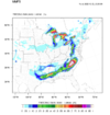
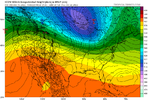
YeahWas the 12z UKMET a cutter? ?
-
Hello, please take a minute to check out our awesome content, contributed by the wonderful members of our community. We hope you'll add your own thoughts and opinions by making a free account!
You are using an out of date browser. It may not display this or other websites correctly.
You should upgrade or use an alternative browser.
You should upgrade or use an alternative browser.
Pattern Dazzling December
- Thread starter Rain Cold
- Start date
Flotown
Member
give us a gander at it pleaseYeah
Shaggy
Member
Theres gonna be so many op runs over the next 5 days until we get a better picture of whats shakin. Theyre fun to go over and look at but in the end its all about the ensembles right now. Never discount the ukmet either and just watch the trends and dont sweat every run.
There are two dynamics at play in this situation: the SE Canada vortex and the ridge over BC/Alberta. If the ridge over BC can be strengthened and moved further north, it will cause the shortwave to lose more latitude before tilting negatively and producing precipitation. This will allow the shortwave to tap into moisture from the Gulf of Mexico, as shown by the 12z GFS model. In general, a stronger +PNA (Pacific North American pattern) increases the potential for storms further south.IDK. I think I prefer the further west/stronger look.
The SE Canada vortex is an important factor in keeping the shortwave tilted positively and allowing it to move eastward. If the vortex is too weak or fast, it can cause the ridge to build in and the shortwave to tilt negatively before reaching the Southeast, leading to a cutter-type storm. This can also result in warmer air moving ahead of the system. On the other hand, if the SE Canada vortex is strong, both waves could consolidate and everyone stays dry as shown by the CMC model.
Notice the difference between the snowy 12z GFS vs the meh 12z Euro. The 12z GFS has a strong SE Canada Vortex and a taller ridge over BC.
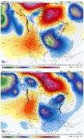
I wasn't a fan of the 18z EPS/Control because it moved unfavorably in both domains, a less positive PNA and weaker SE Canada Vortex. The strength of the wave in the NW is rather trivial because it can gain energy in other ways.
TLDR: Our snow chances increase by strengthening the ridge out west and strengthening the SE Canada vortex.
Last edited:
bouncycorn
Meteorologist
Where do you get this?
As is in most cases the models aren’t going to nail a system that is still 180-200 hours out .. I would have to assume that there will be changes in the exact location and strength of pieces we want and may not even know exist at this range. Which will eventually create different scenarios we maybe weren’t anticipating to see. If we are thinking based on pure climatology .. it wouldn’t make sense to have a storm ride of the east coast like todays runs have been hinting at. You would tend to see something a little further west. I would suggest that eventually models hint at a western jog with time. It may not be fun to see but models don’t get the correct answer this far out usually ever. I hope I am pleasantly surprised. This is strictly about the 22-23 storm I could certainly see a better outcome for us with the 25-27 storm but that’s even further away with further changes likely to come. All in all the pattern is nice and can produce in multiple ways. I just don’t think we’re going to be easily slam dunking widespread winter storms without any wrenches getting thrown in our way.
bouncycorn
Meteorologist
It's my model. Real-time data is accessible here - (account no longer necessary to view data!)Where do you get this?
Site is still under construction.
link:
MMFS
data.mesoscaleforecast.com
Oh if only it could go out a litttleeeee longer ? next few days will be interesting to see if it’s onto something with that initial system. Every system effects the one behind it so it’s important we know for sure what happens to each one.
bouncycorn
Meteorologist
It's still running! to 192 hrs.. and once this run completes, i'll start another one. Seeing it show a major miller A is pretty neat. Haven't really tested it's accuracy beyond 144 hrs, though.Oh if only it could go out a litttleeeee longer ? next few days will be interesting to see if it’s onto something with that initial system. Every system effects the one behind it so it’s important we know for sure what happens to each one.
In my very own opinion, this system that brings the cold is gonna trend to a inland runner/cutter, but after that is game on
I definitely tend to agree with that. I will say though, it wouldn’t suprise me if more areas were in play for CAD ice with the first system. I think, like the past couple days, there will be strong CAD and there’s gonna be a lot more snowpack in place by next Thursday in the northeast.In my very own opinion, this system that brings the cold is gonna trend to a inland runner/cutter, but after that is game on
bouncycorn
Meteorologist
SimeonNC
Member
JHS
Member
Maybe not with this 1st round, but I would carefully watch for a system coming in as the cold air pulls out that could possibly be a big icestorm in the CAD areas. Say around or just after New Years Day. About like 1999, but colder and much colder ground temps. Nothing really on the models yet, but just a feeling I have. We have had a good many events through the years on the back end of cold snaps.I definitely tend to agree with that. I will say though, it wouldn’t suprise me if more areas were in play for CAD ice with the first system. I think, like the past couple days, there will be strong CAD and there’s gonna be a lot more snowpack in place by next Thursday in the northeast.
NorthGaWinter4
Member
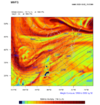
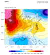
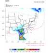
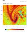
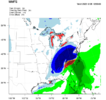
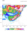
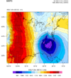
I’m cheering for your model and the GFS. sign me upWow... Final MMFS frames are in for this run.. (987.6mb!)
View attachment 126817View attachment 126818
View attachment 126821View attachment 126822
View attachment 126823
SnowNiner
Member
Wow, another crazy day of runs, just catching up. All said and done, it seems to me the 25th and after is still the time frame. I just don't think the ridge is going to be tall enough, steep enough to dig enough for the 23rd. I could be wrong, hope bounceys model come to fruition. But let's get the cold established and see what happens.
And let's hope the euro doesn't destroy the block.
And let's hope the euro doesn't destroy the block.
Blue_Ridge_Escarpment
Member
Icon really trying for the 21st system

